Zaranj Airport
| Zaranj Airport | |||||||||||
|---|---|---|---|---|---|---|---|---|---|---|---|
|
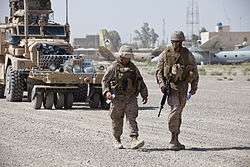
Members of the U.S. Marine Corps performing a safety inspection of the runway, July 2012 | |||||||||||
| Summary | |||||||||||
| Airport type | Military | ||||||||||
| Owner |
| ||||||||||
| Operator |
Afghan Ministry of Defense United States Marine Corps | ||||||||||
| Serves | Zaranj, Nimruz Province | ||||||||||
| Location | Zaranj, Nimruz Province, Afghanistan | ||||||||||
| Elevation AMSL | 1,592 ft / 485 m | ||||||||||
| Coordinates | 30°58′20″N 061°51′57″E / 30.97222°N 61.86583°ECoordinates: 30°58′20″N 061°51′57″E / 30.97222°N 61.86583°E | ||||||||||
| Map | |||||||||||
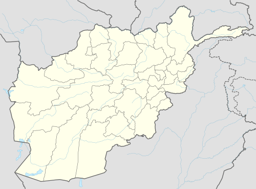
 ZAJ Location of airport in Afghanistan | |||||||||||
| Runways | |||||||||||
| |||||||||||
Zaranj Airport (IATA: ZAJ, ICAO: OAZJ) is a domestic airport located by the city of Zaranj in far southwestern Afghanistan. It was built by the Afghan government to serve the population of Nimruz Province.[3][4] The airport is used for civilian and military purposes. In addition to the Afghan Air Force and Afghan National Police, the U.S military and the International Security Assistance Force (ISAF) also have presence.
Airlines and destinations
| Airlines | Destinations |
|---|---|
| East Horizon Airlines | Herat,[5] Kabul[6] |
The airport also handles charter civilian and military flights.
See also
References
- ↑ Airport record for Zaranj Airport at Landings.com. Retrieved 2013-8-1
- ↑ AIP Afghanistan - Important Information
- ↑ Accident history for ZAJ at Aviation Safety Network
- ↑ Airport information for OAZJ at Great Circle Mapper.
- ↑ 2014 Timetable, http://flyeasthorizon.com/flight-schedule/
- ↑ East Horizon Airlines is proud to announce direct flight between Kabul / Zaranj / Kabul every Monday with new aircraft MA-60 (manufactured 2011) commencing from June 23, 2014., http://flyeasthorizon.com/latest-news/
External links
-

Wikimedia Commons has media related to Zaranj Airport. - Airport record for Zaranj Airport at Landings.com.
This article is issued from
Wikipedia.
The text is licensed under Creative Commons - Attribution - Sharealike.
Additional terms may apply for the media files.
