Yauco Battle Site
|
Yauco Battle Site | |
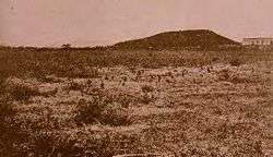 Part of the Hacienda Desideria, owned by Antonio Mariani, where the Battle of Yauco took place in 1898 | |
 Location of the Yauco Battle Site in Puerto Rico | |
| Nearest city | Guánica, Puerto Rico |
|---|---|
| Coordinates | 18°00′03″N 66°53′16″W / 18.000907°N 66.887886°WCoordinates: 18°00′03″N 66°53′16″W / 18.000907°N 66.887886°W |
| Area | 127.013 acres (51.400 ha) |
| Built | 1898 |
| MPS | Spanish-American War in Puerto Rico MPS |
| NRHP Reference # | 00001383[1] |
| Added to NRHP | September 2, 2008 |
The Yauco Battle Site is the site of the Battle of Yauco between Spanish and American forces in the municipality of Guánica, Puerto Rico on July 25 and 26, 1898. It includes agricultural fields plus the main house and a slave building of Hacienda Desideria, a coffee plantation in a small valley about 4 kilometres (2.5 mi) from the town of Guánica, which was headquarters of a Spanish military unit. It was the site of the first major confrontation in the Puerto Rican Campaign of the Spanish–American War.
A 127.013-acre (51.400 ha) area was listed on the national Register of Historic Places in 2008. Non-contributing elements in the listed area include a portion of SR 166R, a 20th century bridge, and Hacienda Quiñones' main house.[2]
References
- ↑ National Park Service (2009-03-13). "National Register Information System". National Register of Historic Places. National Park Service.
- ↑ Arleen Pabón, Eduardo Regis, José E. Marull, and Hugh Tosteson (August 12, 2008). "National Register of Historic Places Registration: Yauco Battle Site / Batalla de Yauco, Hacienda Quiñones, Hacienda Desideria, Hacienda Santa Rita" (PDF). National Park Service. Retrieved February 13, 2017.
| Topics | |
|---|---|
| Lists by states |
|
| Lists by insular areas | |
| Lists by associated states | |
| Other areas | |
| |
This article is issued from
Wikipedia.
The text is licensed under Creative Commons - Attribution - Sharealike.
Additional terms may apply for the media files.