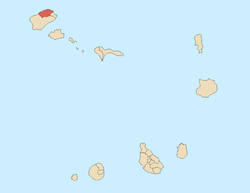
Xoxo, Cape Verde
| Xoxo, Cape Verde | |
|---|---|
 | |
| Coordinates: 17°08′20″N 25°03′58″W / 17.139°N 25.066°WCoordinates: 17°08′20″N 25°03′58″W / 17.139°N 25.066°W | |
| Country | Cape Verde |
| Island | Santo Antão |
| Municipality | Ribeira Grande |
| Civil parish | Nossa Senhora do Rosário |
| Population (2010)[1] | |
| • Total | 361 |
Xoxo (pronunciation: sho-sho) is a settlement in the northeastern part of the island of Santo Antão in Cape Verde. It is situated 10 km (6.2 mi.) south of Ribeira Grande and 12 km (7.4 mi) north of the island capital Porto Novo. The settlement forms a part of Cova-Ribeira da Torre-Paul Natural Park.[2]
Location
Its etymology is of Mandinka origin. Nearby localities are in Monte Joana, which is to the northeast of Xoxo. Other necessities can be found at Pinhão and Corda, which are towns to the west of Xoxo.
The Ribeira da Torre flows through the settlement, its source being about 4 kilometers (2.4 miles) south in the area between Rabo de Curto and the Cova Crater.[3] The entire area of the settlement is on a slope.
Subdivisions of Xoxo includes Fajã de Baixo, Fajã de Cima, Lombo de Pico, Losna, Rabo de Curto, and the center of Xoxo.[3]
Xoxo is located at the terminus of the Ribeira Grande-Xoxo Road (EN3-SA01), a 10 kilometer (6.2 mi) road which was paved in 2013; and it is the only paved road linking Xoxo to Corda, although there are many trails and paths that allow access as well. The Ribeira Grande-Xoxo Road also lead southwest, and another road to Corda Crater in the south.
Sports in Xoxo
The football (soccer) club based in the settlement is Torreense; it is not related to the Portuguese club Torreense , it is named after the stream. The club started to become a part of the Santo Antão North Zone's Second Division in 2016. The club's area serves Ribeira da Torre except for the area of Ribeira Grande and the Corda area. The area has no football (soccer) field alongside Corda, its matches are played at Estádio João Serra up north in Ribeira Grande.
Another football club that also serves the area is Rosariense.
See also
References
- ↑ "2010 Census results". Instituto Nacional de Estatística Cabo Verde (in Portuguese). 17 March 2014.
- ↑ areasprotegidas.gov.cv
- 1 2 "Cape Verde: Islands of Santa Antao". capeverde.com. Retrieved 2016-11-27.

