Lianyungang
| Lianyungang 连云港市 | |
|---|---|
| Prefecture-level city | |
|
View of seaside area in Xilian Island | |
 Lianyungang is highlighted on this map | |
 Lianyungang Location in China | |
| Coordinates: 34°36′N 119°10′E / 34.600°N 119.167°ECoordinates: 34°36′N 119°10′E / 34.600°N 119.167°E | |
| Country | People's Republic of China |
| Province | Jiangsu |
| Government | |
| • Type | Prefecture-level city |
| • CPC secretary | Yang Xingshi (杨省世) |
| • Mayor | Xiang Xuelong (项雪龙) |
| Area | |
| • Prefecture-level city | 7,444 km2 (2,874 sq mi) |
| • Urban | 880 km2 (340 sq mi) |
| Population (2015) | |
| • Prefecture-level city | 4,474,000 |
| • Urban | 2,010,000 |
| Time zone | China Standard (UTC+8) |
| Postal code |
222000 (Urban center) 222100-222300, 222500 (Other areas) |
| Area code(s) | 518 |
| GDP | ¥216.064 billion (2015) |
| GDP per capita | ¥48,416 (2015) |
| Major Nationalities | Han |
| County-level divisions | 7 |
| License Plate | 苏G |
| City Tree | Ginkgo |
| City Flower | Magnolia |
| Website | http://www.lyg.gov.cn/ |

| Lianyungang | |||||||||||||||||||
|
"Lianyungang" in Simplified (top) and Traditional (bottom) Chinese | |||||||||||||||||||
| Simplified Chinese | 连云港 | ||||||||||||||||||
|---|---|---|---|---|---|---|---|---|---|---|---|---|---|---|---|---|---|---|---|
| Traditional Chinese | 連雲港 | ||||||||||||||||||
| Hanyu Pinyin | Liányúngǎng | ||||||||||||||||||
| Literal meaning | the port connected to the clouds | ||||||||||||||||||
| |||||||||||||||||||
.svg.png)
Lianyungang (simplified Chinese: 连云港; traditional Chinese: 連雲港; pinyin: Liányúngǎng) is a prefecture-level city in northeastern Jiangsu province, China. It borders Yancheng to its southeast, Huai'an and Suqian to its south, Xuzhou to its southwest, and the province of Shandong to its north. Its name derives from Lian Island (formally Dongxilian Island) the largest island in Jiangsu Province which lies off its coastline, and Yuntai Mountain (Jiangsu), the highest peak in Jiangsu Province, a few miles from the town center, and the fact that it is a port.
Lianyungang (as Yuntai Mountain) was known in the West as Haichow (Wade–Giles romanization). Haichow was voluntarily opened to foreign trade by the Qing imperial government in 1905.
Geography
Location
Lianyungang is between 118°24' and 119°48' east longitude and 34°11' and 35°07' north latitude. Lianyungang covers an area of 7,777 km2 (3,003 sq mi).
Climate
The temperature in Lianyungang can reach average highs of 30 °C in the summer and drop to as low as -4 °C in the winter. The vast majority of precipitation occurs between June and August, where it can measure up to 278mm of rainfall on average. Winter precipitation is quite low, making snowfall rare and short-lived.[1]
Economy
Lianyungang is the eastern end of the Longhai Railway (formerly the Lunghai Railway), connecting it with Lanzhou in central China. It is now the eastern terminus of the New Eurasian Land Bridge and the proposed Northern East West Freight Corridor. The government counts it among the first 14 Chinese coastal cities opening to the outside world and a rising center of industry, foreign trade, and tourism in east China.
This port is in the center of the coast, linking eastern sea routes with western land routes. Japan and the Republic of Korea in the east can be reached economically and conveniently from Liangyungang, which is also part of the worldwide network of sea transport. As well as this, the New Eurasia Continental Landbridge and the railway networks in Western Europe continue by land, connecting Lianyungang with over 40 countries and regions in Europe, South Asia and the Middle East.
The Chinese government has clearly stated its intention to build an economic belt along the New Eurasia Continental Landbridge in "the Ninth Five-Year Plan of the National Economy and Social Development and the Long-range Goal for the Year 2010." On "China's 21st Century Agenda", Lianyungang is to be developed into an international seaport linking countries on the Pacific rim with those in Central Asia. In the "National Ocean Development Plan" it is listed as one of three special development zones.
Near the Lianyun-Ports, the Tianwan Nuclear Power Plant is one of the biggest nuclear power plants in China, with two operational units and six more planned.
Industry
Lianyungang Economic & Technological Development Zone
Lianyungang Economic & Technological Development Zone (LETDZ) was approved by the State Council as one of the first batch of state-level development zones in December 1984. It is in the eastern new seashore urban area of Liangyungang City. The distance to nearest airport, Liangyungang Airport is 10–20 km (6.2–12.4 mi) and the distance to nearest highway G310 is 10–20 km (6.2–12.4 mi). Lianyungang port is 20–50 km (12–31 mi).[2]
Lianyungang Export Processing Zone
Lianyungang Export Processing Zone is in Lianyungang Economic & Technological Development Zone (LETDZ).[3]
Tourism
Lian Island Resort
One of the most popular tourist attractions in Lianyungang and the only AAAA-Class beachfront in Jiangsu Province, Lian Island (Chinese: 连岛; pinyin: lián dǎo) is a beautiful island connected to Lianyun District by a 6.7 km (4.2 mi) sea dyke, the longest in China. There are two main beach and swimming areas, several places to eat, as well as hotels. Lian Island is home to an annual music extravaganza featuring some of China's most famous pop stars.
Huaguo Mountain
Lianyungang is famous for its Huaguoshan Shuiliandong (花果山, 水帘洞) attraction. Shuiliandong literally means the "Water Curtain Hole," since, according to legend, the hole was hidden behind a waterfall, therefore resembling a "curtain of water."
The hole is famous because according to legend it is the home of Sun Wukong, commonly known as the Monkey King from the epic novel Journey to the West. In this hole, underneath the mountain is where he and his monkey subjects lived. After learning Tao, the Monkey King traveled back to the hole so that he and his subjects could eat and play for eternity. Eventually, the Jade Emperor sent heavenly armies to battle him at this spot because of his misdeeds. While the Monkey King story is a work of fiction, Xuanzang, the monk who he accompanies on the journey of the novel, was based on a historical person.
Transport
Lianyungang has convenient transport including highway, railway, port and airport. It is one of the 42 major transportation hub cities in China.
Airport
Lianyungang Baitabu Airport (连云港白塔埠机场), 25km west of downtown Lianyungang, provides schedule passenger service to major airports in China, including Beijing, Shanghai, Guangzhou, Shenzhen, Chengdu, Shenyang, Dalian, Hangzhou, Changchun, Kunming, Nanning, Tianjin, Xi'an, Zhoushan, Harbin, Urumqi, Xuzhou, Lanzhou, Haikou, Shijiazhuang, Xiamen (as of 2016.10.01).
Lianyungang Huaguoshan International Airport (连云港花果山国际机场) is planned to be built in Xiaoyi, 20km south of downtown by 2020. It will replace Baitapu Airport after completion.
Railway
The city serves as the designated starting point for the New Eurasian Land Bridge, a rail link from China to western Europe. The current major stations include Lianyungang Station and Lianyungang East Station.
Several highspeed railways that go through Lianyungang are under construction:
- Qingdao-Lianyungang Highspeed Railway connects Lianyungang and the second largest city in northern China, Qingdao. It is part of China's Coastal High-speed Railway. The length is 240km and the speed standard is 250km/h. Planned completion year is 2018.
- Shanghai-Nantong-Lianyungang Highspeed Railway connects Lianyungang and the largest city in China, Shanghai. It is also part of China's Coastal High-speed Railway. The length is 240km and the speed standard is 250~350km/h. Planned completion year is 2019.
- Lianyungang-Nanjing/Zhenjiang Highspeed Railway connects Lianyungang and the capital of Jiangsu province, Nanjing. It is part of China's Coastal High-speed Railway. The length of this railway is 300km and the speed standard is 250km/h. Planned completion year is 2019.
- Lianyungang-Xuzhou Highspeed Railway connects Lianyungang and the important transportation hub, Xuzhou. It is part of China's Longhai High-speed Railway which serves as disparity between the east and the west. The length of this railway is 180km and the speed standard is 350km/h. Planned completion year is 2019.
- Heifei-Qingdao Highspeed Railway connects the capital of An'hui province, Hefei, and the second largest city in northern China, Qingdao. It is part of China's Hongkong-Harbin High-speed Railway. The length of this railway is around 600km and the speed standard is 350km/h. Planned completion year is 2020.
Expressways
Lianyungang is the intersection of Shenhai Expressway, Hada Expressway and Tongsan Expressway. Among them Shenhai Expressway and Tongsan Expressway are the two longest in China.
Port
Lianyungang port is among the 10 largest ports in China and the 30 largest port in the world. The cargo throughput of Lianyungang port is 210 million ton/year (2015). The container throughput is 5 million TEU/year (2015).[4]
Administration
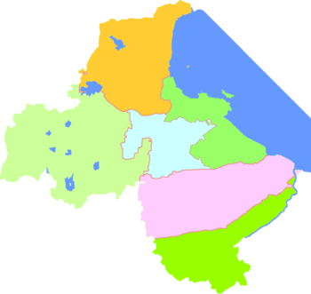
The prefecture-level city of Lianyungang administers six county-level divisions, including three districts and three counties.
| Map | Subdivision | Hanzi | Pinyin | Population (2010) | Area (km2) | Density |
|---|---|---|---|---|---|---|
| City Proper | ||||||
| Haizhou District | 海州区 | Hǎizhōu Qū | 818,134 | 697.28 | 1,173.32 | |
| Lianyun District | 连云区 | Liányún Qū | 231,697 | 404.25 | 573.15 | |
| Suburban | ||||||
| Ganyu District | 赣榆区 | Gànyú Qū | 949,438 | 1,427.27 | 665.21 | |
| Rural | ||||||
| Donghai County | 东海县 | Dōnghǎi Xiàn | 952,250 | 2,250.06 | 423.21 | |
| Guanyun County | 灌云县 | Guànyún Xiàn | 817,629 | 1,775.25 | 460.57 | |
| Guannan County | 灌南县 | Guànnán Xiàn | 624,766 | 1,027.02 | 608.32 | |
| Total | 4,393,914 | 7,499.91 | 585.86 | |||
See also
References
External links
- Government website of Lianyungang (in Chinese) (in English) (in Japanese) (in Korean)
- Lianyungang comprehensive guide with open directory (Jiangsu.NET)
- Tang Seng
| Special Economic Zones | ||
|---|---|---|
| New open development zones | ||