Whitford, New Zealand
Whitford is a suburb in south-east Auckland, New Zealand. There are multiple versions of how the town was named.[1][2] It may be named after Richard Whitford, a man who operated a flax mill on the Waikopua near Housons Creek[1] and was the postman.[2] Others think Whitford referred to the White-ford over the Turanga Creek at the end of Sandstone Road, where the salt dries when the tide is out.[1][2] Another possibility is that it is named after Whitefoord Park part of a vast property belonging to L.D. Nathan was initially listed as ‘Whitefoord Park’ in Wises Post Office Directory for 1875-6, but by the time it went on sale for subdivision in 1903 it was known as Whitford Park.[2]

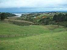
The Pacific Coast highway near Whitford has views of the surrounding countryside, farms, and Hauraki Gulf.
Historical facts
- Whitford's first European settlers, George and William Trice, started a popular farm on Clifton Road in 1843. Most of the following settlers arrived in the mid-1850s.[1]
- The Nathans' “Whitford Park” estate provided feathers from its ostriches for use in the fashion trade from 1869 until the 1920s.[2] Racehorses were also trained there; this practice still occurs today.[1]
- The town's Granger’s brickworks operated from the 1878 until 1920.[2] The Trices goldmine was converted to a landfill. Today, metal is quarried from there.[1]
- Transport usually occurred via water until the 1920s, when roads and motor transport were improved.[1]
- Today, Whitford has a real estate agent, accountant, dentist, service station, restaurant, gift shop and furniture restoration. Lifestyle blocks for city workers now occupy some farms. Beef, sheep, dairy, and timber are the chief economic activities.[1]
- Ayrlies Garden, one of New Zealand's best-known gardens, is located in Whitford.
References
- 1 2 3 4 5 6 7 8 "Howick Welcome Guide" (web). History of Howick, Pakuranga and surrounding areas. Times Newspapers (Greenmount, Auckland). 11 April 2005. Retrieved 2008-01-23.
- 1 2 3 4 5 6 Rod Clough (PhD), Kate Hill (MA Hons), Simon Bickler (PhD) (April 2005). "Whitford Bypass:Archaeological Assessment" (PDF). Manukau City Council. Retrieved 2008-01-23.
Coordinates: 36°56′S 174°58′E / 36.933°S 174.967°E
This article is issued from
Wikipedia.
The text is licensed under Creative Commons - Attribution - Sharealike.
Additional terms may apply for the media files.