White Canyon
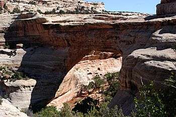
Coordinates: 37°48′32″N 110°25′47″W / 37.80889°N 110.42972°W[1] White Canyon is a canyon in San Juan County, Utah notable for Ancestral Puebloan cliff dwellings [2] and slot canyons.[3] It is spanned by Sipapu Bridge, one of the largest natural bridges in the world.[2]
The canyon begins in the foothills of the Abajo Mountains and passes through Natural Bridges National Monument before emptying into Lake Powell or, if lake levels are low, the Dirty Devil River. Utah State Route 95 parallels the inner gorge of the canyon for much of its length.[3]
One particularly deep and narrow section of White Canyon is known as the Black Hole. The walls in this permanently flooded 500-foot (150 m) long section are only a few feet (about 1 m) apart in some places.[3] Canyoneers sometimes wear wetsuits to guard against hypothermia while traversing this section.[4] The danger of flash flooding is very high due to the canyon's large drainage basin.[4] A 16-year-old girl drowned in a flash flood while hiking in the Black Hole area in September 1996.[5]
References
- ↑ "White Canyon". Geographic Names Information System. United States Geological Survey. 31 December 1979. Retrieved 24 November 2009.
- 1 2 "Natural Bridges Visitor Guide" (PDF). National Park Service. July 2005. Retrieved 25 November 2009.
- 1 2 3 Crossley, John. "White Canyon". americansouthwest.net. Retrieved 25 November 2009.
- 1 2 "Black Hole of White Canyon". Climb-Utah.com. Retrieved 25 November 2009.
- ↑ "Flash Flood & Flood Deaths in Utah". Salt Lake City Weather Forecast Office, National Weather Service. 12 September 2008. Retrieved 25 November 2009.
