Wetton, Cape Town
| Wetton | |
|---|---|
 Wetton  Wetton  Wetton
| |
|
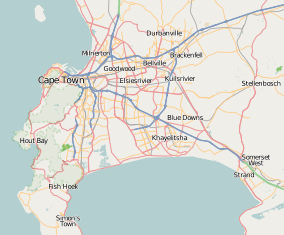
Location within Cape Town  Wetton | |
| Coordinates: 34°1′S 18°33′E / 34.017°S 18.550°ECoordinates: 34°1′S 18°33′E / 34.017°S 18.550°E | |
| Country | South Africa |
| Province | Western Cape |
| Municipality | City of Cape Town |
| Established | Union of South Africa |
| Area[1] | |
| • Total | 0.74 km2 (0.29 sq mi) |
| Population (2011)[1] | |
| • Total | 3,300 |
| • Density | 4,500/km2 (12,000/sq mi) |
| Postal code (street) | 7780 |
Wetton is a small suburb near Cape Town, South Africa, with a surface size of only 0,74 km².During Apartheid, Wetton was declared a whites only area, following the end of apartheid many Coloured people has since made it their home.It situated on the edge of the Southern Suburbs alongside The other former whites only area of Lansdowne.
References
- 1 2 "Sub Place Wetton". Census 2011.
This article is issued from
Wikipedia.
The text is licensed under Creative Commons - Attribution - Sharealike.
Additional terms may apply for the media files.
.svg.png)