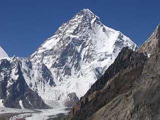
Western Himalaya


Western Himalaya, refers to the western half of the Himalayan Mountain region, stretching from Badakhshan in northeastern Afghanistan/southern Tajikistan, through Kashmir to central Nepal.[1] It is also known as Punjab Himalaya. All five tributary rivers of the Indus in the Punjab region (Jhelum, Chenab, Ravi, Beas, Sutlej) originate from the Western Himalaya.
Included within the western Himalayas are the Zaskar Range, the Pir Panjal Range, and parts of the Siwalik Range and the Great Himalayas. The Jhelum River rises in the Pir Panjal Range in Jammu and Kashmir state, India, and flows northwestward through the Vale of Kashmir before entering the Pakistani-administered sector. The highest point is Nanga Parbat (26,660 feet or 8,126 metres), at the northwestern end of the region. Dalhousie, in Himachal Pradesh in the foothills of the range, is a noted hill station (mountain resort).[1]
Ecology
- Western Himalayan subalpine conifer forests
- Western Himalayan alpine shrub and meadows
- Western Himalayan broadleaf forests
See also
References
- 1 2 "western Himalayas - mountains, Asia". Encyclopædia Britannica.