West Virginia's 1st congressional district
| West Virginia's 1st congressional district | |
|---|---|
|
West Virginia's 1st congressional district - since January 3, 2013. | |
| Current Representative | David McKinley (R–Wheeling) |
| Population (2010) | 615,991 |
| Median income | 30,303 |
| Ethnicity |
|
| Cook PVI | R+19[1] |
West Virginia's 1st congressional district is located in the northern part of the state. It is the most regularly drawn of the state's three districts.
It includes the industrial Rust Belt area of the state's northern panhandle which includes the district's third largest city, Wheeling, as well as Fairmont, Clarksburg, and the college town of Morgantown, the home of the main campus of West Virginia University. The largest city in the district is Parkersburg; the second largest is Morgantown. It also includes many rural farm and timber producing areas. The district has almost no population change reported in the 2010 Census change relative to the other 2 districts, as growth around Morgantown and Parkersburg offset population loss elsewhere, and the district was carried over unchanged for the next ten-year cycle.
The district is currently represented by David McKinley, a Republican who has represented the district since 2011.
West Virginia has tended to give its congressmen very long tenures in Washington, and the 1st District is no exception. Only four men have represented the district since 1953: Bob Mollohan (D) (1953–1957), former Governor Arch Moore, Jr. (R) (1957–1969), Bob Mollohan again (1969–1983), Alan Mollohan (1983–2011) and McKinley.
Despite the lack of turnover in the congressional seat, historically the 1st was not safe for either party. The cities are ancestrally Democratic strongholds, while the rural areas are much more conservative and have a tendency to swing Republican more often. As late as 2014, state legislators were roughly split between both parties.
Historically, the district has been very Democratic, mirroring the state as a whole. However, West Virginia Democrats tend to be somewhat more socially conservative than their counterparts in the rest of the nation, and the district has been swept up in the growing Republican trend in the state at the national level. No Democrat since Bill Clinton (who did so by a plurality in a three way race) has carried the 1st District in presidential elections. George W. Bush carried the district both times in 2000 with 54% of the vote and 2004 with 58% of the vote. John McCain carried the district in 2008 with 56.77% of the vote while Barack Obama received 41.51%.
History
The First District has always included Hancock, Brooke, Ohio, Marshall, and Wetzel counties.[2] The original 1863 districting included also Tyler, Pleasants, Doddridge, Harrison, Ritchie, Wood, Wirt, Gilmer, Calhoun and Lewis counties.[2] In 1882, the counties of Tyler, Doddridge, Harrison, Gilmer, Lewis and Braxton were added to the core counties.[2] In 1902, the core counties were joined by Marion, Harrison, and Lewis counties.[2] In the 1916 redistricting it included only the five core counties and Marion and Taylor.[2] The district was unchanged in the 1934 and 1954 redistrictings.[2] In 1962, Braxton, Calhoun, Doddridge, Gilmer, Harrison, Lewis, Marion and Taylor joined the five core counties.[2] The 1972 redistricting added Tyler, Pleasants, and Woods and deleted Taylor.[2] The 1982 redistricting added Taylor back to the district.[2]
1992 began the district as currently constituted, consisting of Barbour, Brooke, Doddridge, Grant, Hancock, Harrison, Marion, Marshall, Mineral, Monongalia, Ohio, Pleasants, Preston, Ritchie, Taylor, Tucker, Tyler, Wetzel and Wood counties.[2] In 2002 Gilmer was added.[2] For the election cycle that begins in 2012 the district was unchanged.[2]
List of representatives
| Representative | Party | Years | Electoral history |
|---|---|---|---|
| District created | December 17, 1863 | ||
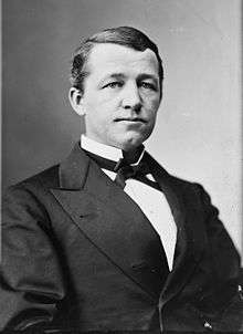
 Jacob B. Blair Jacob B. Blair |
Unconditional Unionist | December 17, 1863 – March 3, 1865 |
Retired |
 Chester D. Hubbard Chester D. Hubbard |
Unconditional Unionist | March 4, 1865 – March 3, 1867 |
Lost re-election |
| Republican | March 4, 1867 – March 3, 1869 | ||
 Isaac H. Duval Isaac H. Duval |
Republican | March 4, 1869 – March 3, 1871 |
Retired |
 John J. Davis John J. Davis |
Democratic | March 4, 1871 – March 3, 1875 |
Retired |
 Benjamin Wilson Benjamin Wilson |
Democratic | March 4, 1875 – March 3, 1883 |
Lost re-election |
 Nathan Goff, Jr. Nathan Goff, Jr. |
Republican | March 4, 1883 – March 3, 1889 |
Retired |
 John O. Pendleton John O. Pendleton |
Democratic | March 4, 1889 – February 26, 1890 |
Lost contested election |
 George W. Atkinson George W. Atkinson |
Republican | February 26, 1890 – March 3, 1891 |
Lost re-election |
 John O. Pendleton John O. Pendleton |
Democratic | March 4, 1891 – March 3, 1895 |
Lost re-election |
 Blackburn B. Dovener Blackburn B. Dovener |
Republican | March 4, 1895 – March 3, 1907 |
Lost re-election |
| William P. Hubbard | Republican | March 4, 1907 – March 3, 1911 |
Retired |
 John W. Davis John W. Davis |
Democratic | March 4, 1911 – August 29, 1913 |
Resigned to become U.S. Solicitor General |
| Vacant | August 29, 1913 – October 14, 1913 | ||
 Matthew M. Neely Matthew M. Neely |
Democratic | October 14, 1913 – March 3, 1921 |
Lost re-election |
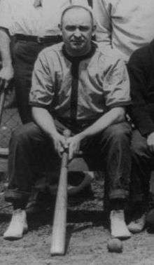
 Benjamin L. Rosenbloom Benjamin L. Rosenbloom |
Republican | March 4, 1921 – March 3, 1925 |
Lost re-election |
 Carl G. Bachmann Carl G. Bachmann |
Republican | March 4, 1925 – March 3, 1933 |
Lost re-election |
 Robert L. Ramsay Robert L. Ramsay |
Democratic | March 4, 1933 – January 3, 1939 |
Lost re-election |
 A. C. Schiffler A. C. Schiffler |
Republican | January 3, 1939 – January 3, 1941 |
Lost re-election |
 Robert L. Ramsay Robert L. Ramsay |
Democratic | January 3, 1941 – January 3, 1943 |
Lost re-election |
 A. C. Schiffler A. C. Schiffler |
Republican | January 3, 1943 – January 3, 1945 |
Lost re-election |
 Matthew M. Neely Matthew M. Neely |
Democratic | January 3, 1945 – January 3, 1947 |
Lost re-election |
 Francis J. Love Francis J. Love |
Republican | January 3, 1947 – January 3, 1949 |
Lost re-election |
 Robert L. Ramsay Robert L. Ramsay |
Democratic | January 3, 1949 – January 3, 1953 |
Lost re-election |
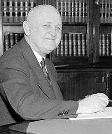
 Bob Mollohan Bob Mollohan |
Democratic | January 3, 1953 – January 3, 1957 |
Lost re-election |
 Arch A. Moore, Jr. Arch A. Moore, Jr. |
Republican | January 3, 1957 – January 3, 1969 |
Resigned to become Governor of West Virginia |
 Bob Mollohan Bob Mollohan |
Democratic | January 3, 1969 – January 3, 1983 |
Retired |
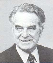
 Alan Mollohan Alan Mollohan |
Democratic | January 3, 1983 – January 3, 2011 |
Lost renomination |
 David McKinley David McKinley |
Republican | January 3, 2011 – Present |
Elected in 2010 |
Historical district boundaries

See also
References
- Martis, Kenneth C. (1989). The Historical Atlas of Political Parties in the United States Congress. New York: Macmillan Publishing Company.
- Martis, Kenneth C. (1982). The Historical Atlas of United States Congressional Districts. New York: Macmillan Publishing Company.
- Congressional Biographical Directory of the United States 1774–present
Coordinates: 39°22′55″N 80°16′07″W / 39.38194°N 80.26861°W
.tif.png)