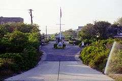
West Gilgo Beach, New York

West Gilgo Beach is a small private gated community located in the town of Babylon, in Suffolk County, New York, United States. It is part of the Gilgo census-designated place.
History
West Gilgo Beach was founded in the late 1930s by residents of High Hill Beach, who were displaced by the creation of Jones Beach State Park. Some of their original houses were moved by barge, from Jones Beach to the new community; the others were moved by road over the newly constructed causeway connecting Jones Beach to Captree State Park. Since then, the West Gilgo Beach Association has grown to approximately 80 houses.
Description
Originally almost entirely a summer community, over half of the houses are now winterized, and there is a mix of full-time and second home residents. The community hosts a small non-denominational church, a self-service library, an unmanned post office, and small firehouses that have hoses on carts. Residents depend on central well water and individual septic tanks. Cable television remains inaccessible.
The land is not owned by the residents, but is on long term lease from the Town of Babylon. In the early 1990s, there was litigation by New York State to not extend the lease. After much negotiation, the lease was renewed, with a ramp up in costs.
Noteworthy projects
In July 2011, West Gilgo Beach residents united to beautify the community via a large-scale mural painting in the beach-access tunnel.[1]
Geography
West Gilgo Beach is located on Jones Beach Island, a barrier island situated between the Atlantic Ocean and the Great South Bay of Long Island. West Gilgo Beach is an L-shaped community with two roads: Ocean Walk, which begins at the border of Nassau County and Suffolk County and extends east along Ocean Parkway, and Bay Walk, which begins at the gate and heads north towards the Great South Bay. West Gilgo Beach is a Right-in/right-out exit from Ocean Parkway, between Tobay Beach and Gilgo Beach.
References
- ↑ West Gilgo Beach Mural Project. Vimeo. (Documentary)
External links
- Map: 40°36′44″N 73°25′07″W / 40.61222°N 73.41861°WCoordinates: 40°36′44″N 73°25′07″W / 40.61222°N 73.41861°W