West End, Cincinnati

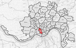
West End is a neighborhood in Cincinnati, Ohio, located north-west of downtown, east of Queensgate, west of Over-the-Rhine, and south-east of Fairview.
The historic West End was largely razed in the 1950s as part of a series of urban renewal projects, including the construction of Interstate 75.[1]
The West End is the location of City West, the largest housing development project in Cincinnati since World War II.[2] The project transformed the once low-income area into mixed-income development.[2] In 1999 many of the blighted, cramped buildings were leveled to make way for new townhomes with ample parking.[2] In 2007, part 1 crimes were down by 30% when compared to 1999.[2]
Controversy erupted in 2005 when plans were announced to open a $15-million "one-stop" social services facility at 800 Bank Street.[3] The project, known as CityLink, would be the largest such facility in Cincinnati.[4] Some argued that it would increase crime and poverty in the West End, decrease property value, and undermine the redevelopment there.[4] Some even accused the city of trying to relocate the poor from the thriving Over-the-Rhine neighborhood to the West End.[4] However, proponents argued that the West End's central location makes it easy for the poor to access.[4] A lawsuit to stop the CityLink project failed, as did the subsequent appeal to the Ohio Supreme Court.[3]
The West End is served by a branch of the Public Library of Cincinnati and Hamilton County.[5]
Historic architecture and districts

- Laurel Homes
- Union Terminal, 1301 Western Ave
- Dayton Street Historic District
- Betts–Longworth Historic District
- Betts House, 416 Clark St
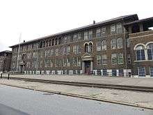
- Washburn School (Now Cincinnati College Preparatory Academy West), 1425 Linn St
- Former Lafayette-Bloom School, 1941 Baymiller St.
- The Regal Theatre, Clark and Linn Street
- The State Theatre, 1504 Central Ave
- St. Joseph’s Catholic School, 745 Ezzard Charles Dr.
- Former Heberle Elementary School, 2009 Freeman Ave.
References
- ↑ Gratz, Roberta Brandes (Sep 1, 1994). "The Living City: How America's Cities Are Being Revitalized by Thinking Small in a Big Way". John Wiley & Sons. p. 70. Retrieved 9 December 2013.
- 1 2 3 4 Demeropolis, Tom (April 25, 2008). "City West project recreates West End". Business Courier of Cincinnati. Retrieved 2008-08-10.
- 1 2 "Court decision go-ahead for Cincinnati's CityLink". Business Courier of Cincinnati. March 24, 2008. Retrieved 2008-08-10.
- 1 2 3 4 Carter-Novotni, Stephen (2005-12-21). "CityLink Divides West End". Cincinnati CityBeat. Retrieved 2008-08-10.
- ↑ "West End Branch". Public Library of Cincinnati and Hamilton County. Retrieved 12 June 2014.
Further reading
Harshaw, J. W. (2009). Cincinnati's West End: Through our eyes. United States: CreateSpace.[1]
Singer, A. J. (2005). Stepping out in Cincinnati: Queen City Entertainment 1900-1960. Mount Pleasant, SC: Arcadia Publishing.[2]
External links
- Comprehensive West End Revitalization Plan
- Official CityLink site
- Ezzard Charles Drive, the Making of a Parkway
Coordinates: 39°06′43″N 84°31′31″W / 39.1119444°N 84.5252778°W
- ↑ Harshaw, John (2009). Cincinnati's West End: Through our eyes. United States: CreateSpace. ISBN 1456306022.
- ↑ Singer, Allen (2005). Stepping Out in Cincinnati: Queen City Entertainment 1900-1960. South Carolina: Arcadia Publishing. ISBN 0738534323.
.png)