Wenceslas Square


Wenceslas Square (Czech: ![]() Václavské náměstí [ˈvaːt͡slafskɛː ˈnaːmɲɛsciː], colloquially Václavák [ˈvaːt͡slavaːk]) is one of the main city squares and the centre of the business and cultural communities in the New Town of Prague, Czech Republic. Many historical events occurred there, and it is a traditional setting for demonstrations, celebrations, and other public gatherings. The square is named after Saint Wenceslas, the patron saint of Bohemia. It is part of the historic centre of Prague, a World Heritage Site.[1]
Václavské náměstí [ˈvaːt͡slafskɛː ˈnaːmɲɛsciː], colloquially Václavák [ˈvaːt͡slavaːk]) is one of the main city squares and the centre of the business and cultural communities in the New Town of Prague, Czech Republic. Many historical events occurred there, and it is a traditional setting for demonstrations, celebrations, and other public gatherings. The square is named after Saint Wenceslas, the patron saint of Bohemia. It is part of the historic centre of Prague, a World Heritage Site.[1]
Formerly known as Koňský trh (Horse Market), for its periodic accommodation of horse markets during the Middle Ages, it was renamed Svatováclavské náměstí (English: Saint Wenceslas square) in 1848 on the proposal of Karel Havlíček Borovský.
Features
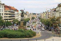
Less a square than a boulevard, Wenceslas Square has the shape of a very long (750 m, total area 45,000 m2) rectangle, in a northwest–southeast direction. The street slopes upward to the southeast side. At that end, the street is dominated by the grand neoclassical Czech National Museum. The northwest end runs up against the border between the New Town and the Old Town.
History
In 1348, Bohemian King Charles IV founded the New Town of Prague. The plan included several open areas for markets, of which the second largest was the Koňský trh, or Horse Market (the largest was the Charles Square[2]). At the southeastern end of the market was the Horse Gate, one of the gates in the walls of the New Town.
During the Czech national revival movement in the 19th century, a more noble name for the street was requested. At this time the statue was built, and the square was renamed.
On 28 October 1918, Alois Jirásek read the proclamation of independence of Czechoslovakia in front of the Saint Wenceslas statue.
The Nazis used the street for mass demonstrations. During the Prague Uprising in 1945, a few buildings near the National Museum were destroyed. They were later replaced by department stores.
On 16 January 1969, student Jan Palach set himself on fire in Wenceslas Square to protest the invasion of Czechoslovakia by the Soviet Union in 1968.
On 28 March 1969, the Czechoslovakian national ice hockey team defeated the USSR team for the second time in that year's Ice Hockey World Championships. As the country was still under Soviet occupation, the victory induced great celebrations. Perhaps 150,000 people gathered on Wenceslas Square, and skirmishes with police developed. A group of agents provocateurs provoked an attack on the Prague office of the Soviet airline Aeroflot, located on the street. The vandalism served as a pretext for reprisals and the period of so-called normalization.
In 1989, during the Velvet Revolution, large demonstrations (with hundreds of thousands of people or more) were held here.
Wenceslas Square is lined by hotels, offices, retail stores, currency exchange booths and fast-food joints. To the dismay of locals and city officials, the street is also a popular location for prostitutes to ply their trade late at night. Many strip clubs exist on and around Wenceslas Square, making Prague a popular location for stag parties.
Art and architecture
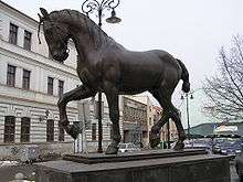
The two obvious landmarks of Wenceslas Square are at the southeast, uphill end: the 1885–1891 National Museum Building, designed by Czech architect Josef Schulz, and the statue of Wenceslas.
Other significant buildings on the square include:
- Antonin Pfeiffer and Matěj Blecha's Palác Koruna office building and shopping center, #1–2, 1912–1914, with architectural sculpture by Vojtěch Sucharda
- Ludvík Kysela's Lindt Building, No. 4, an early work of architectural constructivism
- the BAŤA shoe store, No. 6, 1929
- Matěj Blecha and Emil Králíček's Adam Pharmacy, No. 8, 1911–1913
- Jan Kotěra's Peterka Building, No. 12, 1899–1900
- Pavel Janák's Hotel Juliš, No. 22, 1926
- Alois Dryák's Hotel Evropa, #25–27, 1905 redesign, with architectural sculptor Ladislav Šaloun
- Antonin Wiehl's Wiehl House, No. 34, 1896
- the Melantrich Building, No. 36, 1914, where Alexander Dubček and Václav Havel appeared together on its balcony in November 1989, a major event of the Velvet Revolution
- Hotel Adria, No 26, reconstruction in 1912, in 1918 sold to František Tichý, Burian’s Theatre (1925–1928)
Transport
The Prague Metro's line A runs underneath Wenceslas Square, and the Metro's two busiest stations, Muzeum (lines A and C) and Můstek (lines A and B), have entrances on the street. Tram tracks running the length of the street were removed from the street in 1980; a proposal to reintroduce trams is under consideration. Currently trams bisect the square only. Most of the street is open to automobile traffic; the northwestern end is pedestrianised.
Literary references
- A tavern in the square, the Golden Goose, is mentioned in Franz Kafka's Amerika, as the place where the Manageress previously worked.
- Wenceslas Square is the name of a theatrical play by Larry Shue, which is set in Prague.
- Wenceslas Square is the name of a story written by Arthur Phillips, which takes place in Czechoslovakia at the end of the Cold War. The story was published in the compendium Wild East: Stories from the Last Frontier, and featured in Episode 337 of the radio show This American Life.
- "Wenceslas Square" featured in Marc Adnitt's short film "You Want Christmas?" in December 2008.
References
| Wikimedia Commons has media related to Wenceslas Square. |
- ↑ "Historic Centre of Prague - World Heritage Site - Pictures, info and travel reports". Archived from the original on 2004-01-15. Retrieved 30 April 2016.
- ↑ http://www.prague-wiki.com/wiki/Charles_Square Charles Square
- Lazarova, Daniela (27 Nov 2004). The Changing Face of Wenceslas Square Radio Praha.
- Stankova, Jaroslava, et al. (1992) Prague: Eleven Centuries of Architecture. Prague: PAV. ISBN 80-900003-1-2.
Coordinates: 50°04′53″N 14°25′39″E / 50.08139°N 14.42750°E