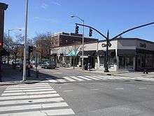
Wayland Square
Coordinates: 41°49′48″N 71°23′16″W / 41.830106°N 71.387779°W

Wayland Square in Providence, RI
Wayland Square is a historic area on the East Side of Providence, Rhode Island near Brown University and the Rhode Island School of Design.
History

Francis Wayland, President of Brown University
The square and Wayland Avenue are named after Francis Wayland, a Baptist pastor and president of Brown University.[1] Most of the area was developed in the early twentieth century with many Queen Anne style apartment buildings. The area remained largely undeveloped until the twentieth century because of the marshy environment adjacent to the river. Today, the square features numerous businesses, houses of worship, and restaurants. It is also home to the Red Bridge, which crosses the Seekonk River.[2]
See also
- Lincoln School (Providence, Rhode Island)
- Saint Martin's Church, Providence
- Temple Beth-El (Providence, Rhode Island)
- Wayland Historic District
References
- ↑ "Francis Wayland: A Founding Father of American learning". Archived from the original on September 22, 2011. Retrieved April 29, 2012.
- ↑ Official city of Providence information (accessed April 27, 2011)
This article is issued from
Wikipedia.
The text is licensed under Creative Commons - Attribution - Sharealike.
Additional terms may apply for the media files.