Wölfersheim
| Wölfersheim | ||
|---|---|---|
|
View of the town | ||
| ||
 Wölfersheim | ||
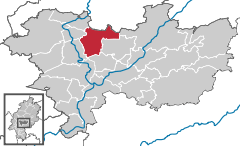
Location of Wölfersheim within Wetteraukreis district 
 | ||
| Coordinates: 50°23′51″N 8°48′41″E / 50.39750°N 8.81139°ECoordinates: 50°23′51″N 8°48′41″E / 50.39750°N 8.81139°E | ||
| Country | Germany | |
| State | Hesse | |
| Admin. region | Darmstadt | |
| District | Wetteraukreis | |
| Government | ||
| • Mayor | Rouven Kötter (SPD) | |
| Area | ||
| • Total | 43.15 km2 (16.66 sq mi) | |
| Elevation | 142 m (466 ft) | |
| Population (2015-12-31)[1] | ||
| • Total | 9,925 | |
| • Density | 230/km2 (600/sq mi) | |
| Time zone | CET/CEST (UTC+1/+2) | |
| Postal codes | 61200 | |
| Dialling codes | 06036 | |
| Vehicle registration | FB | |
| Website | www.woelfersheim.de | |
Wölfersheim is a municipality in the Wetteraukreis in Hessen, Germany. It is located approximately 34 kilometers north of Frankfurt am Main.
Division of the municipality
The municipality consists of 5 districts:
- Wölfersheim
- Södel
- Melbach
- Berstadt
- Wohnbach
Holocaust
There was a small Jewish community in Wolfersheim since at least 1700.[2] On Kristallnacht, the night of broken glass, the Jews of the town were brutally attacked by thugs. Their legal documents were destroyed and some were sent to the concentration camps where they perished at the hands of the Nazis. The Jewish cemetery still stands today though there are no Jews left in the town.
| Wikimedia Commons has media related to Wölfersheim. |
References
- ↑ "Bevölkerung der hessischen Gemeinden". Hessisches Statistisches Landesamt (in German). August 2016.
- ↑ ""Wölfersheim" Encyclopaedia of Jewish Communities: Germany volume 3". jewishgen.org. Retrieved March 27, 2014.
This article is issued from
Wikipedia.
The text is licensed under Creative Commons - Attribution - Sharealike.
Additional terms may apply for the media files.
