Van Dorn Street station
| Washington Metro rapid transit station | |||||||||||
 | |||||||||||
| Location |
5690 Eisenhower Avenue Alexandria, VA 22310 | ||||||||||
| Coordinates | 38°47′57″N 77°07′45″W / 38.79925°N 77.12922°WCoordinates: 38°47′57″N 77°07′45″W / 38.79925°N 77.12922°W | ||||||||||
| Owned by | WMATA | ||||||||||
| Line(s) |
| ||||||||||
| Platforms | 1 island platform | ||||||||||
| Tracks | 2 | ||||||||||
| Connections |
| ||||||||||
| Construction | |||||||||||
| Structure type | Embankment | ||||||||||
| Parking | 361 spaces | ||||||||||
| Bicycle facilities | 20 racks, 6 lockers | ||||||||||
| Disabled access | Yes | ||||||||||
| Other information | |||||||||||
| Station code | J02 | ||||||||||
| History | |||||||||||
| Opened | June 15, 1991 | ||||||||||
| Traffic | |||||||||||
| Passengers (2016) |
3,052 daily [1] | ||||||||||
| Services | |||||||||||
| |||||||||||
| Location | |||||||||||
 | |||||||||||
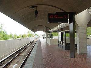
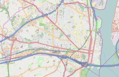
Van Dorn Street is a Washington Metro station straddling the boundary between Fairfax County and the independent city of Alexandria in Virginia, United States. The station’s island platform lies in unincorporated Rose Hill in Fairfax County, while the station’s entrance and parking facilities are in Alexandria. The station was opened on June 15, 1991, and is operated by the Washington Metropolitan Area Transit Authority (WMATA). Providing service for the Blue Line, the station is located at South Van Dorn Street and Eisenhower Avenue, next to the Capital Beltway. From 1991 to 1997 it was the southwestern terminus of the Blue Line.
In June 1977, the city of Alexandria, Southern Railway, and the United Parcel Service reached an agreement allowing for Metro to retain the air rights for the construction of the Van Dorn station when funding became available.[2] After years of planning, in March 1987 Metro awarded a $32.3 million contract to complete the station by 1991 to Dillingham Construction of Pleasanton, California.[3] Originally slated to be part of the Yellow Line, in early 1990 it was decided Van Dorn would be served by the Blue Line with the Yellow Line being shifted to the Huntington station.[4] The station opened on June 15, 1991, with the completion of 3.9 miles (6.3 km) of rail west of the King Street – Old Town station.[5][6] Van Dorn Street would remain as the southwestern terminus of the Blue Line from its completion through the opening of the Franconia–Springfield station on June 29, 1997.[7]
On June 25, 2017, Yellow Line trains stopped serving the station due to the elimination of Rush+, which is part of major changes to the Metrorail system.[8]
Station layout
| P Platform level |
Westbound | ← |
| Island platform, doors will open on the left | ||
| Eastbound | → | |
| M | Mezzanine | One-way faregates, ticket machines, station agent |
| G | Street Level | Exit/ Entrance |
References
- ↑ "Metrorail Average Weekday Passenger Boardings" (PDF). WMATA. Retrieved 2017-04-26.
- ↑ Feaver, Douglas B. (June 30, 1977), "Alexandria agreement saves Metro station site", The Washington Post, p. VA3
- ↑ Henderson, Nell (March 13, 1987), "Metro awards contract to build Van Dorn Station", The Washington Post, p. C1
- ↑ Henderson, Nell (March 16, 1990), "Metro seeks comments on budget that includes new rail stations", The Washington Post, p. D3
- ↑ Staff Reporters (June 15, 1991), "Van Dorn Station to open", The Washington Post, p. B5
- ↑ Washington Metropolitan Area Transit Authority (July 2009). "Sequence of Metrorail openings" (PDF). Retrieved July 25, 2010.
- ↑ Tousignant, Marylou (June 27, 1997), "At last, Metro reaches end of the Blue Line; Franconia-Springfield station to begin service on Sunday", The Washington Post, p. B1
- ↑ https://www.wmata.com/service/status/details/upload/June25FareServiceChanges_PrintableBrochure_English.pdf
External links
![]() Media related to Van Dorn Street (WMATA station) at Wikimedia Commons
Media related to Van Dorn Street (WMATA station) at Wikimedia Commons
- WMATA: Van Dorn Street Station
- StationMasters Online: Van Dorn Street Station
- The Schumin Web Transit Center: Van Dorn Street Station
- Station from Google Maps Street View