Massachusetts's 1st congressional district
| Massachusetts's 1st congressional district | |
|---|---|
|
Massachusetts's 1st congressional district - since January 3, 2013. | |
| Current Representative | Richard Neal (D–Springfield) |
| Area | 3,101.14 sq mi (8,031.9 km2) |
| Distribution |
|
| Population (2000) | 634,479 |
| Median income | 50,210[1] |
| Ethnicity |
|
| Occupation |
|
| Cook PVI | D+12[2] |
Massachusetts's 1st congressional district is located in western and central Massachusetts. The largest Massachusetts district in area, it covers about one-third of the state and is more rural than the rest. It has the state's highest point, Mount Greylock. The district includes the cities of Springfield, West Springfield, Pittsfield, Holyoke, and Westfield.
The shape of the district underwent some changes effective from the elections of 2012, after Massachusetts congressional redistricting to reflect the 2010 census.[3] The entire Springfield area is included in the new 1st district, and the Worcester County areas of the old 1st district were split between the new 2nd and 3rd districts.
Richard Neal, a Democrat from Springfield, represents the district.
Cities and towns currently in the district
All of Berkshire County, all of Hampden County (except for Precinct 1A in Palmer), and the following towns and cities:
In Franklin County: Ashfield, Bernardston, Buckland, Charlemont, Colrain, Conway, Hawley, Heath, Leyden, Monroe, Rowe, and Shelburne.
In Hampshire County: Chesterfield, Cummington, Easthampton, Goshen, Granby, Huntington, Middlefield, Plainfield, South Hadley, Southampton, Westhampton, Williamsburg, and Worthington.
In Worcester County: Brookfield, Charlton, Dudley, East Brookfield, Southbridge, Sturbridge, and Warren.
Cities and towns in the district prior to 2013
When the District was created it covered part of eastern Massachusetts, generally south of Boston.
1840s
1849: "City of Boston."[4]
1860s
1862: "All of Barnstable, Dukes and Nantucket counties; the city of New Bedford and towns of Dartmouth and Fairhaven, in Bristol county; the towns of Carver, Kingston, Plymouth, Plympton, Rochester, and Wareham, in Plymouth county."[5]
1910s
1916: "Berkshire County. Franklin County: Towns of Ashfleld, Buckland, Charlemont, Colrain, Conway, Greenfield, Hawley, Heath, Leyden, Monroe, Rowe, and Shelburne. Hampshire County: Towns of Chesterfield, Cummington, Goshen, Huntington, Middlefield, Plainfield, Southampton, Westhampton and Worthington. Hampden County: City of Holyoke and towns of Blandford, Chester, Granville, Montgomery, Russell, Southwick, Tolland, and Westfield."[6]
1950s-1970s
1953: "Counties: Berkshire and Franklin. Hamdpen County: Cities of Holyoke and Westfield; towns of Blandford, Chester, Granville, Montgomery, Russell, Southwick, and Tolland. Hampshire County: Towns of Belchertown, Chesterfield, Cummington, Goshen, Huntington, Middlefield, Pelham, Plainfield, Southampton, Westhampton, Williamsburg, and Worthington. Worcester County: Towns of Athol, Petersham, Phillipston, Royalston, and Templeton."[7]
1963: "Berkshire County: Cities of North Adams and Pittsfield. Towns of Adams, Alford, Becket, Cheshire, Clarksburg, Dalton, Egremont, Florida, Great Barrington, Hancock, Hinsdale, Lanesborough, Lee, Lenox, Monterey, Mount Washington, New Ashford, New Marlborough, Otis, Peru, Richmond, Sandisfield, Savoy, Sheffield, Stockbridge, Tyringham, Washington, West Stockbridge, Williamstown, and Windsor. Franklin County: Towns of Ashfield, Bernardston, Buckland, Charlemont, Colrain, Conway, Deerfield, Erving, Gill, Greenfield, Hawley, Heath, Leverett, Leyden, Monroe, Montague, New Salem, Northfield, Orange, Rowe, Shelburne, Shutesbury, Sunderland, Warwick, Wendell, and Whately. Hampden County: Cities of Holyoke and Westfield. Towns of Blandford, Chester, Granville, Montgomery, Russell, Southwick, and Tolland. Hampshire County: City of Northampton. Towns of Amherst, Chesterfield, Cummington, Easthampton, Goshen, Hadley, Hatfield, Huntington, Middlefield, Pelham, Plainfield, Southampton, Westhampton, Williamsburg, and Worthington. Worcester County: Towns of Athol, Petersham, Phillipston, Royalston, and Templeton."[8]
1972: "Berkshire County: All cities and towns. Franklin County: All towns. Hampden County: Cities of Holyoke and Westfield. Towns of Agawam, Blandford, Chester, Granville, Montgomery, Russell, Southwick, Tolland, and West Springfield. Hampshire County: City of Northampton. Towns of Amherst, Chesterfield, Cummington, Easthampton, Goshen, Hadley, Hatfield, Huntington, Middlefield, Pelham, Plainfleld, Southampton, Westhampton, Williamsburg, and Worthington. Worcester County: Towns of Athol, Barre, Hardwick, Hubbardston, New Braintree, Oakham, Petersham, Phillipston, Royalston. Rutland, and Templeton."[9]
1973: "Berkshire County: All cities and towns. Franklin County: All towns except Orange. Hampden County: Cities of Holyoke and Westfleld. Towns of Agawam, Blandford, Chester, Granville, Montgomery, Russell, Southwick, Tolland, West Springfield. Hampshire County: City of Northampton. All towns."[10]
2003-2013

The district contains all of Berkshire County and Franklin County as well the following towns and cities:
In Hampden County: Blandford, Chester, Granville, Holyoke, Montgomery, Russell, Southwick, Tolland, Westfield, West Springfield.
In Hampshire County: Amherst, Belchertown, Chesterfield, Cummington, Easthampton, Goshen, Granby, Hatfield, Huntington, Middlefield, Pelham, Plainfield, Southampton, Ware, Westhampton, Williamsburg, Worthington.
In Middlesex County: Ashby, Pepperell, Townsend.
In Worcester County: Ashburnham, Athol, Barre, Fitchburg, Gardner, Hardwick, Hubbardston, Leominster, Lunenburg, New Braintree, Oakham, Petersham, Phillipston, Royalston, Sterling, Templeton, West Brookfield, Westminster, Winchendon.
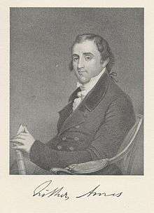
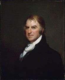
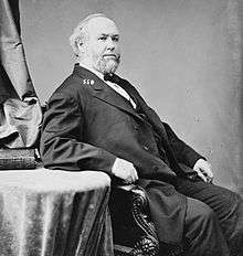
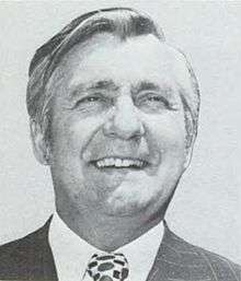
List of representatives
Recent election results
| Party | Candidate | Votes | % | ± | |
|---|---|---|---|---|---|
| Democratic | John Olver | 137,841 | 67.56 | ||
| Republican | Matthew Kinnaman | 66,061 | 32.40 | ||
| Write-in | 117 | 0.06 | |||
| Majority | 71,780 | 35.18 | |||
| Turnout | 204,019 | ||||
| Democratic hold | Swing | ||||
| Party | Candidate | Votes | % | ± | |
|---|---|---|---|---|---|
| Democratic | John Olver | 229,465 | 99.02 | + 31.46 | |
| Write-in | 2,282 | 0.98 | + 0.92 | ||
| Majority | 227,183 | 98.04 | + 62.86 | ||
| Turnout | 231,747 | ||||
| Democratic hold | Swing | ||||
| Party | Candidate | Votes | % | ± | |
|---|---|---|---|---|---|
| Democratic | John Olver | 158,035 | 76% | ||
| Unenrolled challenger | William H. Szych | 49,123 | 24% | {{{change}}} | |
| Socialist | Eric Chester | <253 | <1% | ||
| Democratic hold | Swing | ||||
| Party | Candidate | Votes | % | ± | |
|---|---|---|---|---|---|
| Democratic | John Olver | ||||
| Democratic | Robert Feuer | ||||
| Republican | Nathan Bech | ||||
See also
References
- ↑ "Fast Facts for Congress: Congressional District 1, Massachusetts - Fact Sheet: 2006-2010 American Community Survey 5-Year Estimates: Profile of Selected Economic Characteristics". U.S. Census Bureau. Retrieved April 1, 2014.
- ↑ "Partisan Voting Index – Districts of the 115th Congress" (PDF). The Cook Political Report. April 7, 2017. Retrieved April 7, 2017.
- ↑ http://www.sec.state.ma.us/spr/sprcat/catpdf2010/cong2010/CongressionalDistrict_2011State.pdf Access Date March 29, 2012
- ↑ John Hayward (1849). "Congressional Districts". Gazetteer of Massachusetts. Boston: J.P. Jewett & Co.
- ↑ "Congressional Districts". Massachusetts Register 1862. Boston: Adams, Sampson, & Co.
- ↑ "Massachusetts". Official Congressional Directory: 64th Congress (2nd ed.). Washington DC: Government Printing Office. 1916.
- ↑ "Massachusetts". Official Congressional Directory: 83rd Congress. Washington DC: Government Printing Office. 1953.
- ↑ "Massachusetts". Official Congressional Directory: 88th Congress. Washington DC: Government Printing Office. 1963.
- ↑ "Massachusetts". Official Congressional Directory: 92nd Congress. Washington DC: Government Printing Office. 1972.
- ↑ "Massachusetts". Official Congressional Directory: 93rd Congress. Washington DC: Government Printing Office. 1973.
- ↑ "Massachusetts". Congressional Directory for the Second Session of the Thirty-Seventh Congress. Washington DC: House of Representatives. 1861.
- ↑ Ben. Perley Poore (1869). "Massachusetts". Congressional Directory for the First Session of the Forty-First Congress (2nd ed.). Washington DC: Government Printing Office.
- ↑ Ben. Perley Poore (1878). "Massachusetts". Congressional Directory: 45th Congress (3rd ed.). Washington DC: Government Printing Office.
- ↑ Ben. Perley Poore (1882). "Massachusetts". Congressional Directory: 47th Congress (3rd ed.). Washington DC: Government Printing Office.
- ↑ L.A. Coolidge (1897). "Massachusetts". Official Congressional Directory: Fifty-Fifth Congress. Washington DC: Government Printing Office.
- ↑ A.J. Halford (1903). "Massachusetts". Official Congressional Directory: Fifty-Eighth Congress. Washington DC: Government Printing Office.
- ↑ A.J. Halford (1909). "Massachusetts". Congressional Directory: 60th Congress (2nd ed.). Washington DC: Government Printing Office.
- ↑ "Massachusetts". Official Congressional Directory: 75th Congress (2nd ed.). Washington DC: Government Printing Office. 1938.
- ↑ "Massachusetts". Official Congressional Directory: 90th Congress. Washington DC: Government Printing Office. 1968.
- ↑ http://www.masslive.com/news/index.ssf/2011/10/us_rep_john_olver_announces_pl.html
- Martis, Kenneth C. (1989). The Historical Atlas of Political Parties in the United States Congress. New York: Macmillan Publishing Company.
- Martis, Kenneth C. (1982). The Historical Atlas of United States Congressional Districts. New York: Macmillan Publishing Company.
- Congressional Biographical Directory of the United States 1774–present
- Massachusetts Congressional Districts
External links
| Wikimedia Commons has media related to Massachusetts's 1st congressional district. |
- CNN.com 2004 election results
- CNN.com 2006 election results
- Map of Massachusetts's 1st Congressional District, via Massachusetts Secretary of the Commonwealth
Coordinates: 42°19′52″N 72°51′51″W / 42.33111°N 72.86417°W
.tif.png)


.jpg)

.jpg)


_Picture.png)


.jpg)


.jpg)


