Union County, New Jersey
| Union County, New Jersey | ||
|---|---|---|
|
| ||
| ||
 Location in the U.S. state of New Jersey | ||
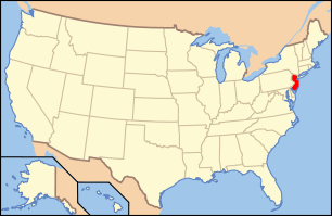 New Jersey's location in the U.S. | ||
| Founded | 1857[1] | |
| Seat | Elizabeth[2] | |
| Largest city | Elizabeth (population and area) | |
| Area | ||
| • Total | 105.40 sq mi (273 km2) | |
| • Land | 102.86 sq mi (266 km2) | |
| • Water | 2.55 sq mi (7 km2), 2.42% | |
| Population | ||
| • (2010) |
536,499[3] 555,630 (2016 est.; 7th in state)[4] | |
| • Density | 5,403/sq mi (2,086.2/km²) | |
| Congressional districts | 7th, 8th, 10th, 12th | |
| Website |
www | |


Union County is a county in the U.S. state of New Jersey. As of the 2016 Census estimate, the county's population was 555,630, making it the seventh-most populous of the state's 21 counties,[4][5][6] an increase of 3.6% from the 2010 United States Census, when its population was enumerated at 536,499,[3] in turn an increase of 13,958 (2.7%) from the 522,541 enumerated in the 2000 Census.[7] In 2010, Union County slipped to the seventh-most populous county in the state, having been surpassed by Ocean County.[8][9] Union County is part of the New York metropolitan area. Its county seat is Elizabeth.[2] The Bureau of Economic Analysis ranked the county as having the 119th-highest per capita income of all 3,113 counties in the United States (and the eighth-highest in New Jersey) in 2009.[10] A study by Forbes.com determined that Union County pays the second-highest property taxes of all U.S. counties, based on 2007 data.[11] With a population density of 4,955 people per square mile (water excluded), Union County was the 15th-most densely populated county in America as of the 2010 Census, and third-densest in New Jersey, behind Hudson County (ranked 6th nationwide at 9,754 per square mile) and Essex County (ranked 11th at 6,126).[12][13]
History
All of present-day Union County was part of the Elizabethtown Tract, which was purchased in 1664, by English colonists from the Lenape Native Americans that lived in the area of present-day Elizabeth, New Jersey. Union County was formed on March 19, 1857, from portions of Essex County; it was the last of New Jersey's 21 counties to be established.[1]
Many historic places and structures are to be found in the county, including on the National Register of Historic Places listings in Union County, New Jersey.[14]
Every fall, Union County holds its annual "Four Centuries in a Weekend" festival for the public, celebrating and touring historic buildings, museums and sites in the county.[15]
Museums and historical societies
Union County Historical Society
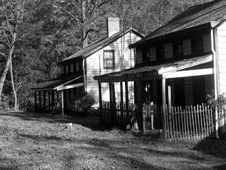
In 1869, the Union County Historical Society of New Jersey was incorporated. The society meets at the Hanson House in Cranford.[16]
Municipal historical societies
- Berkeley Heights - The Berkeley Heights Historical Society.[17]
- Clark - The Clark Historical Society was founded in 1970. It operates the Dr. William Robinson Plantation House Museum, built in 1690 by a doctor from Scotland.[18]
- Cranford - The Cranford Historic Preservation Advisory Board is an official township committee body, while the Cranford Historical Society itself is citizen-run. It is located in the Hanson House in Hanson Park on Springfield Avenue and maintains the Crane-Phillips House (c. 1845) a couple of blocks south on North Union Avenue as a museum.[19]
- Garwood - Garwood Historical Committee.[20]
- Hillside - The Hillside Historical Society, founded in 1975, meets at the Woodruff House.[21]
- Kenilworth - The Kenilworth Historical Society dates to 1974. It runs the Oswald J. Nitschke House (c. 1880).[22]
- Linden - The Linden Society for Historical Preservation is an offshoot of an official cultural board in the city.[23]
- Mountainside - The Mountainside Restoration Committee, Inc. is also called the Mountainside Historic Committee, founded in 1984.[24]
- Plainfield - The Historical Society of Plainfield is headquartered at the Nathaniel Drake House Museum, built in 1746 on the Old York Road.[25][26]
- Scotch Plains and Fanwood - The Scotch Plains-Fanwood Historical Society runs the Osborn Cannonball House.[27]
- Rahway - The Rahway Historical Society is now called the Merchants' and Drovers' Tavern Museum Association.[28]
- Westfield - The Westfield Historical Society is in the Reeve History & Cultural Resource Center, a structure from the 1870s. The Society also runs the Miller-Cory House Museum, in a home that dates back to the 1740s.[29]
Other historical preservation groups
- Friends of Rahway River Parkway is dedicated to preserving Olmsted design principles and features of county parkland along the Rahway River as it flows to the Arthur Kill.
Geography
According to the 2010 Census, the county had a total area of 105.40 square miles (273.0 km2), including 102.86 square miles (266.4 km2) of land (97.6%) and 2.55 square miles (6.6 km2) of water (2.4%).[9][30]
Much of Union County is relatively flat and low-lying. Only in the northwestern corner does any significant relief appear as the Watchung Mountains cross the county. It is there that highest elevations, two areas approximately 560 feet (170 m) above sea level, are found in Berkeley Heights.[31] The lowest elevation is sea level along the eastern shore.
Rivers, lakes and streams
- Arthur Kill
- Rahway River
- Elizabeth River
- Nomahegan Brook
- Marshes Creek
- Morses Creek
- Peach Orchard Brook
Climate and weather
| Elizabeth, New Jersey | ||||||||||||||||||||||||||||||||||||||||||||||||||||||||||||
|---|---|---|---|---|---|---|---|---|---|---|---|---|---|---|---|---|---|---|---|---|---|---|---|---|---|---|---|---|---|---|---|---|---|---|---|---|---|---|---|---|---|---|---|---|---|---|---|---|---|---|---|---|---|---|---|---|---|---|---|---|
| Climate chart (explanation) | ||||||||||||||||||||||||||||||||||||||||||||||||||||||||||||
| ||||||||||||||||||||||||||||||||||||||||||||||||||||||||||||
| ||||||||||||||||||||||||||||||||||||||||||||||||||||||||||||
In recent years, average temperatures in the county seat of Elizabeth have ranged from a low of 24 °F (−4 °C) in January to a high of 86 °F (30 °C) in July, although a record low of −14 °F (−26 °C) was recorded in February 1934 and a record high of 105 °F (41 °C) was recorded in July 1993. Average monthly precipitation ranged from 2.99 inches (76 mm) in February to 4.76 inches (121 mm) in July.[32]
Adjacent counties
Union County adjoins the following counties:[33]
- Essex County, New Jersey – north
- Hudson County, New Jersey – northeast
- Richmond County, New York – east
- Middlesex County, New Jersey – south
- Somerset County, New Jersey – west
- Morris County, New Jersey – northwest
Parks and recreation

County parks are maintained and operated by the Union County Department of Parks and Recreation, successor agency to the Union County Park Commission.
"The plan of any County Park System should be based on the principle that such system would benefit the whole population of the county, that it should be convenient and easily accessible to the large centers of population and that above all else, it should take over and preserve for park purposes land adoptable for parks before it is utilized for residences, factories or other purposes.”
Parks
County-run parks
- Ash Brook Reservation
- Black Brook Park
- Briant Park
- "Briant Park, located in the City of Summit and Springfield Township, contains 30.3 acres. It is bordered along its western side by Park Drive, along the east by Shunpike Road, and on the northern side by Briant Parkway and Morris Avenue. A brook cuts through the park, and the park is connected via a greenway to Hidden Valley Park in the southeast. There is a pond for ice-skating and fishing, some picnic areas, athletic fields, and a fitness trail." [34][35]
- Brookside Park
- Cedar Brook Park. Home to the Shakespeare Garden in Plainfield.
- Echo Lake Park
- Westfield and Mountainside
- The privately owned Echo Lake Country Club donated the parkland for this park in the 1920s. The name arises from the echo heard off the high bluff on the far side of the lake. Echo Lake itself was created by damning when mills were established on Nomahegan Brook, a tributary of the Rahway River. The Great Minisink Trail passed by Echo Lake Park.
- Elizabeth River Park
- Green Brook Park
- Hidden Valley Park
- "Hidden Valley Park, located in the City of Summit and Springfield Township. The park contains 70.4 acres of basically undeveloped land that is connected via a greenway along Orchard Street to Briant Park. Hidden Valley Park is bordered along its southern edge by U.S. Route 78 and along the west by the residential neighborhoods along Baltusrol Road and Morris Avenue." [36][35] Its eastern border is adjacent to the now-closed Houdaille Quarry.
- The Houdaille Quarry (closed to public)
- Lenape Park
- Cranford/Westfield/Kenilworth
- In the 1930s, workers digging Lenape Lake found mastodon bones here.
- Madison Avenue Park
- Mattano Park. This park is named for a Lenape tribal leader, whose name was recorded by colonists as Mattano. In 1664, a group called the Elizabethtown Associates bought land in the Union County area from Mattano and another Lenape leader named Warinanco.
- MacConnell Park; Named for the first town doctor in Cranford, New Jersey
- Milton Lake Park
- Mindowaskin Park
- Nomahegan Park
- Located in Cranford, this park contains Nomahegan Park Pond and encircles the Rahway River.
 Nomahegan Pond near Union County College Cranford NJ
- Located in Cranford, this park contains Nomahegan Park Pond and encircles the Rahway River.
- Oak Ridge Park
- Passaic River Park
- "Passaic River Park is actually six small park areas along the Passaic River in western Union County (Summit, New Providence, Berkeley Heights). These areas are undeveloped with no facilities, and contain 133.4 acres in total. Area #1 in Summit and New Providence is located between Route 124 and the railroad tracks. The northern area of the park is bordered by Morris County, and the southern area is bordered by River Road in Summit."[37][35]
- Phil Rizzuto Park
- Elizabeth
- Ponderosa Farm Park
- Rahway River Park
- Rahway
- Environmental groups protested at the building of a stadium here in 2016. The movement gave birth to Friends of Rahway River Parkway.[38]
- Rahway River Parkway
- Tamaques Park
- Unami Park
- Watchung Reservation
- Warinanco Park; Named for the Native American known as "Warinanco." Designed by the Olmsted Brothers firm.
Other notable parks
Parks that are not controlled by county government include:
- Hawk Rise Sanctuary. A bird sanctuary built in 2012 on banks of Rahway River in Linden. Hawk Rise Sanctuary is a 95-acre ecological preserve and wetland complex in Linden in an area previously concealed by various industrial land uses. Its trails were created adjacent to the former Linden Landfill area by the New Jersey Department of Environmental Protection, the city of Linden and the New Jersey Audubon Society.[39] The trails in the Hawk Rise forest are boardwalk, with some continuing as gravel along the edge of the former Linden Landfill. It has an overlook area where hikers can view the Rahway River and nearby marshes. It has been open to the public since 2012. The site includes diverse environments: forested wetlands, vernal pools, grasslands, shrublands, salt marsh, mudflats, a pond, and the tidal Rahway River. 163 bird species have been spotted there.[40][41] It has been reported as vandalized.[39]
- Reeves-Reed Arboretum in Summit.
- Kennedy Reservation in Union.[42]
- The grounds of Liberty Hall museum near the campus of Kean University in Union and Elizabeth.
Rahway River Parkway
The Rahway River Parkway is a greenway of parkland that hugs the Rahway River and its tributaries, such as Nomahegan Brook. It was the inaugural project of the Union County Parks Commission designed in the 1920s by the Olmsted Brothers firm, who were the sons of landscape architect Frederick Law Olmsted.
Several county and municipal parks run along the Rahway River.[43][44]
- Millburn/Springfield section
- Cranford section
- The Cranford section follows the banks of the meandering Rahway River as it flows south through Lenape Park, Nomahegan Park, Hampton Park, MacConnell Park, Hanson Park, William Miller Sperry Park, Crane's Park, Droeschers Mill Park, and Mohawk Park.[45]

- Clark section
- Rahway section
Elizabeth River Parkway
The Elizabeth River Parkway is a greenway of parkland alongside the Elizabeth River and its tributaries. It runs through Kean University and Liberty Hall Museum on the river's way to the Arthur Kill. The Elizabeth River Parkway is broken down into separate sections.
- Chatfield/Zimmerman - Hillside and Union Township[46]
- Lightning Brook - Hillside and Union[47]
- Pruden/Pearl Oval - Elizabeth[48]
- Salem/Rutgers/Liberty - Hillside and Union[49]
- Woodruff/Conant Street - Hillside and Union[50]
- Ursino - Hillside and Union Township[51]
Golf
Public golf courses
Union County’s Division of Golf Operations runs two golf courses, which offer golf lessons and practice areas.[52]
- Ash Brook Golf Course in Scotch Plains.
- Galloping Hill Golf Course and Golf Learning Center in Kenilworth.[53] The facility, which hosts the headquarters of the New Jersey State Golf Association, hosted the 2016 New Jersey State Open golf tournament, the first public golf course to host the tournament since it was established in 1921.[54]
Private golf courses
- Baltusrol Golf Club
- Shackamaxon Country Club
- Suburban Golf Club
- Echo Lake Country Club
- Hyatt Hills Golf Complex in Clark.
Other recreational facilities
- Clark Community Pool[55]
- Cranford Pool
- Oak Ridge Archery Range
- Trailside Nature and Science Center at Watchung Reservation
- Warinanco Ice Skating Rink
- Wheeler Park
- County Pool – Wheeler Park (Linden)
- County Pool – Rahway River Park (Rahway)
Potential rail-to-trails
Union County Park Line rail trail is a proposed walking and/or biking trail proposed on old railroad tracks. Two abandoned rails exist in the county.[56]
The City of Summit and the Summit Park Line Foundation are working on turning the line from Morris Avenue to Briant Park in Summit into a rail trail that will be approximately one mile long. This rail trail, potentially called the Summit Park Line, could provide a greenway to connect several county parks, akin to a Summit High Line.[57] A path could run directly from Summit to the Arthur Kill in Linden, New Jersey on the Rahway Valley Railroad and the Staten Island Rapid Transit line.
The Summit city council applied for a $1 million grant toward the Summit Park Line project in November 2016.[58] “If Summit is able to complete the project, it might help other parts of the greenway come through,” said Union County Public Relations Coordinator, Sebastian Delia.[59]
The Rahway Valley Railroad runs from Summit to Roselle Park. Beginning in Hidden Valley Park, the railroad right-of-way continues by connecting Houdaille Quarry, Briant Park, Meisel Park, Rahway River Parkway, Galloping Hill Golf Course and Black Brook Park. The ending of the railway is on Westfield Avenue in Roselle Park. The Staten Island Rapid Transit runs from Cranford to Staten Island, although the project would only include the section that runs from Cranford to Linden.[59] The possible inception in Cranford would be a lot on South Avenue East. The ending of this trail would be in Linden at an empty lot. A boardwalk would run over the existing tracks to ease line reactivation.
The impact of the controversial planned Pilgrim Pipeline, which would use this particular abandoned rail line to pipe crude oil, kerosene, and diesel fuel through Cranford, New Jersey and Roselle, New Jersey, is not known.[60]
Demographics
| Historical population | |||
|---|---|---|---|
| Census | Pop. | %± | |
| 1860 | 27,780 | — | |
| 1870 | 41,859 | 50.7% | |
| 1880 | 55,571 | 32.8% | |
| 1890 | 72,467 | 30.4% | |
| 1900 | 99,353 | 37.1% | |
| 1910 | 140,197 | 41.1% | |
| 1920 | 200,157 | 42.8% | |
| 1930 | 305,209 | 52.5% | |
| 1940 | 328,344 | 7.6% | |
| 1950 | 398,138 | 21.3% | |
| 1960 | 504,255 | 26.7% | |
| 1970 | 543,116 | 7.7% | |
| 1980 | 504,094 | −7.2% | |
| 1990 | 493,819 | −2.0% | |
| 2000 | 522,541 | 5.8% | |
| 2010 | 536,499 | 2.7% | |
| Est. 2016 | 555,630 | [4] | 3.6% |
| Historical sources: 1790–1990[61] 1970–2010[9] 2000[7] 2010[3] 2000–2010[62] | |||
Union County is diverse ethnically. Berkeley Heights, Clark, Roselle Park, Cranford, Kenilworth, Linden, New Providence, Scotch Plains, Springfield, Summit, Union and Westfield have high percentages of Italian American residents. Elizabeth, Linden, Plainfield, Rahway, Roselle and Union all have large African American communities. Roselle Park has a notably large Indian American community, while Roselle Park, Linden, Rahway, Plainfield and particularly Elizabeth have fast-growing Hispanic and Portuguese populations.
The county's Jewish population was 35,000 as of 2004, with notable communities located in Cranford, Elizabeth, Hillside, Linden, Scotch Plains, Springfield, Union, and Westfield.[63]
Census 2010
As of the 2010 United States Census, there were 536,499 people, 188,118 households, and 134,692 families residing in the county. The population density was 5,216.1 per square mile (2,013.9/km2). There were 199,489 housing units at an average density of 1,939.5 per square mile (748.8/km2). The racial makeup of the county was 61.33% (329,052) White, 22.05% (118,313) Black or African American, 0.39% (2,080) Native American, 4.63% (24,839) Asian, 0.03% (163) Pacific Islander, 8.48% (45,496) from other races, and 3.09% (16,556) from two or more races. Hispanic or Latino of any race were 27.34% (146,704) of the population.[3]
There were 188,118 households out of which 34.4% had children under the age of 18 living with them, 50.1% were married couples living together, 15.6% had a female householder with no husband present, and 28.4% were non-families. 23.6% of all households were made up of individuals, and 9.7% had someone living alone who was 65 years of age or older. The average household size was 2.82 and the average family size was 3.32.[3]
In the county, the population was spread out with 24.5% under the age of 18, 8.6% from 18 to 24, 27.5% from 25 to 44, 26.8% from 45 to 64, and 12.6% who were 65 years of age or older. The median age was 38 years. For every 100 females there were 94 males. For every 100 females ages 18 and old there were 90.7 males.[3]
Census 2000
At the 2000 United States Census,[64] there were 522,541 people, 186,124 households and 133,264 families residing in the county. The population density was 5,059 per square mile (1,953/km²). There were 192,945 housing units at an average density of 1,868 per square mile (721/km²). The racial makeup of the county was 65.51% White, 20.78% Black or African American, 0.23% Native American, 3.83% Asian, 0.04% Pacific Islander, 6.37% from other races, and 3.25% from two or more races. 19.71% of the population were Hispanic or Latino of any race.[7][65] Among those residents listing their ancestry, 13.6% were of Italian, 11.1% Irish, 8.8% German and 7.6% Polish ancestry according to Census 2000.[66]
There were 186,124 households of which 34.00% had children under the age of 18 living with them, 52.60% were married couples living together, 14.20% had a female householder with no husband present, and 28.40% were non-families. 23.60% of all households were made up of individuals and 10.20% had someone living alone who was 65 years of age or older. The average household size was 2.77 and the average family size was 3.28.[7]
24.90% of the population were under the age of 18, 7.90% from 18 to 24, 31.30% from 25 to 44, 22.10% from 45 to 64, and 13.80% who were 65 years of age or older. The median age was 37 years. For every 100 females there were 92.70 males. For every 100 females age 18 and over, there were 88.90 males.[7]
The median household income was $55,339 and the median family income was $65,234. Males had a median income of $44,544 compared with $32,487 for females. The per capita income for the county was $26,992. About 6.3% of families and 8.4% of the population were below the poverty line, including 10.5% of those under age 18 and 8.0% of those age 65 or over.[67]
Government
Union County is governed by a nine-member Board of Chosen Freeholders. The members are elected at large to serve three-year terms on a staggered basis, with three seats coming up for election each year.[68] The Freeholder Board sets policies for the operation of the County. Actual day-to-day operation of departments is supervised by an appointed County Manager, Alfred Faella.
The Freeholders perform the county's legislative and executive functions. In their legislative role, they formulate and adopt a budget and set county policies and procedures. In their executive role, they oversee county spending and functioning. Many of the administrative duties are delegated by the Board of Chosen Freeholders to the County Manager.
Each of the freeholders serves on various committees and boards as a part of their duties. These include committees on Economic Development, Parks and Recreation, and Public Works and Policy. In addition, the Board oversees the county's Open Space Trust Fund.
Since the January 2016 reorganization, Union County's Freeholders are:[68][69]
- Freeholder Chairman Bruce H. Bergen (D, Springfield, 2017)[70]
- Freeholder Vice Chairman Sergio Granados (D, Elizabeth, 2018)[71]
- Linda Carter (D, Plainfield, 2019)[72]
- Angel G. Estrada (D, Elizabeth, 2017)[73]
- Christopher Hudak (D, Linden, 2018)[74]
- Mohamed S. Jalloh (D, Union Township, 2019)[75]
- Bette Jane Kowalski (D, Cranford, 2019)[76]
- Alexander Mirabella (D, Fanwood, 2018)[77]
- Vernell Wright (D, Vauxhall in Union, 2017)[78]
Constitutional officers include County clerk Joanne Rajoppi (D, Union Township, 2020),[79] Sheriff Joseph Cryan (D, Union Township, 2017),[80] and Surrogate James S. Lacorte (D, Union Township, 2019).[81]
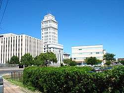
Union County constitutes Vicinage 12 of the New Jersey Superior Court.[82] Vicinage 12 is seated at the Union County Courthouse in Elizabeth, with additional facilities also located in Elizabeth; the Assignment Judge for Vicinage 12 is the Honorable Karen M. Cassidy.[83][84] Law enforcement at the county level includes the Union County Police Department, the Union County Sheriff's Office, and the Union County Prosecutor's Office.
Union County has the only county seal in the USA that depicts a woman being shot, the murder of Elizabethtown's Hannah Caldwell by British soldiers during the American Revolutionary War.[85][86]
Four federal Congressional Districts cover the county, including portions of the 7th, 8th, 10th and 12th Districts.[87][88] New Jersey's Seventh Congressional District is represented by Leonard Lance (R, Clinton Township).[89] New Jersey's Eighth Congressional District is represented by Albio Sires (D, West New York).[90] New Jersey's Tenth Congressional District is represented by Donald Payne Jr. (D, Newark).[91] New Jersey's Twelfth Congressional District is represented by Bonnie Watson Coleman (D, Ewing Township).[92]
The county is part of the 20th, 21st and 22nd Districts in the New Jersey Legislature.[93] For the 2016–2017 session (Senate, General Assembly), the 20th Legislative District of the New Jersey Legislature is represented in the State Senate by Raymond Lesniak (D, Elizabeth) and in the General Assembly by Jamel Holley (D, Roselle) and Annette Quijano (D, Elizabeth).[94] For the 2016–2017 session (Senate, General Assembly), the 21st Legislative District of the New Jersey Legislature is represented in the State Senate by Thomas Kean Jr. (R, Westfield) and in the General Assembly by Jon Bramnick (R, Westfield) and Nancy Munoz (R, Summit).[95] For the 2016–2017 session (Senate, General Assembly), the 22nd Legislative District of the New Jersey Legislature is represented in the State Senate by Nicholas Scutari (D, Linden) and in the General Assembly by Jerry Green (D, Plainfield) and James J. Kennedy (D, Rahway).[96]
Politics
| Year | Republican | Democratic | Third Parties |
|---|---|---|---|
| 2016 | 30.5% 68,114 | 65.9% 147,414 | 3.6% 8,042 |
| 2012 | 32.5% 68,314 | 66.5% 139,752 | 1.0% 2,022 |
| 2008 | 35.4% 78,768 | 63.6% 141,417 | 1.0% 2,241 |
| 2004 | 40.6% 82,517 | 58.7% 119,372 | 0.8% 1,613 |
| 2000 | 36.8% 68,554 | 60.1% 112,003 | 3.1% 5,816 |
| 1996 | 34.7% 65,912 | 56.8% 108,102 | 8.5% 16,227 |
| 1992 | 41.8% 87,742 | 46.0% 96,671 | 12.2% 25,699 |
| 1988 | 54.3% 112,967 | 44.8% 93,158 | 1.0% 2,028 |
| 1984 | 59.1% 135,446 | 40.2% 92,056 | 0.7% 1,638 |
| 1980 | 51.7% 112,288 | 39.6% 86,074 | 8.7% 18,977 |
| 1976 | 51.6% 118,019 | 46.4% 106,267 | 2.0% 4,616 |
| 1972 | 61.0% 148,290 | 37.2% 90,482 | 1.7% 4,201 |
| 1968 | 45.7% 110,309 | 45.5% 109,674 | 8.8% 21,273 |
| 1964 | 33.3% 82,999 | 66.2% 164,989 | 0.6% 1,359 |
| 1960 | 50.3% 123,224 | 49.0% 119,986 | 0.7% 1,798 |
| 1956 | 67.6% 146,228 | 31.2% 67,540 | 1.2% 2,646 |
| 1952 | 60.5% 122,885 | 38.5% 78,336 | 1.0% 2,024 |
| 1948 | 53.9% 87,402 | 41.2% 66,759 | 4.9% 8,019 |
| 1944 | 52.6% 86,543 | 46.2% 75,969 | 1.3% 2,113 |
| 1940 | 52.5% 79,962 | 46.5% 70,737 | 1.1% 1,597 |
| 1936 | 45.1% 59,553 | 53.6% 70,813 | 1.3% 1,731 |
| 1932 | 54.9% 67,512 | 41.8% 51,357 | 3.3% 4,092 |
| 1928 | 64.2% 68,119 | 35.3% 37,476 | 0.5% 497 |
| 1924 | 68.0% 50,356 | 19.9% 14,738 | 12.1% 8,966 |
| 1920 | 72.6% 39,409 | 22.3% 12,103 | 5.1% 2,791 |
| 1916 | 59.2% 16,705 | 36.6% 10,328 | 4.2% 1,181 |
| 1912 | 21.6% 5,421 | 38.5% 9,695 | 39.9% 10,040[98] |
| 1908 | 60.9% 15,920 | 33.7% 8,809 | 5.4% 1,414 |
| 1904 | 58.9% 13,906 | 36.3% 8,574 | 4.8% 1,120 |
| 1900 | 59.0% 12,533 | 36.1% 7,667 | 5.0% 1,061 |
On March 23, 2011, there were a total of 286,071 registered voters in Union County, of whom 119,520 (41.8%) were registered as Democrats, 43,643 (15.3%) were registered as Republicans and 122,799 (42.9%) were registered as Unaffiliated. There were 109 voters registered to other parties.[99] Among the county's 2010 Census population, 53.3% were registered to vote, including 70.6% of those ages 18 and over.[99][100]
In the 2012 presidential election, Democrat Barack Obama received 139,752 votes here (66.0%), ahead of Republican Mitt Romney with 68,314 votes (32.3%) and other candidates with 1,765 votes (0.8%), among the 211,597 ballots cast by the county's 307,628 registered voters, for a turnout of 68.8%.[101][102] In the 2008 presidential election, Democrat Barack Obama received 141,417 votes here (63.1%), ahead of Republican John McCain with 78,768 votes (35.2%) and other candidates with 1,912 votes (0.9%), among the 223,951 ballots cast by the county's 299,762 registered voters, for a turnout of 74.7%.[103] In the 2004 presidential election, Democrat John Kerry received 119,372 votes here (58.3%), ahead of Republican George W. Bush with 82,517 votes (40.3%) and other candidates with 1,498 votes (0.7%), among the 204,759 ballots cast by the county's 283,270 registered voters, for a turnout of 72.3%.[104]
In the 2009 gubernatorial election, Democrat Jon Corzine received 68,867 ballots cast (50.6%), ahead of Republican Chris Christie with 56,769 votes (41.7%), Independent Chris Daggett with 7,999 votes (5.9%) and other candidates with 1,058 votes (0.8%), among the 136,110 ballots cast by the county's 292,490 registered voters, yielding a 46.5% turnout.[105]
Sheriff's Office
The Union County Sheriff's Office is located in Elizabeth, New Jersey.
It is currently headed by Joseph P. Cryan who was elected into office in 2014 after the passing of the sitting Sheriff. Sheriff Cryan was an Assemblyman and Undersheriff prior to being elected Sheriff.
It was headed by Ralph Froehlich, a Union resident who was first elected in 1977 and served in office for 37 years, making him the longest-serving Sheriff in New Jersey history.[106]
There are three top deputies, known as undersheriffs, are Michael Frank, Gerald B. Green Jr., and Amilcar Colon.
A 1981 investigation of the Union County Jail reviewed issues relating to overcrowding, escapes, escape attempts and suicides in the detention facility.[107]
The New Jersey State Policemen's Benevolent Association Local 108 is the official labor union and collective bargaining agent for the Sheriff's Officers of Union County. This body is subdivided into Local 108 for the line officers and Local 108A for the supervisors (sergeants, lieutenants, & captains). The official website for this union is WWW.NJSPBALOCAL108.COM.

Union County Police
Union county is one of a limited number of US counties with a county police department called the Union County Police Department, which operates independently of the Sheriff's office. The Union County Police Department originally began as the Union County Park Police. The Union County Police are tasked with patrolling Union County's properties. They also supplement the local municipalities with police presence and patrol when requested. Captain James Debbie is the current Officer in Charge.
The Union County Police have several divisions and are relied upon for their multiple services. Currently assigned are Patrol, Detective Bureau, Emergency Services Unit, and the Marine Unit. Union County Regional 911 and Dispatch is one of the many services that the County Police provide. They are the primary PSAP for multiple municipalities, provide police/fire/EMS dispatch, dispatch medics, and Union County Fire Mutual Aid. The PD belongs to the New Jersey State Policemen's Benevolent Association, Local 73.
The only line of duty death was under the Union County Park Police. After two years of service, Patrolman Fitzpatrick was killed by a drunk driver October 17, 1928.[108] [109]
Education
Kean University, a co-educational, public research university dating back to 1855 is located in Union and Hillside, serving nearly 13,000 undergraduates. Kean University educates its students in the liberal arts, the sciences and the professions; it is best known for its programs in the humanities and social sciences and in education, graduating the most teachers in the state of New Jersey annually, along with a physical therapy program which it holds in conjunction with the University of Medicine and Dentistry of New Jersey.[110]
Union County College is the two-year community college for Union County, one of a network of 19 county colleges in New Jersey. Union County College was founded in 1933 and has campuses in Cranford, Elizabeth, Plainfield and Scotch Plains.[111]
Economy
The top employers in 2011, according to the Union County Economic Development Corporation, were:[112]
| # | Employer | # of employees |
|---|---|---|
| 1 | Merck & Co. | 10,000 |
| 2 | New England Motor Freight | 3,900 |
| 3 | USI Services Group | 3,200 |
| 4 | Overlook Medical Center | 2,961 |
| 5 | Maher Terminals | 1,700 |
| 6 | Trinitas Hospital | 1,674 |
| 7 | Children's Specialized Hospital | 1,440 |
| 8 | Alcatel-Lucent | 1,300 |
| 9 | ConocoPhillips | 1,000 |
Transportation
The county is served by rail, air, highways and ports.
Roads and highways
As of 2010, the county had a total of 1,418.31 miles (2,282.55 km) of roadways, of which 1,158.45 miles (1,864.34 km) were maintained by the local municipality, 176.32 miles (283.76 km) by Union County and 66.22 miles (106.57 km) by the New Jersey Department of Transportation and 17.32 miles (27.87 km) by the New Jersey Turnpike Authority.[113]
Major highways which traverse the county include the New Jersey Turnpike (I-95), Garden State Parkway, I-78, I-278, U.S. Route 1/9, U.S. Route 22, Route 24. Route 27, Route 28, Route 35, Route 82, Route 124, Route 439, and the Goethals Bridge.
Public transportation
Passenger rail service is provide by New Jersey Transit via the Northeast Corridor, North Jersey Coast Line, Raritan Valley Line, the Morristown Line and the Gladstone Branch.[114][115][116][117][118] Freight service is provided by on Conrail's Lehigh Line and Chemical Coast Branch. Freight and passenger rail service was provided by the Rahway Valley Railroad from 1897 until 1992 when the short line closed due to lack of customers.
NJ Transit provides bus service to the Port Authority Bus Terminal in Midtown Manhattan, as well as service to major cities in New Jersey and within Union County.[119]
The Port Newark-Elizabeth Marine Terminal is part of the Port Authority of New York and New Jersey.[120]
The southern portion of Newark Airport is located in Elizabeth, within Union County.[121]
Municipalities
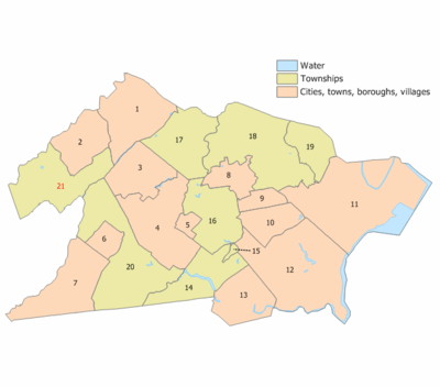
Municipalities in Union County (with 2010 Census data for population, housing units and area) are:[122]
| Municipality (with map key) |
Municipal type |
Population | Housing Units |
Total Area |
Water Area |
Land Area |
Pop. Density |
Housing Density |
Communities[123] |
|---|---|---|---|---|---|---|---|---|---|
| Berkeley Heights (21) | township | 13,183 | 4,596 | 6.27 | 0.05 | 6.21 | 2,122.4 | 739.9 | Murray Hill (part) |
| Clark (14) | township | 14,756 | 5,751 | 4.49 | 0.19 | 4.30 | 3,430.5 | 1,337.0 | |
| Cranford (16) | township | 22,625 | 8,816 | 4.87 | 0.04 | 4.83 | 4,684.6 | 1,825.4 | |
| Elizabeth (11) | city | 124,969 | 45,516 | 13.46 | 1.15 | 12.32 | 10,144.1 | 3,694.7 | |
| Fanwood (6) | borough | 7,318 | 2,686 | 1.34 | 0.00 | 1.34 | 5,454.1 | 2,001.9 | |
| Garwood (5) | borough | 4,226 | 1,870 | 0.66 | 0.00 | 0.66 | 6,362.7 | 2,815.5 | |
| Hillside (19) | township | 21,404 | 7,536 | 2.76 | 0.01 | 2.75 | 7,784.0 | 2,740.6 | |
| Kenilworth (8) | borough | 7,914 | 2,924 | 2.16 | 0.00 | 2.16 | 3,668.3 | 1,355.3 | |
| Linden (12) | city | 40,499 | 15,872 | 11.41 | 0.73 | 10.68 | 3,793.8 | 1,486.8 | |
| Mountainside (3) | borough | 6,685 | 2,558 | 4.05 | 0.04 | 4.01 | 1,668.0 | 638.3 | |
| New Providence (2) | borough | 12,171 | 4,537 | 3.66 | 0.02 | 3.64 | 3,343.4 | 1,246.3 | Murray Hill (part) |
| Plainfield (7) | city | 49,808 | 16,621 | 6.03 | 0.01 | 6.02 | 8,270.1 | 2,759.8 | |
| Rahway (13) | city | 27,346 | 11,300 | 4.03 | 0.13 | 3.90 | 7,016.8 | 2,899.5 | |
| Roselle (10) | borough | 21,085 | 7,939 | 2.66 | 0.01 | 2.65 | 7,953.5 | 2,994.7 | |
| Roselle Park (9) | borough | 13,297 | 5,231 | 1.23 | 0.00 | 1.23 | 10,792.7 | 4,245.8 | |
| Scotch Plains (20) | township | 23,510 | 8,896 | 9.05 | 0.03 | 9.02 | 2,606.9 | 986.4 | |
| Springfield (17) | township | 15,817 | 6,736 | 5.19 | 0.02 | 5.17 | 3,057.2 | 1,302.0 | |
| Summit (1) | city | 21,457 | 8,190 | 6.05 | 0.05 | 6.00 | 3,578.9 | 1,366.0 | |
| Union (18) | township | 56,642 | 20,250 | 9.09 | 0.02 | 9.07 | 6,244.3 | 2,232.4 | |
| Westfield (4) | town | 30,316 | 10,950 | 6.74 | 0.02 | 6.72 | 4,512.2 | 1,629.8 | |
| Winfield (15) | township | 1,471 | 714 | 0.18 | 0.00 | 0.18 | 8,320.1 | 4,038.5 | |
| Union County | county | 536,499 | 199,489 | 105.40 | 2.55 | 102.85 | 5,216.1 | 1,939.5 |
Arts and culture
- The Union County Performing Arts Center, located in the Rahway Arts District, offers professional productions in music and theater as well as training in the performing arts.[124]
- Kean Stage is the professional performing arts arm of Kean University. It is home to Wilkins Theatre on the Kean Main Campus in Union, Enlow Recital Hall directly across the Elizabeth River in East Campus in Hillside, as well as Premiere Stages, the professional equity theater company in residence at Kean University.[125][126]
- The Cranford Dramatic Club has been putting on theatrical productions since its establishment in 1919.[127]
- Tomasulo Art Gallery is in the MacKay Library at Union County College's Cranford campus.[128]
- The Wharton Institute for the Performing Arts, located in Berkeley Heights and New Providence, is a center for music training and other training in performing arts, particularly aimed at children. It consists of the Performing Arts School (formerly Wharton Music Center), New Jersey Youth Symphony, and Paterson Music Project.[129]
- The Plainfield Symphony Orchestra was founded in 1919, making it the state's oldest community orchestra.[130]
- The duCret School of Art in Plainfield was founded in 1926.[131]
- The Swain Gallery, in Plainfield, was founded in 1868 and is the oldest privately owned art gallery in the state.[132]
Sister city
The county has a sister city relationship with Wenzhou in Zhejiang, China.[133][134]
See also
References
- 1 2 Snyder, John P. The Story of New Jersey's Civil Boundaries: 1606–1968, Bureau of Geology and Topography; Trenton, New Jersey; 1969. p. 237. Accessed January 21, 2013.
- 1 2 New Jersey County Map, New Jersey Department of State. Accessed July 10, 2017.
- 1 2 3 4 5 6 DP1 – Profile of General Population and Housing Characteristics: 2010 Demographic Profile Data for Union County, New Jersey, United States Census Bureau. Accessed January 21, 2013.
- 1 2 3 State & County QuickFacts - Union County, New Jersey, United States Census Bureau. Accessed April 9, 2017.
- ↑ Annual Estimates of the Resident Population: April 1, 2010 to July 1, 2016 - 2016 Population Estimates, United States Census Bureau. Accessed April 9, 2017.
- ↑ GCT-PEPANNCHG: Estimates of Resident Population Change and Rankings: July 1, 2015 to July 1, 2016 - State -- County / County Equivalent from the 2016 Population Estimates for New Jersey, United States Census Bureau. Accessed April 9, 2017.
- 1 2 3 4 5 DP-1 – Profile of General Demographic Characteristics: 2000; Census 2000 Summary File 1 (SF 1) 100-Percent Data for Union County, New Jersey, United States Census Bureau. Accessed September 30, 2013.
- ↑ NJ Labor Market Views, New Jersey Department of Labor and Workforce Development, March 15, 2011. Accessed October 6, 2013.
- 1 2 3 New Jersey: 2010 - Population and Housing Unit Counts; 2010 Census of Population and Housing, p. 6, CPH-2-32. United States Census Bureau, August 2012. Accessed August 29, 2016.
- ↑ 250 Highest Per Capita Personal Incomes of the 3113 Counties in the United States, 2009, Bureau of Economic Analysis. Accessed April 9, 2012.
- ↑ Woolsey, Matt. "In Depth: Who Pays America's Highest Property Taxes? 2. Union County, N.J.", Forbes, January 23, 2009. Accessed October 2, 2013.
- ↑ "Census 2000 Data Rankings; A data rankings document focused on the Roanoke Valley and Alleghany Highlands region", Roanoke Valley-Alleghany Regional Commission, p. 22. Accessed October 6, 2013.
- ↑ Staff. "Census 2010 data show population and diversity trends", USA Today. Accessed October 2, 2013. Click on "Population per Square Mile" to sort counties nationwide by descending population density, which was calculated based on total land area (including water) and lists Union as 18th and Essex as 14th.
- ↑ New Jersey and National Registers of Historic Places - Union County, New Jersey Department of Environmental Protection Historic Preservation Office, updated November 28, 2016. Accessed December 21, 2016.
- ↑ Staff. "'Four Centuries in a Weekend' program at Nitschke House celebrates New Orange/Kenilworth, A College Town", Suburban News, October 8, 2015. Accessed January 3, 2017.
- ↑ Home Page, Union County Historical Society of New Jersey. Accessed November 21, 2016.
- ↑ Berkeley Heights Historical Society seeks new members http://s.nj.com/0yK2UVD
- ↑ http://www.DrRobinsonMuseum.org
- ↑ Location of Crane-Phillips House: https://goo.gl/maps/HsqH85rasLm
- ↑ The Evolution of Garwood, Borough of Garwood. Accessed December 21, 2016.
- ↑ About the Hillside Historical Society. http://hillsidehistoricalsociety.org/about-the-hillside-historical-society/
- ↑ About Us, Kenilworth Historical Society. Accessed December 21, 2016.
- ↑ http://www.linden-nj.org/Boards/cultural/
- ↑ About Us, Mountainside Restoration Committee. Accessed December 21, 2016.
- ↑ About, Drake House Museum. Accessed January 3, 2017.
- ↑ Staff. "Historical Society of Plainfield to host discussion on 'Wagon Train' journey", Suburban News, February 16, 2016. January 3, 2017.
- ↑ About, Scotch Plains-Fanwood Historical Society. Accessed December 21, 2016.
- ↑ About s, The Merchants and Drovers Tavern Museum. Accessed January 3, 2017.
- ↑ Home Page, Westfield Historical Society. Accessed January 3, 2017. "The Westfield Historical Society is based in the Reeve History & Cultural Resource Center, located in an 1870's home at 314 Mountain Avenue. The Society also owns the Miller - Cory House Museum located at 614 Mountain Avenue."
- ↑ Census 2010 U.S. Gazetteer Files: New Jersey Counties, United States Census Bureau. Accessed March 22, 2017.
- ↑ New Jersey County High Points, Peakbagger.com. Accessed October 5, 2013.
- 1 2 "Monthly Averages for Elizabeth, New Jersey". The Weather Channel. Retrieved 2012-10-13.
- ↑ Areas touching Union County, MapIt. Accessed September 27, 2015.
- ↑ City of Summit, https://www.cityofsummit.org/DocumentCenter/Home/View/612
- 1 2 3 County map of Hidden Valley and Houdaille. http://ucnj.org/wp-content/uploads/2014/06/Hidden-Valley-Park-Houdaille-Quarry.pdf
- ↑ City of Summit. https://www.cityofsummit.org/DocumentCenter/Home/View/612
- ↑ City of Summit. https://www.cityofsummit.org/DocumentCenter/Home/View/612
- ↑
- 1 2 http://www.njaudubon.org/SectionHawkRiseSanctuary/Introduction.aspx
- ↑ http://ebird.org/content/nj/news/birds-of-lindens-hawk-rise-sanctuary/
- ↑ http://www.linden-nj.org/featured/pdf/Hawk-Rise-Survey-Results.pdf
- ↑ https://www.tapinto.net/towns/union/sections/government/articles/community-meeting-set-for-kennedy-reservation-dis
- ↑ Rahway River, Union County, New Jersey. Accessed January 3, 2017.
- ↑ Parks along the Rahway River Parkway, Google Maps. Accessed January 3, 2017.
- ↑ Friends of Rahway River Parkway http://www.rahwayriverparkway.org/the-inception-of-a-parkway.html
- ↑ Zimmerman Park, Union County, New Jersey. Accessed December 22, 2016.
- ↑ Lightning Brook Section, Union County, New Jersey. Accessed December 22, 2016.
- ↑ Pruden Section, Union County, New Jersey. Accessed December 22, 2016.
- ↑ Salem Section, Union County, New Jersey. Accessed December 22, 2016.
- ↑ Conant Park, Union County, New Jersey. Accessed December 22, 2016.
- ↑ Ursino Section, Union County, New Jersey. Accessed December 22, 2016.
- ↑ Golf, Union County, New Jersey. Accessed January 3, 2017.
- ↑ Home Page, Galloping Hill Golf Course. Accessed January 3, 2017.
- ↑ Levin, Eric. "At Galloping Hill, a Promise Fulfilled; After eight years of renovation and preparation, Galloping Hill in Kenilworth becomes the first public golf course to host the New Jersey State Open. 'There is no better golf course in the state of New Jersey,' says winner Tyler Hall.", New Jersey Monthly, July 13, 2016. Accessed January 3, 2017. "The capper, though, is that the complete renovation of the course and the upgrading of the entire facility convinced the New Jersey State Golf Association to move its headquarters into the new clubhouse and, more importantly, commit to Galloping Hill as the site of the 2016 New Jersey State Open."
- ↑ http://www.ourclark.com/departments/swim-pool-utility
- ↑ Abandoned right-of-ways Union County, Google Maps. Accessed December 21, 2016.
- ↑ About, Summit Park Line Foundation. Accessed January 3, 2017.
- ↑ Faszczewski, Bob. "Summit Council Applies for $1 Million Grant Toward Park Line Project; Parking ‘Holidays’ for Thanksgiving Weekend, December Approved", TAPintoSummit, November 3, 2016. Accessed January 3, 2017. "The Summit Common Council, at its first meeting of November, authorized application for a maximum $1 million federal grant that the majority of Council members feel will kick start the proposed Summit Park Line project, and bring needed sidewalks to sections of Broad Street and Morris Avenue in East Summit.... As envisioned by the Summit Park Line Foundation, which is collecting private funding to pay for the project, the Park Line will convert an abandoned rail line right-of-way stretching from Briant Park through the central business district to a public park, walkways and nature areas while offering a view of the Manhattan skyline."
- 1 2 http://unionnewsdaily.com/news/2465
- ↑ Detailed map of the proposed Pilgrim Pipeline route https://arcg.is/0iaOHr
- ↑ Forstall, Richard L. Population of states and counties of the United States: 1790 to 1990 from the Twenty-one Decennial Censuses, pp. 108–109. United States Census Bureau, March 1996. ISBN 9780934213486. Accessed October 6, 2013.
- ↑ U.S. Census Bureau Delivers New Jersey's 2010 Census Population Totals, United States Census Bureau, February 3, 2011. Accessed February 5, 2011.
- ↑ Union County, Jewish Virtual Library. Accessed November 24, 2014. "UNION COUNTY, county in N.E. New Jersey. Of Union County's 532,000 residents (2004 census), about 35,000 were Jews. Major Jewish communities are in Elizabeth-Hillside, Westfield, Scotch Plains, Springfield, Union, Cranford, and Linden."
- ↑ American FactFinder, United States Census Bureau. Accessed September 4, 2014.
- ↑ Tables DP-1 to DP-4 from Census 2000 for Union County, New Jersey, United States Census Bureau, backed up by the Internet Archive as of July 4, 2008. Accessed October 2, 2013.
- ↑ DP-2 – Profile of Selected Social Characteristics: 2000 from the Census 2000 Summary File 3 (SF 3) – Sample Data for Union County, New Jersey, United States Census Bureau. Accessed September 30, 2013.
- ↑ DP-3 – Profile of Selected Economic Characteristics: 2000 from Census 2000 Summary File 3 (SF 3) – Sample Data for Union County, New Jersey, United States Census Bureau. Accessed September 30, 2013.
- 1 2 Board of Chosen Freeholders, Union County, New Jersey. Accessed January 25, 2016.
- ↑ "Elected Officials". County of Union, New Jersey. Retrieved 2016-01-25.
- ↑ Freeholder Chairman Bruce H. Bergen Union County, New Jersey. Accessed January 25, 2016.
- ↑ Freeholder Vice Chairman Sergio Granados, Union County, New Jersey. Accessed January 25, 2016.
- ↑ Freeholder Mohamed S. Jalloh, Union County, New Jersey. Accessed January 25, 2016.
- ↑ Freeholder Angel G. Estrada, Union County, New Jersey. Accessed January 25, 2016.
- ↑ Freeholder Christopher Hudak, Union County, New Jersey. Accessed January 25, 2016.
- ↑ Freeholder Chairman Linda Carter, Union County, New Jersey. Accessed January 26, 2014.
- ↑ Freeholder Bette Jane Kowalski, Union County, New Jersey. Accessed January 25, 2016.
- ↑ Freeholder Alexander Mirabella, Union County, New Jersey. Accessed January 25, 2016.
- ↑ Freeholder Vernell Wright, Union County, New Jersey. Accessed January 25, 2016.
- ↑ County Clerk, Union County, New Jersey. Accessed January 25, 2016.
- ↑ Office of the Union County Sheriff, Union County, New Jersey. Accessed January 25, 2016.
- ↑ Surrogate, Union County, New Jersey. Accessed January 25, 2016.
- ↑ "Welcome to the New Jersey Court System". New Jersey Courts. New Jersey Courts. Retrieved 28 February 2016.
- ↑ "Local Court Addresses". New Jersey Courts. New Jersey Courts. Retrieved 28 February 2016.
- ↑ "New Jersey Courts Union Vicinage". New Jersey Courts. New Jersey Courts. Retrieved 28 February 2016.
- ↑ Union County officials battle activist over use of controversial county seal July 10, 2011.
- ↑ Seal of Union County, NJ
- ↑ 2012 Congressional Districts by County, New Jersey Department of State Division of Elections. Accessed October 2, 2013.
- ↑ Plan Components Report, New Jersey Department of State Division of Elections, December 23, 2011. Accessed October 2, 2013.
- ↑ Directory of Representatives: New Jersey, United States House of Representatives. Accessed January 5, 2012.
- ↑ Directory of Representatives: New Jersey, United States House of Representatives. Accessed January 5, 2012.
- ↑ Directory of Representatives: New Jersey, United States House of Representatives. Accessed January 5, 2012.
- ↑ Bonnie Watson Coleman Biography, United States House of Representatives. Accessed January 7, 2015.
- ↑ 2011 Legislative Districts by County, New Jersey Department of State Division of Elections. Accessed October 6, 2013.
- ↑ Legislative Roster 2016-2017 Session, New Jersey Legislature. Accessed January 17, 2016.
- ↑ Legislative Roster 2016-2017 Session, New Jersey Legislature. Accessed January 17, 2016.
- ↑ Legislative Roster 2016-2017 Session, New Jersey Legislature. Accessed January 17, 2016.
- ↑ http://uselectionatlas.org/RESULTS
- ↑ The leading "other" candidate, Progressive Theodore Roosevelt, received 8,429 votes, while Socialist candidate Eugene Debs received 1,484 votes, Prohibition candidate Eugene Chafin received 82 votes, and Socialist Labor candidate Arthur Reimer received 45 votes.
- 1 2 Voter Registration Summary – Union, New Jersey Department of State Division of Elections, March 23, 2011. Accessed May 26, 2013.
- ↑ GCT-P7: Selected Age Groups: 2010 – State – County Subdivision; 2010 Census Summary File 1 for New Jersey, United States Census Bureau. Accessed May 26, 2013.
- ↑ Presidential November 6, 2012 General Election Results – Union County, New Jersey Department of State Division of Elections, March 15, 2013. Accessed May 26, 2013.
- ↑ Number of Registered Voters and Ballots Cast November 6, 2012 General Election Results – Union County, New Jersey Department of State Division of Elections, March 15, 2013. Accessed May 26, 2013.
- ↑ 2008 Presidential General Election Results: Union County, New Jersey Department of State Division of Elections, December 23, 2008. Accessed May 26, 2013.
- ↑ 2004 Presidential Election: Union County, New Jersey Department of State Division of Elections, December 13, 2004. Accessed May 26, 2013.
- ↑ 2009 Governor: Union County, New Jersey Department of State Division of Elections, December 31, 2009. Accessed May 26, 2013.
- ↑ Haydon, Tom. "Ralph Froehlich, longest-serving sheriff in NJ history, was told in 1970s he'd never win re-election", NJ Advance Media for NJ.com, July 22, 2014. Accessed March 22, 2017. "For 13 terms and 37 years, Froehlich presided over the Union County Sheriff’s Office, developing programs that helped protect children and victims of domestic violence, fighting for tougher gun-control laws and working to save money by consolidating services.... Froehlich, the longest-serving sheriff in New Jersey history, died Sunday night at Trinitas Hospital in Elizabeth after a battle with cancer, county officials said."
- ↑ Parisi, Albert J. "Suicide Sparks Union County Jail Inquiry", The New York Times, August 23, 1981. Accessed October 2, 2013.
- ↑ Accessed June 5, 2014.
- ↑ Union County Police Department, Union County, New Jersey. Accessed October 2, 2013.
- ↑ Kean University, U.S. News & World Report. Accessed October 2, 2013.
- ↑ General Information, Union County College. Accessed October 2, 2013.
- ↑ "Major Employers Report for Union County, NJ" (PDF). Union County, New Jersey. Union County Economical Development Corporation. Retrieved 28 October 2013.
- ↑ Union County Mileage by Municipality and Jurisdiction, New Jersey Department of Transportation, May 2010. Accessed July 18, 2014.
- ↑ Gladstone Branch, New Jersey Transit. Accessed October 6, 2013.
- ↑ Morristown Line, New Jersey Transit. Accessed October 6, 2013.
- ↑ Northeast Corridor, New Jersey Transit. Accessed October 6, 2013.
- ↑ North Jersey Coast Line, New Jersey Transit. Accessed October 6, 2013.
- ↑ Raritan Valley Line, New Jersey Transit. Accessed October 6, 2013.
- ↑ Union County Bus / Rail Connections, New Jersey Transit, backed up by the Internet Archive as of May 22, 2009. Accessed October 6, 2013.
- ↑ About the Port, Port Authority of New York and New Jersey. Accessed October 6, 2013.
- ↑ About the Airport, Newark Airport. Accessed October 6, 2013.
- ↑ GCT-PH1: Population, Housing Units, Area, and Density: 2010 – County – County Subdivision and Place from the 2010 Census Summary File 1 for Union County, New Jersey, United States Census Bureau. Accessed March 24, 2017.
- ↑ Locality Search, State of New Jersey. Accessed March 24, 2017.
- ↑ History of the Center, Union County Performing Arts Center. Accessed December 22, 2016.
- ↑ About, Kean Stage. Accessed January 3, 2017.
- ↑ About Us, Premiere Stages. Accessed January 4, 2017.
- ↑ About, Cranford Dramatic Club. Accessed January 3, 2017.
- ↑ Tomasulo Art Gallery, Union County College. Accessed December 22, 2016. "The Tomasulo Art Gallery is located on the first floor of the Kenneth Campbell MacKay Library on the Cranford, New Jersey campus of Union County College."
- ↑ Staff. "Joel Perry, guitarist and educator, has all the jazz", Courier News, December 3, 2016. Accessed January 3, 2017. "The Wharton Institute for the Performing Arts’ mission is to provide the highest quality performing arts education to a range of students in a supportive and inclusive environment, according to the news release. Wharton Institute for the Performing Arts is located in Berkeley Heights, New Providence and Paterson, New Jersey and reaches students from 13 counties."
- ↑ About, Plainfield Symphony Orchestra. Accessed December 22, 2016. "Plainfield Symphony Orchestra, founded in 1919, is the oldest community symphony in New Jersey."
- ↑ Sagara, Eric. "Plainfield art school celebrates 85th anniversary", The Star-Ledger, March 26, 2012. Accessed December 22, 2016. "DuCret was founded in 1926 by Marjorie Van Emburgh, a local artist and teacher who wanted to create an art school comparable to what was found in major metropolitan areas such as New York City or Philadelphia."
- ↑ History, Swain Galleries. Accessed January 3, 2017.
- ↑ "Position Paper on Sister State and Sister City Relations Between Australia and China", Australia-China Chamber of Commerce and Industry of New South Wales, dated November 14, 2001. Accessed August 30, 2015.
- ↑ Dennis, Anita. "NEW JERSEY & CO.; The Selling of New Jersey, and Its Difficulties", The New York Times, October 1, 2000. Accessed February 25, 2017. "In addition, the Chinese province has a long relationship with the state and with Union County. Zheijiang and New Jersey are sister states, and Wenzhou, another city in the province, has been a sister city with Union County for the past 19 years -- though there has been little trade between them."
External links
Municipalities and communities of Union County, New Jersey, United States | ||
|---|---|---|
| Cities | | |
| Boroughs | ||
| Town | ||
| Townships | ||
| Unincorporated communities | ||

Coordinates: 40°39′N 74°17′W / 40.65°N 74.29°W