New Jersey Route 122
| ||||
|---|---|---|---|---|
| New Brunswick Avenue | ||||
 | ||||
| Route information | ||||
| Maintained by NJDOT and Warren County | ||||
| Length: | 2.42 mi[1] (3.89 km) | |||
| Existed: | 1993 – present | |||
| Major junctions | ||||
| West end: |
| |||
| East end: |
| |||
| Location | ||||
| Counties: | Warren | |||
| Highway system | ||||
| ||||
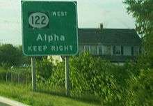
Route 122 is a short, 2.42-mile (3.89 km) long state highway in Warren County, New Jersey. The route runs from Warren County Route 678 and Pursel Street in Phillipsburg to an intersection with U.S. Route 22 in Pohatcong Township. The route is a former alignment of U.S. Route 22, designated in 1926. The route became U.S. Route 22 Alternate until 1993, when the route was decommissioned and replaced by County Route 678 and Route 122.
Route description
Route 122 begins at the intersection with Pursel Street as a county-maintained continuation of Warren County Route 678 in Phillipsburg. The highway progresses eastward as South Main Street, heading through residential homes along the Delaware River. Route 122 makes a large bend around some trees that surround a factory hidden on the Delaware. The highway heads to the southeast, passing through hills and factories and working its way away from the Delaware River. At an intersection with Kent Street, Route 122 makes a gradual bend to the east, passing under Norfolk Southern's Lehigh Line, and then paralleling and intersecting with Warren County Route 642 (Carpentersville Road).[2]

Route 122 continues eastward along South Main Street, entering Pohatcong Township where state maintenance begins.[1] At first, the road passes residential homes; continuing eastward, the highway enters a large residential district, with homes surrounding the highway for several blocks. At the intersection with County Route 519 (Saint James Avenue), the two routes head along a wrong-way concurrency, running along New Brunswick Avenue, passing the residential district and several schools. At that point, the residential district becomes more commercial, with County Route 519 heading to the south along Third Avenue. Route 122 continues eastward along New Brunswick Avenue, returning to the residential portions of Pohatcong Township. At an intersection with Ohio Avenue, the highway becomes gradually less populated, with fields appearing on both sides. Route 122 continues eastward, interchanging partially with U.S. Route 22, where the designation terminates. New Brunswick Avenue continues ahead without a designation.[2]
History
Route 122 originates as an alignment of U.S. Route 22, which was designated in 1926 as part of the highway system, coming in on the Phillipsburg-Easton Bridge.[3] The route continued as U.S. Route 22 until the completion of the bypass around Phillipsburg, which US 22 was transferred to the bypass. The former alignment became U.S. Route 22 Alternate, lasting through the 1953 state highway renumbering.[4] The route continued to run from the Phillipsburg-Easton Bridge to US 22, until 1993, when US 22 Alternate was decommissioned and replaced by NJ 122 and County Route 678.[5]
Major intersections
The entire route is in Warren County.
| Location | mi[1] | km | Destinations | Notes | |
|---|---|---|---|---|---|
| Phillipsburg | 0.00 | 0.00 | |||
| Pohatcong Township | 1.19 | 1.92 | Western terminus of CR 519 overlap | ||
| 1.37 | 2.20 | Eastern terminus of CR 519 overlap | |||
| 2.42 | 3.89 | ||||
1.000 mi = 1.609 km; 1.000 km = 0.621 mi
| |||||
See also
 U.S. Roads portal
 New Jersey portal
References
- 1 2 3 New Jersey Route 122 Straight Line Diagram from the New Jersey Department of Transportation
- 1 2 Overview map of Route 122 (Map). Cartography by NAVTEQ Inc. Bing Maps. 2009. Retrieved October 30, 2009.
- ↑ Bureau of Public Roads & American Association of State Highway Officials (November 11, 1926). United States System of Highways Adopted for Uniform Marking by the American Association of State Highway Officials (Map). 1:7,000,000. Washington, DC: U.S. Geological Survey. OCLC 32889555. Retrieved November 7, 2013 – via University of North Texas Libraries.
- ↑ 1953 renumbering, New Jersey Department of Highways, retrieved July 31, 2009
- ↑ New Jersey Official Road Map (Map). Cartography by New Jersey Department of Transportation. New Jersey Department of Transportation. 1993.
External links
Route map: Google
 Media related to New Jersey Route 122 at Wikimedia Commons
- U.S. Route 22 Alternate on Alps Roads
