Tsing Ma Bridge
| Tsing Ma Bridge | |
|---|---|
 Tsing Ma Bridge | |
| Coordinates | 22°21′05″N 114°04′27″E / 22.35139°N 114.07417°E |
| Carries |
6 lanes of roadway (upper) 2 MTR rail tracks, 2 lanes of roadway (lower) |
| Crosses | Ma Wan Channel |
| Locale | Ma Wan Island and Tsing Yi Island |
| Official name | Tsing Ma Bridge |
| Characteristics | |
| Design | Double-decked suspension bridge |
| Width | 41 metres (135 ft) |
| Longest span | 1,377 metres (4,518 ft) |
| Clearance below | 53 metres (174 ft) |
| History | |
| Opened | 22 May 1997 |
| Statistics | |
| Daily traffic | trains and cars |
| Toll | HK$30 (cars, combined with Kap Shui Mun Bridge) |
| Tsing Ma Bridge | |||||||||||||
| Traditional Chinese | 青馬大橋 | ||||||||||||
|---|---|---|---|---|---|---|---|---|---|---|---|---|---|
| Literal meaning | Tsing Yi-Ma Wan Great Bridge | ||||||||||||
| |||||||||||||

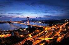
Tsing Ma Bridge is a bridge in Hong Kong. It is the world's 11th-longest span suspension bridge, and was the second longest at time of completion.[1] The bridge was named after two of the islands at its ends, namely Tsing Yi and Ma Wan. It has two decks and carries both road and rail traffic, which also makes it the largest suspension bridge of this type. The bridge has a main span of 1,377 metres (4,518 ft) and a height of 206 metres (676 ft). The span is the longest of all bridges in the world carrying rail traffic.
The 41-metre-wide (135 ft) bridge deck carries six lanes of automobile traffic, with three lanes in each direction. The lower level contains two rail tracks and two sheltered carriageways used for maintenance access and traffic lanes when particularly severe typhoons strike Hong Kong and the bridge deck is closed to traffic.[2]
History
Numerous consortia bid on the contract to construct the bridge. Hyundai made the lowest bid but were disqualified for non-compliance with the financial requirements.[3] A Japanese bid was ruled out for being too expensive. An Anglo-Japanese joint venture, comprising Costain, Mitsui, and Trafalgar House, won the job.[4] Construction work on the bridge began in June 1992.[3] Gammon Construction constructed the caissons for the bridge towers. The framework for each caisson was floated into place and sunk, and then filled with concrete underwater.[5] The two caissons on the Ma Wan side weigh 4,500 tons each, while those on the Tsing Yi side (closer to shore) each weigh about 3,000 tons.[5] Land reclamation was carried out at both ends of the bridge. The more substantial reclamation on Ma Wan was used as a work platform for construction crews.[5]
The first steel deck segment was lifted into place in late 1994.[6] The approach deck segments were constructed in Britain and Dubai and then shipped to Hong Kong for assembling. The main span segments were built by Cleveland in the U.K. and by Mitsui in Japan.[6] The climbing cranes used to erect the tower portals were coincidentally also used on the HSBC Main Building a decade earlier, as well as at Canary Wharf in the interim.[7]
Construction was finished in May 1997. It cost HK$7.2 billion. The Lantau Link, of which the bridge is an integral part, was inaugurated on 27 April 1997 by former British Prime Minister Margaret Thatcher.[8] Security was extremely tight as Thatcher was considered one of the top targets of the Irish Republican Army.[9]
The commemoration ceremony began with a flotilla of police and other government vessels passing beneath the bridge, before Government Flying Service and Royal Air Force aircraft flew above the concrete towers.[10] Thatcher, Chief Secretary Anson Chan, and Governor Chris Patten then switched on the bridge lights and drove across the span with other dignitaries. The celebration concluded with a 20-minute firework and laser show, featuring fire pouring from the length of the bridge, engineered by the Pyromagic Productions company.[10] Chief Executive-designate Tung Chee-hwa declined to attend as he said he would rather meet with officials in Guangdong.[10][11]
The opening ceremony was highly anticipated and attracted more than 100,000 spectators, most of them standing along Castle Peak Road, which was closed to road traffic.[12] The Tuen Mun Road was also closed to traffic from 7:40 to 8:20 pm, and a 20-minute fireworks display, costing $5 million ($US640,000) was unleashed at 8 pm.[9][13] MTR, Citybus, and KCR Corporation arranged special transport services for the event.[14] More than 2,300 police officers were deployed, and the crowd control exercise was studied by the police for its relevance to the upcoming Handover ceremony.[12] Three boating accidents occurred during the bridge inauguration.[12]
The Lantau Link was opened to traffic on 22 May 1997 at 8:00 am. Cars queued for four hours before police opened the bridge.[15] Snaking queues also formed at bus stations at 7:00 am as passengers sought to view the new infrastructure as well as the North Lantau New Town, which was still under construction.[15]
The first road accident on the Lantau Link occurred on the Tsing Ma Bridge on 23 May 1997. Two motorcyclists were injured in a collision with a lorry.[16] The police warned the public not to rush to use the new bridges and highways to avoid causing chaos.[16]
Two special bus routes came into operation on 24 May 1997 for passengers to view the Lantau Link. The X21 and X31 buses ran from Tai Kok Tsui and Tsuen Wan, respectively.[16]
Operation
The Tsing Ma Bridge links Tsing Yi island on the east to Ma Wan island on the west over Ma Wan Channel. It is part of the Lantau Link, which, with two long span bridges, links the New Territories and Lantau Island, and eventually leads to the Hong Kong International Airport on Chek Lap Kok via the North Lantau Highway. The other bridges are the Kap Shui Mun Bridge linking Ma Wan to Lantau Island over Kap Shui Mun and the Ting Kau Bridge linking Tsing Yi to the New Territories over Rambler Channel.
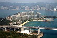
The Tsing Ma Bridge has been an important gateway to Lantau Island. It is part of the Route 8 expressway, which connects the Lantau Link, the West Kowloon expressway, Cheung Sha Wan and Shatin. The rail line is part of MTR's Tung Chung Line and Airport Express. The Noah's Ark attraction is located next to the bridge.[17]
The bridge, together with other highway, bridge and tunnel connections in the area, are part of the Tsing Ma Control Area under the Tsing Ma Control Area Ordinance (Cap. 498) in Hong Kong Law.[18] The control area has been managed by Tsing Ma Management Limited since opening. The control area's traffic management system was developed by Delcan Corporation of Toronto. Special regulations and by-laws are carried out in the area.
Along with the Ting Kau Bridge and Kap Shui Mun Bridge, the bridge is closely monitored by the Wind and Structural Health Monitoring System (WASHMS). Surveillance cameras are also installed on the bridge to record traffic conditions. The video is available at the government website.[19] It is updated every two minutes.
Tolls on the Lantau Link—of which Tsing Ma Bridge is part—for motorcycles, private cars, public double-decker buses and heavy goods vehicles are HK$20, $30, $60 and $80 respectively, charged only for the eastbound direction from Lantau to Tsing Yi.[20] The normal speed limit on the bridge is 80 kilometres per hour (50 mph), subject to lowering in the event of road work or strong wind. Traffic may also be directed to the sheltered carriageways on the lower deck when there are very strong winds. There is no sidewalk on the bridge.
Design

The bridge was designed by Mott MacDonald.[21] The firm designed an early iteration of the bridge in 1982, with a two lane dual carriageway on the top deck, and a light railway on the lower deck.[22] The bridge was redesigned beginning in 1989 to account for the three lane dual highway and the heavier airport railway. The designers were inspired by the Forth Bridge in Scotland and the Severn Bridge in England.[22]
Wind tunnel testing
The objectives of the wind tunnel studies were to demonstrate the safety of the structure under construction and once completed, both with respect to aerodynamic stability as well as the possible effects of extreme typhoon wind speeds. A further objective was to provide dynamic response data at several key locations to compare with full scale data from the ongoing monitoring program, conducted by the Highways Department of Hong Kong.
A 1 to 80 scale section model of the deck in the erection stage, and a 1 to 400 scale full aeroelastic model of the entire bridge were constructed. It is a Monte-Carlo simulation of the typhoon wind climate. The full model was tested in different stages of construction in turbulent boundary layer flow, complete with the local topography to model the wind conditions at the site. The model tests identified critical stages of erection that allowed the construction schedule of the bridge to be tailored to avoid the typhoon season. The comparison of model test results and the full scale monitoring will assist engineers to better understand the behaviour of long span bridges in wind and to improve current design methods.
Major components

There is one tower located on Wok Tai Wan of Tsing Yi side and another on a man-made island 120 metres (390 ft) off the coast of Ma Wan.[23] Both towers are 206 metres (676 ft) above sea level and founded on relatively shallow bedrock. The towers are two-legged with trusses at intervals, in the form of portal beam design. The legs were constructed with high-strength concrete of 50 MPa (concrete grade 50/20) strength, using a slipform system in a continuous operation.
The pulling force in the main suspension cables is taken up by large gravity anchorages located at both ends of the bridge.[24] They are massive concrete structures deeply seated on bedrock on the landside of Tsing Yi and Ma Wan island. The total weight of concrete used in the Tsing Yi anchorage is 200,000 tonnes, and Ma Wan Anchorage has 250,000 tonnes of concrete.
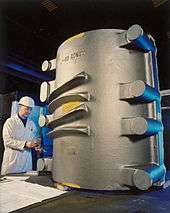
The cables were constructed by an aerial spinning process. The process involved drawing wires from a constant-tension supply, and pulling loops of these wires from one anchorage to the other, passing through a 500-tonne cast-iron saddle on top of each bridge tower seating the cable. A total of 70,000 galvanised wires of 5.38-millimetre (0.212 in) diameter were placed and adjusted to form the two 1.1-metre (3.6 ft) diameter main cables.
The steelwork for the deck structure was fabricated in Britain and Japan. After delivery, they were further processed and assembled in Dongguan, China into standard deck modules. A total of 96 modules, each 18 metres (59 ft) long and about 480 tonnes in weight, were prepared. These deck modules were brought to the site by specially designed barges and raised into the deck position by a pair of strand jack gantries that could manoeuvre along the main cable.
The approach span on the Tsing Yi side is similar in form and cross-section to the suspended deck, but is supported on piers instead by cables. The first span was assembled on the ground and raised into position using strand jacks. Further construction then proceeded in cantilever in smaller sections, using derrick cranes stationed on the deck level. An expansion joint which allowed for a maximum thermal movement of ± 835 millimetres (32.9 in) was also provided and located inside the approach span.
The bridge parapets are of a special design by Hong Kong standards, comprising high-tension steel strands anchored on metal posts.[25]
Ship impact protection
The rock seawalls around the base of each bridge tower are capable of halting a 220,000 tonne ship moving at eight knots.[26]
Tourism

The Tsing Ma Bridge has become a scenic spot as well as a landmark. There is a visitor centre, the Lantau Link Visitor Centre and Viewing Platform, located at the northwest corner of Tsing Yi Island, near the bridge's Tsing Yi end. From the Scenery Viewing Platform, one can also see the Ting Kau Bridge and Kap Shui Mun Bridge. The bridge can also be seen from the Airport Core Programme Exhibition Centre located about 2 kilometres (1.2 mi) north of the bridge.
See also
References
- ↑ "10 Tallest Bridges in the World | Top Weird,Odd and Cool lists". Weirdly Odd. 2010-12-01. Retrieved 2013-04-29.
- ↑ of typhoon induced fatigue damage for Tsing Ma Bridge
- 1 2 "Work starts on Tsing Ma contract". South China Morning Post. 28 May 1992. p. 35.
- ↑ Davis, Chris (22 May 1997). "Engineering marvel becomes territory's latest landmark". South China Morning Post. p. 1.
- 1 2 3 "Gammon begins bridge under the water". South China Morning Post. 30 July 1992. p. 26.
- 1 2 Wallis, Keith (25 October 1994). "Tsing Ma milestone reached". South China Morning Post. p. 4.
- ↑ Metcalfe, Tim (29 April 1997). "Kvaerner's expertise in building spans the years". South China Morning Post. p. 25.
- ↑ http://www.scmp.com/lifestyle/article/2098515/tsing-ma-bridge-height-debacle-costing-hong-kong-billions
- 1 2 "Security tight for Thatcher's bridge opening". South China Morning Post. 27 April 1997. p. 4.
- 1 2 3 Delfino, Brendan (28 April 1997). "Territory's new gateway opens in spectacular style". South China Morning Post. p. 1.
- ↑ Wallen, David; Lo, Alex (30 April 1997). "Firework harmony hopes up in smoke". South China Morning Post. p. 3.
- 1 2 3 Lee, Stella (29 April 1997). "Spotlight on crowd control for handover". South China Morning Post.
- ↑ Flint, John (17 April 1997). "Lantau link fireworks not for the faint-hearted". South China Morning Post. p. 5.
- ↑ Lo, Alex (26 April 1997). "Long march home faces fireworks fans". South China Morning Post. p. 5.
- 1 2 Delfino, Brendan (23 May 1997). "Woman injured as hundreds cross link". South China Morning Post. p. 4.
- 1 2 3 Flint, John; Lo, Clifford (24 May 1997). "Police issue warning after crash on Link". South China Morning Post. p. 4.
- ↑ "Hong Kong Noah's Arch, Ma Wan Park". Travelchinaguide.com. Retrieved 2013-04-29.
- ↑ "Parsons Brinckerhoff: Tsing Ma Control Area, Traffic Control and Surveillance System". Pbworld.com. Retrieved 2013-04-29.
- ↑ Surveillance cameras of Transportation Department
- ↑ plaza
- ↑ Clarke, Rachel (25 October 1997). "Construction 'Oscars' go to Tsing Ma span". South China Morning Post. p. 4.
- 1 2 "New bridge a dream come true". South China Morning Post. 28 May 1992. p. 35.
- ↑ "Tsing Ma Bridge". Cityu.edu.hk. Retrieved 2013-04-29.
- ↑ "Tsing Ma Bridge Anchorages, Hong Kong". Geo-Design. Retrieved 2013-04-29.
- ↑ "Tuen Mun Road Traffic Incident – The Use of Vehicular Parapets and Proposed Way Forward" (PDF). Legislative Council Panel on Transport. 16 July 2003.
- ↑ "'Gateway to China' plan moves ahead". South China Morning Post. 27 November 1992. p. 62.
Further reading
- Y. L. Xu, J. M. Ko and Z. Yu. "Modal analysis of tower-cable system of Tsing Ma long suspension bridge". Engineering Structures. Volume 19, Issue 10, October 1997, pp. 857–867.
External links
| Wikimedia Commons has media related to Tsing Ma Bridge. |
Coordinates: 22°21′05″N 114°04′27″E / 22.35139°N 114.07417°E
| Preceded by Nam Wan Tunnel |
Hong Kong Route 8 Tsing Ma Bridge |
Succeeded by Ma Wan Viaduct |