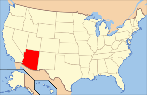
Trans-Canyon Telephone Line, Grand Canyon National Park
|
Trans-Canyon Telephone Line, Grand Canyon National Park | |
 | |
  | |
| Nearest city | Grand Canyon, Arizona |
|---|---|
| Coordinates | 36°6′36″N 112°5′34″W / 36.11000°N 112.09278°WCoordinates: 36°6′36″N 112°5′34″W / 36.11000°N 112.09278°W |
| Built | 1934 |
| Architect | Civilian Conservation Corps; National Park Service |
| Architectural style | Other |
| NRHP Reference # | 86001102 |
| Added to NRHP | May 13, 1986[1] |
The Trans-Canyon Telephone line in Grand Canyon National Park crosses the Grand Canyon from the South Rim to the North Rim via the Inner Canyon. The lines were constructed in 1934 and altered in 1938-39 by the Civilian Conservation Corps, and have been unchanged since their installation. Telephone lines are supported using 592 assemblies of 2-inch (5.1 cm) galvanized pipes and fittings, which could be easily transported and assembled with minimal impact to the canyon environment. It is a rare surviving example of open-wire copper -weld technology. The line extends for 18 miles (29 km), paralleling the Bright Angel Trail and the North Kaibab Trail, providing a direct link between the North and South Rims, as well as the Inner Canyon. A spur line ran along the South Kaibab Trail to the Tipoff.[2]
The line was placed on the National Register of Historic Places on May 13, 1986.[1]
See also
References
- 1 2 National Park Service (2010-07-09). "National Register Information System". National Register of Historic Places. National Park Service.
- ↑ "Trans-Canyon Telephone Line". List of Classified Structures. National Park Service. 2008-11-25.

