Torella dei Lombardi
| Torella dei Lombardi | ||
|---|---|---|
| Comune | ||
| Comune di Torella dei Lombardi | ||
|
The central street "Via Angelo Appia" | ||
| ||
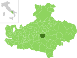
 Torella within the Province of Avellino | ||
 Torella dei Lombardi Location of Torella dei Lombardi in Italy | ||
| Coordinates: 40°56′22.3″N 15°06′49.5″E / 40.939528°N 15.113750°ECoordinates: 40°56′22.3″N 15°06′49.5″E / 40.939528°N 15.113750°E | ||
| Country | Italy | |
| Region | Campania | |
| Province / Metropolitan city | Avellino (AV) | |
| Frazioni | Aquara, Piano Marotta, San Vito, Montanaldo, Ss. Giovanni e Paolo. | |
| Government | ||
| • Mayor | Amado Delli Gatti[1] (Civic List, from 2016) | |
| Area | ||
| • Total | 26 km2 (10 sq mi) | |
| Elevation | 666 m (2,185 ft) | |
| Population (2011)[2] | ||
| • Total | 2,225 | |
| • Density | 86/km2 (220/sq mi) | |
| Time zone | CET (UTC+1) | |
| • Summer (DST) | CEST (UTC+2) | |
| Postal code | 83057 | |
| Dialing code | 0827 | |
| Patron saint | St. Eustace | |
| Saint day | 20 September | |
| Website | Official website | |
Torella dei Lombardi is a town and comune in the province of Avellino, Campania, Italy. In 2011 it had a population of 2,225.[2]
History
The town was firstly mentioned in the 9th century as Turella. In 1980, along with many other settlements in the province and the neighbouring areas, was heavily damaged during the Irpinia earthquake.[3]
Geography
Torella is a hillside town located in the middle of Irpinia, close to the sources of the river Ofanto, 11 km west of Lioni and 41 east of Avellino. It borders with the municipalities of Castelfranci, Nusco, Paternopoli, Sant'Angelo dei Lombardi and Villamaina.[4]
It counts the hamlets (frazioni) of Aquara, Piano Marotta, San Vito, Montanaldo and Ss. Giovanni e Paolo. These localities are mainly composed by few scattered farmhouses.
Demographics

Main sights
- The Longobard Candriano Castle, located in the middle of the town.[5]
- The Monumental Fountain (19th century), located in the lower side of the town.[6]
Gallery
|
Personalities
- Roberto Roberti (1879–1959), actor, screenwriter and film director. He was the father of Sergio Leone
- Bice Valerian (1886–1969), silent film actress. Born in Rome and died in Torella, she was the mother of Sergio Leone
- Giovanni Preziosi (1881–1945), fascist politician noted for his antisemitism
References
- ↑ (in Italian) Torella dei Lombardi town council
- 1 2 (in Italian) Source: Istat 2011
- ↑ (in Italian) Article about the 1980 earthquake in Torella dei Lombardi (ottopagine.it)
- ↑ 40900 Torella dei Lombardi on OpenStreetMap
- ↑ (in Italian) The castle of Torella dei Lombardi on museodeicastelli.it
- ↑ (in Italian) The fountain of Torella dei Lombardi on irpinia.info
External links
| Wikimedia Commons has media related to Torella dei Lombardi. |
- (in Italian) Torella dei Lombardi official website
- (in Italian) Torella dei Lombardi on tuttaitalia.it
- (in Italian) Ottopagine: Torella dei Lombardi-related articles (provincial newspaper)
.jpg)

.jpg)
.jpg)