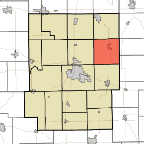
Tippecanoe Township, Kosciusko County, Indiana
| Tippecanoe Township | |
|---|---|
| Township | |
|
Looking west on Epworth Forest Road in North Webster, in Tippecanoe Township | |
 | |
| Coordinates: 41°18′46″N 85°42′30″W / 41.31278°N 85.70833°WCoordinates: 41°18′46″N 85°42′30″W / 41.31278°N 85.70833°W | |
| Country | United States |
| State | Indiana |
| County | Kosciusko |
| Government | |
| • Type | Indiana township |
| Area | |
| • Total | 35.11 sq mi (90.9 km2) |
| • Land | 30.32 sq mi (78.5 km2) |
| • Water | 4.79 sq mi (12.4 km2) |
| Elevation[1] | 860 ft (262 m) |
| Population (2010) | |
| • Total | 6,661 |
| • Density | 219.7/sq mi (84.8/km2) |
| Time zone | Eastern (EST) (UTC-5) |
| • Summer (DST) | EDT (UTC-4) |
| FIPS code | 18-75842[2] |
| GNIS feature ID | 453895 |
Tippecanoe Township is one of seventeen townships in Kosciusko County, Indiana. As of the 2010 census, its population was 6,661 and it contained 5,127 housing units.[3]
Tippecanoe Township was organized in 1838.[4]
Geography
According to the 2010 census, the township has a total area of 35.11 square miles (90.9 km2), of which 30.32 square miles (78.5 km2) (or 86.36%) is land and 4.79 square miles (12.4 km2) (or 13.64%) is water.[3]
Cities and towns
Unincorporated towns
- Barbee at 41°17′27″N 85°42′44″W / 41.2908790°N 85.7122093°W
- Bayfield at 41°16′29″N 85°42′25″W / 41.2747676°N 85.7069312°W
- Eagle Point at 41°19′39″N 85°40′40″W / 41.3275465°N 85.6777642°W
- Epworth Forest at 41°19′59″N 85°41′10″W / 41.3331022°N 85.6860978°W
- Forest Glen at 41°19′36″N 85°45′49″W / 41.3267128°N 85.7636001°W
- Highbanks at 41°19′24″N 85°40′16″W / 41.3233798°N 85.6710973°W
- Kalorama Park at 41°20′04″N 85°45′39″W / 41.3344906°N 85.7608222°W
- Lakeview Spring at 41°17′11″N 85°41′17″W / 41.2864347°N 85.6880420°W
- Mineral Springs at 41°19′34″N 85°44′39″W / 41.3261572°N 85.7441550°W
- Potawatomi Park at 41°19′24″N 85°45′31″W / 41.3233793°N 85.7585999°W
- Walker Park at 41°19′46″N 85°45′12″W / 41.3294905°N 85.7533219°W
- Yellowbanks at 41°19′18″N 85°40′44″W / 41.3217131°N 85.6788753°W
(This list is based on USGS data and may include former settlements.)
References
- ↑ "US Board on Geographic Names". United States Geological Survey. 2007-10-25. Retrieved 2008-01-31.
- ↑ "American FactFinder". United States Census Bureau. Retrieved 2008-01-31.
- 1 2 "Population, Housing Units, Area, and Density: 2010 - County -- County Subdivision and Place -- 2010 Census Summary File 1". United States Census. Retrieved 2013-05-10.
- ↑ Biographical and Historical Record of Kosciusko County, Indiana. Lewis Publishing Company. 1887. p. 708.
External links
This article is issued from
Wikipedia.
The text is licensed under Creative Commons - Attribution - Sharealike.
Additional terms may apply for the media files.
