Timeline of the 2008 Atlantic hurricane season
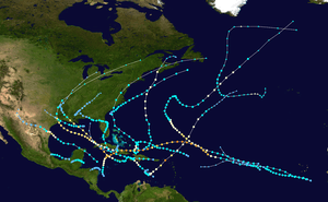
The Atlantic hurricane season of 2008 was the first such year to feature a major hurricane in every month from July to November.[1][nb 1] The timeline includes information that was not operationally released, meaning that data from post-storm reviews by the National Hurricane Center, such as information about a storm that was not operationally warned on, has been included. Although Tropical Storm Arthur formed on May 30, 2008, the season officially began on June 1 and ended on November 30, dates that conventionally delimit the period of each year when most tropical cyclones develop in the Atlantic basin.[3] The season's final storm, Hurricane Paloma, dissipated on November 10.
The 2008 Atlantic hurricane season was the fourth most active season in recorded history,[1] and featured slightly more activity than that of the previous year. Pre-season forecasts noted a high possibility for an above average number of tropical cyclones, primarily due to lingering La Niña effects and abnormally warm sea surface temperatures across the Atlantic basin.[1] Seventeen tropical cyclones were observed during the season, of which sixteen intensified into tropical storms, eight became hurricanes, and five became major hurricanes.[nb 2] With the exception of Tropical Storm Nana, every tropical cyclone during the season affected land to an extent.
Timeline of events

May
- May 31
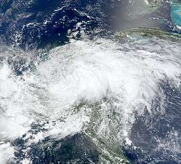
- 0000 UTC (8:00 p.m. EDT May 30) – Tropical Storm Arthur develops from an area of low pressure roughly 45 mi (75 km)[nb 3] east of Belize City, Belize.[6]
- 0600 UTC (2:00 a.m. EDT) – Tropical Storm Arthur attains its peak intensity with winds of 45 mph (75 km/h) and a barometric pressure of 1004 mbar (hPa; 29.65 inHg).[6]
- 0900 UTC (5:00 a.m. EDT) – Tropical Storm Arthur makes landfall in northeastern Belize, about midway between Belize City and Chetumal, Mexico, with winds of 45 mph (75 km/h).[6]
June
- June 1
- The 2008 Atlantic hurricane season officially begins.
- 1200 UTC (8:00 a.m. EDT) – Tropical Storm Arthur weakens to a tropical depression over the Yucatan, roughly 15 mi (25 km) north of the northern border of Guatemala and Mexico.[6]
- June 2
- 0000 UTC (8:00 p.m. EDT June 1) – Tropical Depression Arthur degenerates into a non-convective remnant low pressure area.[6]
July
- July 3
- 0600 UTC (2:00 a.m. AST) – Tropical Depression Two develops from a tropical wave roughly 220 mi (350 km) south-southeast of the Cape Verde Islands.[7]
- 1200 UTC (8:00 a.m. AST) – Tropical Depression Two strengthens into Tropical Storm Bertha to the south of the Cape Verde Islands.[7]
- July 7
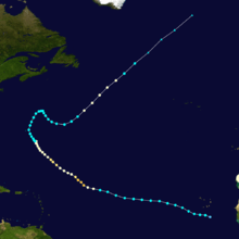
- 0600 UTC (2:00 a.m. AST) – Tropical Storm Bertha strengthens into a Category 1 hurricane on the Saffir–Simpson hurricane scale, the first of the season, roughly 750 mi (1,210 km) east of the northern Leeward Islands.[7]
- 1800 UTC (2:00 p.m. AST) – Hurricane Bertha rapidly strengthens into a major hurricane—a storm with winds of 111 mph (178 km/h) or higher.[7]
- 2100 UTC (5:00 p.m. AST) – Hurricane Bertha attains its peak intensity with winds of 125 mph (205 km/h) and a minimum barometric pressure of 951 mbar (28.1 inHg).[7]
- July 8
- 1200 UTC (8:00 a.m. AST) – Hurricane Bertha weakens to a Category 2 hurricane.[7]
- 1800 UTC (2:00 p.m. AST) – Hurricane Bertha weakens to a Category 1 hurricane.[7]
- July 9
- 1800 UTC (2:00 p.m. AST) – Hurricane Bertha restrengthens into a Category 2 hurricane.[7]
- July 10
- 0600 UTC (2:00 a.m. AST) – Hurricane Bertha weakens to a Category 1 hurricane.[7]
- July 13
- 1200 UTC (8:00 a.m. AST) – Hurricane Bertha weakens to a tropical storm.[7]
- July 18
- 1800 UTC (2:00 p.m. AST) – Tropical Storm Bertha strengthens into a Category 1 hurricane for a second time.[7]
- July 19
- 0000 UTC (8:00 p.m. AST July 18) – Tropical Depression Three develops from an area of low pressure roughly 60 mph (95 km/h) east of the Georgia/South Carolina border.[8]
- 1200 UTC (8:00 a.m. AST) – Tropical Depression Three strengthens into Tropical Storm Cristobal off the coast of South Carolina.[8]
- July 20

- 0000 UTC (8:00 p.m. AST July 19) – Hurricane Bertha weakens into a tropical storm once again.[7]
- 1200 UTC (8:00 a.m. AST) – Tropical Storm Bertha transitions into an extratropical cyclone.[7]
- 1200 UTC (8:00 a.m. AST) – Tropical Storm Dolly develops from a tropical wave 270 mi (430 km) east of Chetumal, Mexico.[9]
- July 21
- 0530 UTC (1:30 a.m. AST) – Tropical Storm Dolly makes landfall near Cancun, Mexico with winds of 50 mph (85 km/h).[9]
- July 22
- 1200 UTC (8:00 a.m. AST) – Tropical Storm Cristobal reaches its peak intensity with winds of 65 mph (105 km/h) and a minimum barometric pressure of 998 mbar (29.5 inHg).[8]
- July 23
- 0000 UTC (7:00 p.m. CDT July 22) – Tropical Storm Dolly intensifies into a Category 1 hurricane.[9]
- 1200 UTC (8:00 a.m. AST) – Tropical Storm Cristobal is absorbed by a larger extratropical cyclone.[8]
- 1400 UTC (9:00 a.m. CDT) – Hurricane Dolly strengthens into a Category 2 hurricane and reaches its peak intensity with winds of 100 mph (160 km/h) and a minimum barometric pressure of 963 mbar (28.4 inHg) off the coast of Texas.[9]
- 1820 UTC (1:20 p.m. CDT) – Hurricane Dolly makes landfall on the Texas mainland, about 15 mi (25 km) southeast of Port Mansfield, Texas, with winds of 85 mph (140 km/h).[9]
- 2000 UTC (3:00 p.m. CDT) – Hurricane Dolly makes landfall on the Texas mainland, roughly 10 mi (15 km) south of Port Mansfield, Texas, with winds of 80 mph (130 km/h).[9]
- July 24
- 0600 UTC (1:00 a.m. CDT) – Hurricane Dolly weakens to a tropical storm.[9]
- July 25
- 0000 UTC (7:00 p.m. CDT July 24) – Tropical Storm Dolly weakens to a tropical depression over extreme northern Mexico.[9]
- July 26
- 0000 UTC (7:00 p.m. CDT July 25) – Tropical Depression Dolly degenerates into a non-convective remnant low pressure area over the mountainous terrain of inland Mexico.[9]
August
- August 3
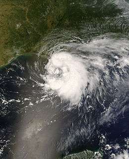
- 1200 UTC (7:00 a.m. CDT) – Tropical Depression Five develops from an area of low pressure roughly 140 mi (230 km) south of Pensacola, Florida.[10]
- August 4
- 0000 UTC (7:00 p.m. CDT August 3) – Tropical Depression Five strengthens into Tropical Storm Edouard to the southeast of Louisiana.[10]
- August 5
- 1200 UTC (7:00 a.m. CDT) – Tropical Storm Edouard reaches its peak intensity with winds of 65 mph (105 km/h) and a minimum barometric pressure of 996 mbar (29.4 inHg). At this time, Edouard also makes landfall at McFaddin National Wildlife Refuge, Texas.[10]
- August 6
- 0000 UTC (7:00 p.m. CDT August 6) – Tropical Storm Edouard weakens to a tropical depression over inland Texas.[10]
- 0600 UTC (1:00 a.m. CDT) – Tropical Depression Edouard degenerates into a non-convective remnant low pressure area over northern Texas.[10]
- 1200 UTC (8:00 a.m. EDT) – A tropical depression develops just west of the northwestern tip of Puerto Rico.[11]
- 1430 UTC (10:30 a.m. EDT) – The tropical depression near Puerto Rico strengthens into Tropical Storm Fay and makes landfall near El Cabo, Dominican Republic with winds of 40 mph (65 km/h).[11]
- August 16
- 1145 UTC (7:45 a.m. EDT) – Tropical Storm Fay makes landfall along eastern Gonavé Island, Haiti with winds of 45 mph (75 km/h).[11]
- August 17
- 0900 UTC (5:00 a.m. EDT) – Tropical Storm Fay makes landfall 20 mi (30 km) east of Cabo Cruz, Cuba with winds of 45 mph (75 km/h).[11]
- August 18
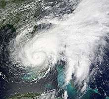
- 0700 UTC (3:00 a.m. EDT) – Tropical Storm makes landfall 20 mi (30 km) west of Cienfuegos, Cuba with winds of 45 mph (75 km/h).[11]
- 2030 UTC (4:30 p.m. EDT) – Tropical Storm Fay makes its first landfall on Florida, near Key West, with winds of 60 mph (95 km/h).[11]
- August 19
- 0845 UTC (4:45 a.m. EDT) – Tropical Storm Fay makes its second landfall on Florida, just east of Cape Romano, with winds of 65 mph (100 km/h).[11]
- 1800 UTC (2:00 p.m. EDT) – Tropical Storm Fay reaches its peak intensity with winds of 70 mph (110 km/h) and a minimum barometric pressure of 986 mbar (29.1 inHg).[11]
- August 21
- 1900 UTC (3:00 p.m. EDT) – Tropical Storm Fay makes its third landfall on Florida, near Flagler Beach, with winds of 65 mph (100 km/h).[11]
- August 23
- 0615 UTC (2:15 a.m. EDT) – Tropical Storm Fay makes a record-breaking fourth landfall on Florida, just southwest of Carrabelle, with winds of 50 mph (85 km/h).[11]
- August 24
- 0000 UTC (8:00 p.m. EDT August 23) – Tropical Storm Fay weakens to a tropical depression.[11]
- August 25
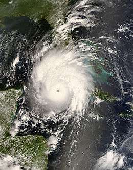
- 0000 UTC (8:00 p.m. EDT August 24) – Tropical Depression Seven forms from a tropical wave roughly 95 mi (155 km) northeast of Bonaire.[12]
- 1200 UTC (8:00 a.m. EDT) – Tropical Depression Seven rapidly intensifies into Tropical Storm Gustav.[12]
- August 26
- 0600 UTC (2:00 a.m. EDT) – Tropical Storm Gustav strengthens into a Category 1 hurricane.[12]
- 1800 UTC (2:00 p.m. EDT) – Hurricane Gustav makes landfall on the southwestern peninsula of Haiti with winds of 80 mph (130 km/h)
- 0000 UTC (8:00 p.m. EDT August 26) – Hurricane Gustav weakens to a tropical storm over the southwestern peninsula of Haiti.[12]
- 0600 UTC (2:00 a.m. EDT) – Tropical Storm Fay merges with a larger extratropical cyclone.[11]
- August 28
- 0000 UTC (8:00 p.m. EDT August 27) – Tropical Depression Eight forms from an area of low pressure roughly 275 mi (445 km) east-northwest of the northern Leeward Islands.[13]
- 1200 UTC (8:00 a.m. EDT) – Tropical Depression Eight strengthens into Tropical Storm Hanna.[13]
- 1800 UTC (2:00 p.m. EDT) – Tropical Storm Gustav makes landfall near Manchioneal, Jamaica with winds of 70 mph (110 km/h).[12]
- August 29
- 0200 UTC (10:00 p.m. EDT August 28) – Tropical Storm Gustav makes landfall just east of Lionel Town, Jamaica with winds of 70 mph (110 km/h).[12]
- 1800 UTC (2:00 p.m. EDT) – Tropical Storm Gustav restrengthens into a hurricane.[12]
- August 30
- 1800 UTC (2:00 p.m. EDT) – Hurricane Gustav makes landfall on the southeastern coast of the Isle of Youth, Cuba with winds of 145 mph (235 km/h).[12]
- 2200 UTC (6:00 p.m. EDT) – Hurricane Gustav reaches its peak intensity with winds of 155 mph (250 km/h) and a minimum barometric pressure of 941 mbar (27.8 inHg). Additionally, Gustav makes landfall just east of Los Palacios, Cuba at this intensity.[12]
September
- September 1
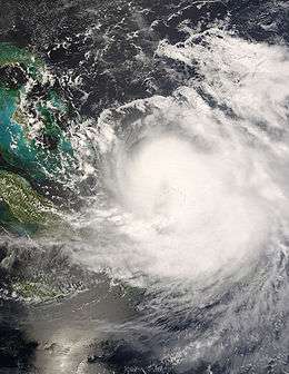
- 0600 UTC (2:00 a.m. AST) – Tropical Depression Nine forms from a tropical wave roughly 675 mi (1,085 km) west of the Cape Verde Islands.[14]
- 1200 UTC (8:00 a.m. AST) – Tropical Depression Nine strengthens into Tropical Storm Ike.[14]
- 1500 UTC (10:00 a.m. CDT) – Hurricane Gustav makes landfall near Cocodrie, Louisiana with winds of 100 mph (160 km/h).[12]
- 1800 UTC (2:00 p.m. AST) – Tropical Storm Hanna strengthens into a Category 1 hurricane north of the Dominican Republic.[13]
- September 2
- 0000 UTC (7:00 p.m. CDT September 1) – Hurricane Gustav weakens to a tropical storm over southwestern Louisiana.[12]
- 0000 UTC (8:00 p.m. AST September 2) – Hurricane Hanna reaches its peak intensity with winds of 85 mph (135 km/h) and a minimum barometric pressure of 977 mbar (28.9 inHg). Additionally, the system makes landfall near Providencials Island, Caicos Islands at this intensity.[13]
- 0000 UTC (8:00 p.m. AST September 1) – Tropical Depression Ten forms from a tropical wave roughly 275 mi (445 km) south-southeast of Sal, Cape Verde Islands.[15]
- 0600 UTC (2:00 a.m. AST) – Tropical Depression Ten strengthens into Tropical Storm Josephine.[15]
- 1200 UTC (7:00 a.m. CDT) – Tropical Storm Gustav weakens to a tropical depression.[12]
- 1200 UTC (8:00 a.m. AST) – Hurricane Hanna weakens to a tropical storm.[13]
- September 3
- 0600 UTC (2:00 a.m. AST) – Tropical Storm Josephine reaches its peak intensity with winds of 65 mph (105 km/h) and a minimum barometric pressure of 994 mbar (29.4 inHg).[15]
- 1800 UTC (2:00 p.m. AST) – Tropical Storm Ike strengthens into a Category 1 hurricane roughly 600 mi (965 km) east-northwest of the northern Leeward Islands.[14]
- 1900 UTC (3:00 p.m. AST) – Tropical Storm Hanna makes landfall near Middle Caicos Island with winds of 60 mph (95 km/h).[13]
- September 4
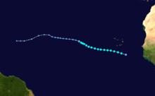
- 0000 UTC (8:00 p.m. AST September 3) – Hurricane Ike rapidly strengthens into a Category 3 hurricane.[14]
- 0600 UTC (2:00 a.m. AST) – Hurricane Ike reaches its peak intensity with winds of 145 mph (233 km/h) and a minimum barometric pressure of 935 mbar (27.6 inHg).[14]
- 1200 UTC (7:00 a.m. CDT) – Tropical Depression Gustav transitions into an extratropical cyclone over Missouri.[12]
- September 5
- 1200 UTC (8:00 a.m. AST) – Hurricane Ike weakens to a Category 3 hurricane.[14]
- September 6
- 0000 UTC (8:00 p.m. AST September 5) – Tropical Storm Josephine weakens to a tropical depression.[15]
- 0600 UTC (2:00 a.m. AST) – Tropical Depression Josephine degenerates into a non-convective remnant low-pressure area.[15]
- 0720 UTC (3:20 a.m. EDT) – Tropical Storm Hanna makes landfall near the North Carolina/South Carolina border with winds of 70 mph (115 km/h).[13]
- 1200 UTC (8:00 a.m. AST) – Hurricane Ike weakens to a Category 2 hurricane.[14]
- 1800 UTC (2:00 p.m. AST) – Hurricane Ike rapidly strengthens to a Category 4 hurricane.[14]
- September 7
- 0600 UTC (2:00 a.m. EDT) – Tropical Storm Hanna transitions into an extratropical cyclone.[13]
- 1200 UTC (8:00 a.m. AST) – Hurricane Ike weakens to a Category 3 hurricane.[14]
- 1300 UTC (9:00 a.m. EDT) – Hurricane Ike makes landfall on Great Inagua Island, Bahamas with winds of 125 mph (200 km/h).[14]
- September 8
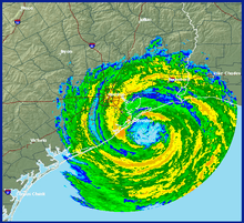
- 0000 UTC (8:00 p.m. EDT September 7) – Hurricane Ike restrengthens to a Category 4 hurricane.[14]
- 0215 UTC (10:15 p.m. EDT) – Hurricane Ike makes landfall near Cabo Lucrecia, Cuba with winds of 135 mph (215 km/h).[14]
- 0600 UTC (2:00 a.m. EDT) – Hurricane Ike weakens to a Category 3 hurricane.[14]
- 1200 UTC (8:00 a.m. EDT) – Hurricane Ike weakens to a Category 2 hurricane.[14]
- 1800 UTC (2:00 p.m. EDT) – Hurricane Ike weakens to a Category 1 hurricane.[14]
- September 9
- 1400 UTC (10:00 a.m. EDT) – Hurricane Ike makes landfall near Punta La Capitana, Cuba with winds of 80 mph (130 km/h).[14]
- September 10
- 1800 UTC (2:00 p.m. EDT) – Hurricane Ike restrengthens into a Category 2 hurricane.[14]
- September 13
- 0700 UTC (2:00 a.m. CDT) – Hurricane Ike makes landfall at the north end of Galveston Island, Texas with winds of 110 mph (175 km/h).[14]
- 1800 UTC (1:00 p.m. CDT) – Hurricane Ike rapidly weakens to a tropical storm.[14]
- September 14
- 1200 UTC (7:00 a.m. CDT) – Tropical Storm Ike transitions into an extratropical cyclone.[14]
- September 25
- 0000 UTC (8:00 p.m. AST September 24) – A tropical depression forms from a tropical wave about 100 mi (160 km) north of the Dominican Republic.[16]
- 0600 UTC (2:00 a.m. AST) – The tropical depression north of the Dominican Republic strengthens into Tropical Storm Kyle.[16]
- September 27
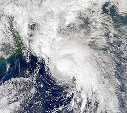
- 1200 UTC (8:00 a.m. AST) – Tropical Storm Kyle strengthens into a Category 1 hurricane roughly 300 mi (485 km) west of Bermuda.[16]
- September 28
- 1200 UTC (8:00 a.m. AST) – Hurricane Kyle reaches its maximum intensity with winds of 85 mph (135 km/h).[16]
- 1800 UTC (2:00 p.m. AST) – Hurricane Kyle reaches its minimum barometric pressure of 984 mbar (29.1 inHg).[16]
- September 29
- 0000 UTC (8:00 p.m. AST September 28) – Hurricane Kyle makes landfall near Yarmouth, Nova Scotia with winds of 75 mph (120 km/h).[16]
- 0600 UTC (2:00 a.m. AST) – Hurricane Kyle weakens to a tropical storm and transitions into an extratropical cyclone.[16]
- 0600 UTC (2:00 a.m. AST) – Subtropical Laura forms from an extratropical low pressure area roughly 650 mi (1,045 km) south-southeast of Cape Race, Newfoundland.[17]
- September 30
- 1200 UTC (8:00 a.m. AST) – Subtropical Storm Laura transitions into a tropical storm.[17]
- 1800 UTC (2:00 p.m. AST) – Tropical Storm Laura reaches its minimum barometric pressure of 994 mbar (29.4 inHg).[17]
October
- October 1
- 1200 UTC (8:00 a.m. AST) – Tropical Storm Laura degenerates into a non-convective remnant low pressure area.[17]
- October 6
- 0000 UTC (7:00 p.m. CDT October 5) – Tropical Depression Thirteen forms from an area of low pressure over Terminos Lagoon, Campeche.[18]
- 1200 UTC (7:00 a.m. CDT) – Tropical Depression Thirteen strengthens into Tropical Storm Marco roughly 60 mi (95 km) northeast of Coatzacoalcos, Mexico.[18]
- October 7

- 0000 UTC (7:00 p.m. CDT October 6) – Tropical Storm Marco reaches its peak intensity of 65 mph (100 km/h) and a minimum barometric pressure of 998 mbar (29.5 inHg).[18]
- 1200 UTC (7:00 a.m. CDT) –Tropical Storm Marco makes landfall east of Misantla, Veracruz with winds of 65 mph (100 km/h).[18]
- 1800 UTC (1:00 p.m. CDT) – Tropical Storm Marco weakens to a tropical depression.[18]
- October 8
- 0000 UTC (7:00 p.m. CDT) – Tropical Depression Marco dissipates over the mountainous terrain of inland Mexico.[18]
- October 12
- 0600 UTC (2:00 a.m. AST) – A tropical depression forms from an area of low pressure roughly 690 mi (1,110 km) west of the Cape Verde Islands.[19]
- 1200 UTC (8:00 a.m. AST) – The tropical depression west of the Cape Verde Islands strengthens into Tropical Storm Nana.[19]
- October 13
- 0000 UTC (8:00 p.m. AST October 12) – Tropical Storm Nana reaches its peak intensity of 40 mph (65 km/h) and a barometric pressure of 1004 mbar (29.6 inHg).[19]
- 0600 UTC (2:00 a.m. AST) – Tropical Depression Fifteen forms from an area of low pressure roughly 165 mi (265 km) south of the southeastern tip of Dominican Republic.[20]
- 1200 UTC (8:00 a.m. AST) – Tropical Storm Nana weakens to a tropical depression roughly 870 mi (1,400 km) west of the Cape Verde Islands.[19]
- October 14
- 0000 UTC (8:00 p.m. AST) – Tropical Depression Fifteen strengthens into Tropical Storm Omar roughly 125 mi (200 km) north-northeast of Aruba.[20]
- 1200 UTC (8:00 a.m. AST) – Tropical Depression Nana degenerates into a non-convective remnant low pressure area in the central Atlantic.[19]
- 1200 UTC (8:00 a.m. AST) – Tropical Depression Sixteen forms from a tropical wave roughly 45 mi (75 km) northeast of the coast of the Nicaragua/Honduras border. At this time, the depression also reaches its peak intensity of 30 mph (45 km/h) and a minimum barometric pressure of 1,004 mbar (29.6 inHg).[21]
- 1230 UTC (8:30 a.m. EDT) – Tropical Depression Sixteen makes landfall just west of Punta Patuca, Honduras with winds of 30 mph (45 km/h).[21]
- October 15
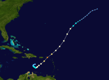
- 0000 UTC (8:00 p.m. AST October 14) – Tropical Storm Omar strengthens into a Category 1 hurricane.[20]
- October 16
- 0000 UTC (8:00 p.m. AST October 15) – Hurricane Omar strengthens into a Category 2 hurricane.[20]
- 0000 UTC (8:00 p.m. AST October 15) – Tropical Depression Sixteen degenerates into a non-convective remnant low pressure area over the mountainous terrain of east-central Honduras.[21]
- 0600 UTC (2:00 a.m. AST) – Hurricane Omar rapidly strengthens into a Category 4 hurricane. At this time, Omar also reaches its peak intensity with winds of 135 mph (215 km/h) and a minimum barometric pressure of 958 mbar (28.3 inHg).[20]
- 1200 UTC (8:00 a.m. AST) – Hurricane Omar weakens to a Category 2 hurricane.[20]
- 1800 UTC (2:00 p.m. AST) – Hurricane Omar weakens to a Category 1 hurricane.[20]
- October 18
- 0000 UTC (8:00 p.m. AST October 17) – Hurricane Omar weakens to a tropical storm.[20]
- 1200 UTC (8:00 a.m. AST) – Tropical Storm Omar degenerates into a non-convective remnant low-pressure area.[20]
November
- November 5
- 1800 UTC (2:00 p.m. EDT) – Tropical Depression Seventeen develops in the southwestern Caribbean Sea roughly 115 mi (185 km) southeast of the Nicaragua/Honduras border.[22]
- November 6
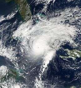
- 0600 UTC (2:00 a.m. EDT) – Tropical Depression Seventeen strengthens into Tropical Storm Paloma roughly 60 mi (95 km) east of the Nicaragua/Honduras border.[22]
- November 7
- 0000 UTC (8:00 p.m. EDT November 6) – Tropical Storm Paloma rapidly intensifies into a Category 1 hurricane.[22]
- November 8
- 0000 UTC (8:00 p.m. EDT November 7) – Hurricane Paloma strengthens into a Category 3 hurricane.[22]
- 1200 UTC (8:00 a.m. EDT) – Hurricane Paloma strengthens into a Category 4 hurricane and attains its peak intensity with winds of 145 mph (230 km/h) and a minimum barometric pressure of 944 mbar (27.9 inHg).[22]
- 2300 UTC (7:00 p.m. EDT) – Hurricane Paloma rapidly weakens into a Category 2 hurricane and makes landfall in Cuba with winds of 110 mph (175 km/h).[22]
- November 9
- 0100 UTC (9:00 p.m. EDT) – Hurricane Paloma makes landfall near Santa Cruz del Sur, Camagüey, Cuba with winds of 100 mph (165 km/h).[22]
- 0600 UTC (2:00 a.m. EDT) – Hurricane Paloma weakens to a tropical storm over Cuba.[22]
- 1800 UTC (2:00 p.m. EDT) – Tropical Storm Paloma weakens to a tropical depression.[22]
- November 10
- 0000 UTC (8:00 p.m. EDT November 9) – Tropical Depression Paloma degenerates into a non-convective remnant low pressure area over Cuba.[22]
- November 30
- The 2008 Atlantic hurricane season officially ends.[3]
See also
Notes
- ↑ An average season, as defined by the National Oceanic and Atmospheric Administration, has twelve tropical storms, six hurricanes and two major hurricanes.[2]
- ↑ A major hurricane is a storm that ranks as Category 3 or higher on the Saffir–Simpson Hurricane Scale.[4]
- ↑ The figures for maximum sustained winds and position estimates are rounded to the nearest 5 units (knots, miles, or kilometers), following the convention used in the National Hurricane Center's operational products for each storm.[5] All other units are rounded to the nearest digit.
References
- 1 2 3 "Atlantic Hurricane Season Sets Records". National Oceanic and Atmospheric Administration. Retrieved December 6, 2011.
- ↑ Climate Prediction Center Internet Team (August 4, 2011). "Background Information: The North Atlantic Hurricane Season". Climate Prediction Center. Retrieved December 5, 2011.
- 1 2 Chris Landsea; Neal Dorst (ed.) (June 2, 2011). "G: Tropical Cyclone Climatology". Hurricane Research Division: Frequently Asked Questions. Atlantic Oceanographic and Meteorological Laboratory. G1) When is hurricane season ?. Archived from the original on June 15, 2006. Retrieved December 27, 2011.
- ↑ Chris Landsea; Neal Dorst (ed.) (June 2, 2011). "A: Basic Definitions". Hurricane Research Division: Frequently Asked Questions. Atlantic Oceanographic and Meteorological Laboratory. A3) What is a super-typhoon? What is a major hurricane ? What is an intense hurricane ?. Archived from the original on June 15, 2006. Retrieved December 27, 2011.
- ↑ 2008 Tropical Cyclone Advisory Archive (Archive). National Hurricane Center. April 21, 2009. Retrieved January 7, 2012.
- 1 2 3 4 5 Eric S. Blake (July 28, 2008). Tropical Cyclone Report: Tropical Storm Arthur (PDF) (Report). National Hurricane Center. pp. 1, 3. Retrieved December 1, 2011.
- 1 2 3 4 5 6 7 8 9 10 11 12 13 Jamie R. Rhome (October 15, 2008). Tropical Cyclone Report: Hurricane Bertha (PDF) (Report). National Hurricane Center. pp. 1–5. Retrieved December 2, 2011.
- 1 2 3 4 Lixion A. Avila (December 15, 2008). Tropical Cyclone Report: Tropical Storm Cristobal (PDF) (Report). National Hurricane Center. pp. 1, 3. Retrieved December 2, 2011.
- 1 2 3 4 5 6 7 8 9 Todd B. Kimberlain; Richard J. Pasch (January 22, 2009). Tropical Cyclone Report: Hurricane Dolly (PDF) (Report). National Hurricane Center. pp. 1, 2, 4. Retrieved December 2, 2011.
- 1 2 3 4 5 James L. Franklin (November 14, 2008). Tropical Cyclone Report: Tropical Storm Edouard (PDF) (Report). National Hurricane Center. pp. 1, 2, 4. Retrieved December 2, 2011.
- 1 2 3 4 5 6 7 8 9 10 11 12 John L. Beven; Stacy R. Stewart (February 8, 2009). Tropical Cyclone Report: Tropical Storm Fay (PDF) (Report). National Hurricane Center. pp. 1, 2, 7, 8. Retrieved December 2, 2011.
- 1 2 3 4 5 6 7 8 9 10 11 12 13 Todd B. Kimberlain; Jack Beven (January 22, 2009). Tropical Cyclone Report: Hurricane Gustav (PDF) (Report). National Hurricane Center. pp. 1, 2, 7, 8. Retrieved December 2, 2011.
- 1 2 3 4 5 6 7 8 Todd B. Kimberlain; Daniel P. Brown (December 17, 2008). Tropical Cyclone Report: Hurricane Hanna (PDF) (Report). National Hurricane Center. pp. 1, 2, 7, 8. Retrieved December 3, 2011.
- 1 2 3 4 5 6 7 8 9 10 11 12 13 14 15 16 17 18 19 20 Robbie Berg (January 23, 2009). Tropical Cyclone Report: Hurricane Ike (PDF) (Report). National Hurricane Center. pp. 1, 2, 3, 15, 16. Retrieved December 3, 2011.
- 1 2 3 4 5 Eric S. Blake (December 5, 2008). Tropical Cyclone Report: Tropical Storm Josephine (PDF) (Report). National Hurricane Center. pp. 1, 3. Retrieved December 3, 2011.
- 1 2 3 4 5 6 7 Lixion A. Avila (December 5, 2008). Tropical Cyclone Report: Hurricane Kyle (PDF) (Report). National Hurricane Center. pp. 1, 4. Retrieved December 3, 2011.
- 1 2 3 4 Richard J. Pasch (February 4, 2009). Tropical Cyclone Report: Tropical Storm Laura (PDF) (Report). National Hurricane Center. pp. 1–3. Retrieved December 3, 2011.
- 1 2 3 4 5 6 James L. Franklin (November 14, 2008). Tropical Cyclone Report: Tropical Storm Marco (PDF) (Report). National Hurricane Center. p. 1, 4. Retrieved December 3, 2011.
- 1 2 3 4 5 Stacy R. Stewart (November 28, 2008). Tropical Cyclone Report: Tropical Storm Nana (PDF) (Report). National Hurricane Center. pp. 1, 3. Retrieved December 3, 2011.
- 1 2 3 4 5 6 7 8 9 John L. Beven; Chris Landsea (February 3, 2009). Tropical Cyclone Report: Hurricane Omar (PDF) (Report). National Hurricane Center. pp. 1, 2, 6. Retrieved December 3, 2011.
- 1 2 3 Daniel P. Brown (November 19, 2008). Tropical Cyclone Report: Tropical Depression Sixteen (PDF) (Report). National Hurricane Center. pp. 1, 3. Retrieved December 3, 2011.
- 1 2 3 4 5 6 7 8 9 10 Michael J. Brennan (January 26, 2009). Tropical Cyclone Report: Hurricane Paloma (PDF) (Report). National Hurricane Center. pp. 1, 2, 6, 7. Retrieved December 2, 2011.
External links
| Wikimedia Commons has media related to 2008 Atlantic hurricane season. |