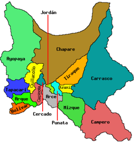
Tapacarí
| Tapacarí San Agustín de Tapacarí[1] Villa de Tapacarí[2] | |
|---|---|
 Tapacarí Location within Bolivia | |
| Coordinates: 17°30′53″S 66°37′15″W / 17.51472°S 66.62083°WCoordinates: 17°30′53″S 66°37′15″W / 17.51472°S 66.62083°W | |
| Country |
|
| Department | Cochabamba Department |
| Province | Tapacarí Province |
| Municipality | Tapacarí Municipality |
| Canton | Tapacarí Canton |
| Government | |
| • Mayor | Pedro Gutierrez Cruz (2007) |
| Elevation | 9,833 ft (2,997 m) |
| Population (2001) | |
| • Total | 411 |
| [3] | |
Tapacarí is a town and the capital of Tapacarí Province in Cochabamba Department, Bolivia.[4] It is located at an elevation of 2,997 m. At the time of census 2001 it had a population of 411.[3] Most of the population lives either in adjacent rural areas or in the city of Cochabamba and they only occupy local dwellings during carnival or other festivals, or on business trips.[1]
Important days include Independence Day on 6 August; the feast day of Saint Augustine on 28 August, and the large fiesta of the Virgen de Dolores (Our Lady of Sorrows) the third weekend of September. There is a food and textile fair in early September that brings in the rural population as well as city folk.[5]
History
The name Tapacarí comes from the Aymara words Thapa Qhari, "nest of men", or settlement.
The town was founded on 23 January 1826, by Antonio José de Sucre.
In June 1836 the Congress of Tapacarí was held in the town to address the issue of giving president Andrés de Santa Cruz the power to establish the Peru–Bolivian Confederation. The congress met for ten days under the chairmanship of vice-president Mariano Enrique Calvo Cuellar. The congress granted the requested powers and granted other beneficences.[6][7][8]
References
- 1 2 Felber 2010, p. 11
- ↑ Villa de Tapacarí (Variant - V) at GEOnet Names Server, United States National Geospatial-Intelligence Agency
- 1 2 "Censo de Poblacion y Vivienda – 2001, Poblacion por Departamentos, Provincias, Secciones Municipales, Localidades y Organizaciones Comunitarias: Tapacarí". Instituto Nacional de Estadística de Bolivia. Archived from the original on 31 May 2014.
- ↑ Tapacarí (Approved - N) at GEOnet Names Server, United States National Geospatial-Intelligence Agency
- ↑ Felber 2010, pp. 27, 31
- ↑ Vargas Ugarte, Rubén (1971). Historia General del Perú: Volume 8, La República (1833-1843) (first ed.). Lima, Perú: Carlos Milla Batres. p. 128. OCLC 490232957.
- ↑ Basadre, Jorge (2005). Historia de la República del Perú 1822 - 1933: La época fundacional de la República (1822-1842). (Volume 2 of Historia de la República del Perú 1822 - 1933). Lima, Perú: Comercio. ISBN 978-9972-205-64-4.
- ↑ Pons Muzzo, Gustavo (1953). Historia del Perú: Epoca de la República. (Volume 4 of Historia del Perú). Lima, Perú: Ministerio de Educación Pública. p. 81. OCLC 19485168.
Further reading
- Felber, Emma (2010). From Centre to Margin: Memory, Mobility and Social Change in a Bolivian Town (PDF). Doctoral thesis, Goldsmiths, University of London. Archived (PDF) from the original on 30 May 2014.
External links
- "Atlas Municipal: Tapacarí (Provincial population data and map)" (PDF). 2 November 2011. Archived (PDF) from the original on 1 April 2014.
