Tanur, Malappuram

| Tanur താനൂർ | |
|---|---|
| town | |
|
Tanur Station | |
| Coordinates: 10°58′N 75°52′E / 10.97°N 75.87°ECoordinates: 10°58′N 75°52′E / 10.97°N 75.87°E | |
| Country |
|
| State | Kerala |
| District | Malappuram |
| Elevation | 1 m (3 ft) |
| Languages | |
| • Official | Malayalam, English |
| Time zone | IST (UTC+5:30) |
| Vehicle registration | KL-10, KL-55 |
Tanur is a small town in the Tirur tehsil, Malappuram district of Kerala state, located on the coast 9 kilometres (5.6 mi) north of Tirur. Its ancient name was Tyndis.
History
Tanur was a part of the kingdom of the same name in medieval times. The name "Tanur (Tanni-ur)" is derived from the Malayalam language. "Tanni" refers to the Bastard myrobalan tree, Terminalia bellirica, while "ur" refers to the village. The small coastal fishing town of Tanur was one of the oldest muslim settlements in India. Many ancient mosques are situated here. This was once a Portuguese colony. It is believed that St. Francis Xavier visited Tanur in 1546 AD.
Culture
Thanoor village is a predominantly Muslim populated area. Hindus exist in comparatively smaller numbers. So the culture of the locality is based upon Muslim traditions. Duff Muttu, Kolkali and Aravanamuttu are common folk arts of this locality. There are many libraries attached to mosques giving a rich source of Islamic studies. Most of the books are written in Arabi-Malayalam which is a version of the Malayalam language written in Arabic script. People gather in mosques for the evening prayer and continue to sit there after the prayers discussing social and cultural issues. Business and family issues are also sorted out during these evening meetings. The Hindu minority of this area keeps their rich traditions by celebrating various festivals in their temples. Hindu rituals are done here with a regular devotion like other parts of Kerala.[1]
Transport
Tanur railway station, in the heart of the town, is located 30 kilometres (19 mi) from Malappuram on the Shoranur - Mangalore Section of the Southern Railway. It is one of the oldest railway stations in Kerala and was a part of first rail route (Tirur-Beypore) in Kerala. The nearest airport is Calicut International Airport, which is approximately 30 kilometres (19 mi) from the town. Tanur is on the Tirur-Kadalundi road and well connected to all parts of the state. Buses run every 10 minutes to locations including Tirur and Parappanangadi. There are also K.S.R.T.C buses to places such as Calicut, Ernakulam and Guruvayur.
Suburbs of Tanur
On Kadalundy Route
- Chiramangalam, Mukkola and Moolakkal
- Devadhar, Puthentheru and Vattathani
- Valiyapadam, Moochikkal and Cherumoochikkal
- Peruvazhiyambalam, Pookkayil and Naduvilangadi
Villages in Tanur Taluk
- Cheriyamundam, Kalpakancheri and Niramaruthoor
- Ozhur, Perumannaklari and Ponmundam
- Tanalur and Valavannur
Education
Islahul Uloom Arabic College in Tanur town is the oldest and first Arabic College in Kerala. It was built in 1924 under the leadership of pangil ahmed kutty Musliyar, a heroic personality who died in 1946. The decision to building an Islamic Institution in Tanur was made by Asasul Islam Sabha of Tanur, in a meeting held at Tanur Valiya Kulangara Palli, on October 24 1924. There are also many private and government schools as well as a state Industrial training institute and a government arts and science college.
Places of interest

The Keraladeshpuram Temple lies about 3 kilometres (1.9 mi) south of Tanur and is dedicated to Lord Krishna. This is believed to be one of the oldest Hindu temples in Kerala. Every year in the Malayalam month of Vrischikam, a grand festival takes place over seven days of celebration. Valiya Kulangara Palli in Tanur has a long history. The Arabic texts in this mosque testify to the history of the mosque and educational system here, that dates to about 1270 AD. Trikkaikattu Temple and Math situated at Pariyapuram, 3 kilometres (1.9 mi) north of Tanur. Math was founded by Sri Sankaracharya. The temple is dedicated to Lord Siva and is situated on top of a hill. There is also a well known Ayyapan Temple. Tanur also has a beautiful beach. Vettakkorumakan Temple at Rayirimangalam is also a noted temple. Shobha Parambu Devi temple is a further temple in this area located in Tanur itself. Kalankari - is a ritual celebration performed in this temple every year for which thousands of devotees used to be present. Raveendran Menon an established local is the chief or the 'uralan' of the temple
Geography
Tanur is located at 10°58′N 75°52′E / 10.97°N 75.87°E.[2] It has an average elevation of 1 m (3.3 ft).
Politics
Tanur assembly constituency is part of Ponnani (Lok Sabha constituency).[3]
Image gallery
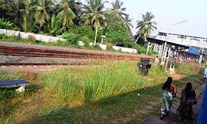
- Railway Station
 Tanur Beach
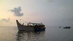
 Fishing boats
References
- ↑ http://www.malappuram.net/art-and-culture.htm
- ↑ Falling Rain Genomics, Inc - Tanur
- ↑ "Assembly Constituencies - Corresponding Districts and Parliamentary Constituencies" (PDF). Kerala. Election Commission of India. Retrieved 2008-10-19.
| Wikimedia Commons has media related to Tanur. |
