Sydney–Brisbane rail corridor
The Sydney–Brisbane railway corridor is a standard gauge railway corridor that connects the state capitals of Brisbane and Sydney in Australia.[1]
Description
The corridor consists of the first 193 km of the Main North Line from Sydney Central Station to Maitland, and then the entire 795 km of the North Coast Line to Roma Street railway station, Brisbane.
The NSW TrainLink XPT passenger service operates along the route, as do a number of other freight and passenger services.
History
Originally the corridor was made up of the Queensland Rail narrow gauge Southern line and the New South Wales Government Railways standard gauge line that met at the inland town of Wallangarra at a break-of-gauge in 1888. It was not until 1930 that the coastal, standard gauge North Coast railway line was extended from Casino to Brisbane making through services possible,[2][3] using a rail ferry for the river crossing in Grafton in New South Wales, until a bridge was opened in 1932.[4]
The old Main North railway line which went to Wallangarra now terminates near Armidale.
Gallery
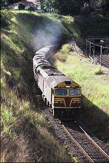
| 44238 & 4470 haul a northbound goods train cross Beaudesert Rd, Acacia Ridge, 1987. This crossing has since been replaced by an overpass |
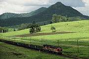
| 4479 and a 45 class haul a southbound train past Mt Lion, on the Brisbane-Casino line, 1987 |
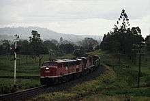
| 4479 and a 45 class haul a southbound goods train through the S bend south of Kyogle station, 1987 |
| 4479 and a 45 class haul a goods train about to exchange electric staffs at Fairy Hill, north of Casino, 1987 |
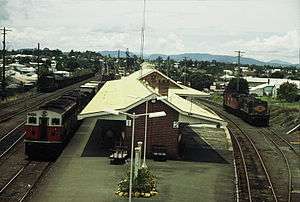
| 4456 and a 45 class haul a southbound goods train through Casino station, 1987 |
| 44231 on a northbound freight train arriving at Casino in 1987 |
|
See also
References
Citations
Sources
- Avery, Rod (2006). Freight Across the Nation: The Australian Superfreighter Experience. Brisbane: Copyright Publishing Co. ISBN 1876344474.
|
|---|
| Corridors | |
|---|
| Passenger trains | |
|---|
| Operators | |
|---|
28°19′57″S 152°58′04″E / 28.332464°S 152.967697°E / -28.332464; 152.967697Coordinates: 28°19′57″S 152°58′04″E / 28.332464°S 152.967697°E / -28.332464; 152.967697


