Suzhou Creek
| Suzhou Creek (苏州河) | |
| Wusong River (吴淞江) | |
| River | |
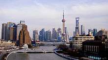
 Suzhou Creek from Waibaidu Bridge | |
| Name origin: Suzhou and Wusong | |
| Country | China |
|---|---|
| Province-level divisions | Jiangsu, Shanghai |
| Part of | Huangpu River |
| City | Suzhou, Shanghai |
| Landmark | Waibaidu Bridge |
| Source | Lake Tai |
| - coordinates | 31°5′35″N 120°35′9″E / 31.09306°N 120.58583°E |
| Mouth | Huangpu River |
| - location | Shanghai |
| - coordinates | 31°14′41″N 121°29′13″E / 31.24472°N 121.48694°ECoordinates: 31°14′41″N 121°29′13″E / 31.24472°N 121.48694°E |
| Length | 125 km (78 mi) |
| Suzhou Creek | |||||||||||||
| Traditional Chinese | 蘇州河 | ||||||||||||
|---|---|---|---|---|---|---|---|---|---|---|---|---|---|
| Simplified Chinese | 苏州河 | ||||||||||||
| Postal | Soochow River | ||||||||||||
| Literal meaning | Suzhou River | ||||||||||||
| |||||||||||||
| Wusong River | |||||||||||||
| Traditional Chinese | 吳淞江 | ||||||||||||
| Simplified Chinese | 吴淞江 | ||||||||||||
| Postal | Woosung River | ||||||||||||
| Literal meaning | Wusong River | ||||||||||||
| |||||||||||||
Suzhou Creek (or Soochow Creek), also called Wusong River, is a river that passes through the Shanghai city center. It is named after the neighbouring city of Suzhou, Jiangsu, the predominant settlement in this area prior to the rise of Shanghai as a metropolis.
One of the principal outlets of Lake Tai in Wujiang District of Suzhou, Suzhou Creek is 125 km (78 mi) long, of which 54 km are within the administrative region of Shanghai and 24 km within the city's highly urbanized parts. It flows into the Huangpu River at the northern end of the Bund in Huangpu District.
History
The river was originally called "Song Jiang" ("Pine River"). When the former Huating Fu (Prefecture) was renamed Songjiang Fu in 1278, the river's name was changed to "Wusong River".
The mouth of the river was known in the 4th or 5th century of Jin as 滬瀆 (沪渎, Hù Dú, lit "Harpoon Ditch"), at which time it was the main conduit into the ocean;[1] the contraction 沪 (Hù)[2] is today the official abbreviation for Shanghai.
The Wusong River formerly entered the mouth of the Yangtze at the same point where today the Huangpu River enters the Yangtze estuary; this point is even today called the "Mouth of the Wusong" (吳淞口).
From principal outlet to tributary
The first recorded works on the river was the building of levees along part of the river bank in 810AD. In 1042, the entire course of the river from Lake Tai to the sea was embanked. [3] The river gradually silted up, and a series of works were undertaken in the 11th century to eliminate bends in the course of the river, in an attempt to speed up water flow and prevent further silting. However, silting continued, necessitating constant dredging and the periodic cutting of new channels. In 1109, 12 sluice gates were completed in the lower reaches of the river in order to control the effect of silt from the nearby and much larger Yangtze River. These works allowed the river to remain a commercial artery during the Song and Yuan dynasties: even as late as 1277, sea-faring merchant ships could sail up the river to reach the gates of Suzhou. By the early 14th century, however, repeated major dredging works were again necessary to maintain the channel. By the late 14th century, during the early Ming Dynasty, the lower reaches of the river had almost entirely become land. A major tributary, the Huangpu River, was similarly affected by silt. In 1403, a major flood affected the area. In response, Xia Yuanji, the Vice Minister of Revenue, devised a plan for major works in what is now the Shanghai area. Water from Lake Tai was partially diverted via the Huangpu, and both the Huangpu and the Wusong were joined to the Fanjiabang canal as their channel to the mouth of the Yangtze and the sea. Further works during the Ming Dynasty established the Huangpu as the main conduit, and by 1569, after dredging works directed by Hai Rui,[4] the relative arrangement of the two channels became established: the Wusong River flowed into the Huangpu near today's Waibaidu Bridge, and the combined channel flowed to the Mouth of the Wusong via the Fanjiabang channel. In the region of today's central Shanghai, Wusong River was by 1569 a narrow channel of about 50 metres wide on the surface, and half that width at the bottom.
Modern era: strategic significance


Suzhou Creek has played an important role for being the demarcation line between political spheres of influences throughout Shanghai's history. After the Treaty of Nanjing forced China to open up in 1842 and Shanghai became an international trade port, the river formed the boundary between the British concession (Southern bank) and the American settlement (Northern bank) until both concessions were merged into the International Settlement in 1863. When the Japanese invaded Shanghai in 1937, the river formed the boundary between the International Settlement (South) and the Japanese concession (North).
Wusong River acquired its modern name in the mid-19th century: because it connected Shanghai with Suzhou, it was called "Soochow Creek" in English, and the popular Chinese name was a translation from the English.[5] The first documented mention of "Soochow Creek" occurred in the 1848 version of the Shanghai Land Regulations, the rules which governed the foreign concessions of Shanghai. From there, the name entered popular parlance, and "Suzhou Creek" is now the predominant name used in Shanghai.[6][7] However, "Wusong Creek" remains in use in some official contexts and is the name used by upstream residents closer to Suzhou.[8]
Trade route
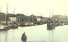
Due to Shanghai's role as trade port, from the 1930s Suzhou Creek was an important shipping route, facilitating the transport of goods into the interior of China. Along the river banks, a multitude of warehouses and factories were built at this time, making the region close to the river a significant industrial area.
In the course of urbanization, local industries withdrew from the city center, leaving the warehouses and factories abandoned. Up to this point, the river had been heavily polluted by industries as well as domestic waste water, making Suzhou Creek locally known as "the smelly river", the most polluted river in Shanghai since the 1920s.
Redevelopment and future
Since 1992, the Shanghai Municipal Government has been pursuing a redevelopment of the area. In 1998, authorities launched the Suzhou Creek Rehabilitation Project, a 12-year-program to improve the water quality, mitigate flood impact, introduce wastewater and water resource management and push for urban revitalization and a higher living standard in the desolated areas along Suzhou River.[9] In the meantime, Suzhou River is considered clean enough to host annual rowing competitions.[10]
Originally, most old factories and warehouses along Suzhou River were set be demolished in favour of the construction of modern high-rise buildings in Shanghai's fast-developing city center, aiming at a social and economic regeneration of the Suzhou River area. However, following initiatives of artists in the late 1990s the riverside has been designated as a protected heritage zone and many warehouses have been conserved, now providing quarters for Shanghai's flourishing art scene.
In 2002, new plans for the redevelopment of the riverfront of Suzhou Creek were approved. These plans, based upon proposals by three international firms, call for the construction of entertainment facilities and 1 square kilometre (250 acres) of parks along the downtown section of Suzhou Creek between Zhongshan Park and its confluence with Huangpu River, aiming to raise the commercial attractiveness of this central part of the river. New structures include shops, bars and a total of 95 greenbelts at the banks of the river, which are supposed to be planted by 2010, the time the Suzhou Creek Rehabilitation Project is completed. While some areas already leased to investors will have to be reclaimed and old residential and industrial facilities are supposed to be replaced, authorities assert that the protection of historical buildings, especially warehouses, will be respected.
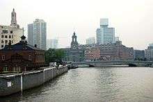
From 2007-2010, the Bund Tunnel was constructed under the Bund and the mouth of the Suzhou Creek. The construction of the tunnel was designed to relieve the heavy traffic through the Bund area. It rendered obsolete the late 20th century concrete Wusong Road Gate Bridge at the mouth of Suzhou Creek, which had impacted the streetscape and sightlines in the Bund area, allowing it to be removed.[11] The tunnel replaced the road transport function of the bridge (and its water control function was replaced by the new Jinshan Road Gate). The concrete road bridge and flood gate, which was built to the west of Garden Bridge to relieve traffic from the historic bridge, was criticised for affecting the historic sightlines between Garden Bridge and landmarks further up Suzhou Creek (such as the General Post Office Building).[12] Wusong Road Gate Bridge was demolished in 2009, prior to the completion of the Bund Tunnel.
Places along the river
Due to its location in the former International Settlement, a number of landmarks from that period can be found along or close to Suzhou Creek. Following the river westward from its confluence, important or famous places include:[13]
- Huangpu Park and the northern end of the Bund
- Astor House
- Consulate-General of Russia
- Shanghai Mansions (previously Broadway Mansions)
- People's Hospital No. 1
- Shanghai General Post Office
- Suzhou Creek Art District ("M50")
- Sihang Warehouse
In the Suzhou area, where the same river is rather called Wusong River, it passes by Suzhou Industrial Park and Suzhou Dushu Lake Higher Education Town, and connects via Huodi Pond and Dushu Lake to the Grand Canal.
Bridges

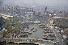
Suzhou Creek is crossed by a number of distinctive bridges, often European in style, the most famous one being Waibaidu Bridge (Garden Bridge) right at its confluence with Huangpu River.
Facilitating north-south traffic in the ever-growing metropolis, a number of new bridges are currently being constructed. Gubei Road bridge, to be opened in late 2006, will be the longest bridge over the waterway. By 2007, there will be thirty bridges spanning Suzhou Creek in Shanghai. In the Suzhou area, another 18 bridges are crossing the river as of 2015.
In the media
The Suzhou Creek plays a pivotal role in Lou Ye's film Suzhou River, which shows the lives of ordinary people living in the old quarters of the northern bank of the river at the turn of the millennium, rather than showcasing modern Shanghai.
In the film Empire of the Sun, Suzhou Creek has an internment camp/POW camp near an airfield.
References
| Wikimedia Commons has media related to Suzhou Creek. |
- ↑ Shanghai Municipal Government. ""申","沪"的由来" ("Origins of Shen and Hu"). (in Chinese)
- ↑ Traditional Chinese: 滬; Shanghainese: Vu2.
- ↑ 第二十三卷水利>>第一章治水方略、工程负担、投入>>第一节治水方略 (in Chinese). 上海地方志办公室. Retrieved 2011-10-01.
- ↑ 海瑞疏浚吴淞江"故道"辨正--《海瑞治理吴淞江》一文商榷 (in Chinese). 《上海地方志》2005年第四期. Retrieved 2011-10-01.
- ↑ 上海租界志 >> 第四篇公共设备 >> 第三章市政 >> 第一节 市政管理 (in Chinese). 上海市地方志办公室.
- ↑ Land Regulations, regulation I(1), Land Regulations and Bye-laws for the Foreign Settlement of Shanghai.
- ↑ 导言-苏州河传播曲 (in Chinese). 东方网财经中心. 2011-07-04. Retrieved 2011-10-01.
- ↑ 地图上从属吴淞江苏州河有望“正名” (in Chinese). 新华网. 2004-11-11. Retrieved 2011-10-01.
- ↑ "Transforming An Urban Waterway — Shanghai, China". 12 Cases of Cleanup and Success 2009. 2009. Retrieved 14 October 2013. External link in
|work=(help) - ↑ http://www.norway.cn/News_and_events/Culture/Sports/Dragonboat-2015/
- ↑ 新外滩:时尚与经典 (New Bund: fasshionable and classic). Wenhui Bao. 28 March 2010
- ↑ 吴淞路闸桥明凌晨全面开拆 今后形成外滩源公园 (Wusong Road Gate Bridge demolition fully commences tomorrow morning; Will in future form "the Bund Origin" park). Morning News. 16 October 2009
- ↑ Li Anlan (30 April 2013). "Sights to see along Suzhou Creek". iDEALShanghai. Retrieved 14 October 2013. External link in
|work=(help)