Sungailiat
| Sungailiat | |
|---|---|
| Town | |
|
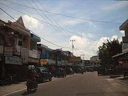
Streets of Sungailiat | |
 Sungailiat Location of Sungailiat in South Sumatra | |
| Coordinates: 1°51′20.7″S 106°7′3.4″E / 1.855750°S 106.117611°E | |
| Country |
|
| Province | Bangka Belitung Islands |
| Regency | Bangka Regency |
| Area[1] | |
| • Total | 146.63 km2 (56.61 sq mi) |
| Population (2015)[1] | |
| • Total | 94,044 |
| • Density | 640/km2 (1,700/sq mi) |
| Time zone | Western Indonesia Time (UTC+7) |
| Area code(s) | +62717 |
Sungailiat (Chinese: 烈港), or Lîet-Kóng in Hakka, is a subdistrict/kecamatan of Bangka Regency, Bangka-Belitung province of Indonesia. It is also the capital of the regency.
It is the second-largest settlement on the island, right after the provincial capital of Pangkal Pinang. The town is located on the eastern coast of the island, about 30 kilometers north of Pangkal Pinang and is connected by a paved road.
The subdistrict is further divided into 13 villages (desa or kelurahan).
Economy
As with many settlements in the province, the economy is heavily affected by the mining and processing of tin, abundant in the area. The locals are also engaged in fisheries and agriculture, cultivating rubber trees, pepper, and to a lesser degree palm oil. Small enterprises also exist, processing raw products from the aforementioned industries into light foods[2].

Tourism is a growing sector, with several Buddhist temples and beaches located within the boundaries of the city attracting visitors from the rest of the country.
Demographics
The majority of the people in Muntok are Hakka Chinese and Malay. Majority of Chinese are Buddhism, Catholic and Protestant.
Coordinates: 1°51′22″S 106°07′09″E / 1.85611°S 106.11917°E
References
- 1 2 "Bangka Regency - Bureau of Statistics". Badan Pusat Statistik Kabupaten Bangka. Statistics Indonesia. Retrieved 4 August 2017.
- ↑ "Statistik Daerah Kecamatan Sungailiat 2016" (PDF). Badan Pusat Statistik Kabupaten Bangka. Bangka Regency Statistics Bureau. Retrieved 4 August 2017.