Stadt Wehlen
| Stadt Wehlen | ||
|---|---|---|
_2006-06-10.jpg) | ||
| ||
 Stadt Wehlen | ||
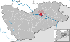
Location of Stadt Wehlen within Sächsische Schweiz-Osterzgebirge district 
 | ||
| Coordinates: 50°57′25″N 14°1′56″E / 50.95694°N 14.03222°ECoordinates: 50°57′25″N 14°1′56″E / 50.95694°N 14.03222°E | ||
| Country | Germany | |
| State | Saxony | |
| District | Sächsische Schweiz-Osterzgebirge | |
| Municipal assoc. | Lohmen/Stadt Wehlen | |
| Government | ||
| • Mayor | Klaus Tittel | |
| Area | ||
| • Total | 10.81 km2 (4.17 sq mi) | |
| Elevation | 220 m (720 ft) | |
| Population (2015-12-31)[1] | ||
| • Total | 1,622 | |
| • Density | 150/km2 (390/sq mi) | |
| Time zone | CET/CEST (UTC+1/+2) | |
| Postal codes | 01829 | |
| Dialling codes | 035024 | |
| Vehicle registration | PIR | |
| Website | www.wehlen-online.de | |
Stadt Wehlen (also: Wehlen) is a town in the Sächsische Schweiz-Osterzgebirge district, in Saxony, Germany. It is situated on the western edge of Saxon Switzerland, on the right bank of the Elbe, 6 km east of Pirna, and 23 km southeast of Dresden (centre).
Municipality subdivisions
Wehlen includes the following subdivisions:
- Dorf Wehlen
- Pötzscha
- Stadt Wehlen
- Zeichen
Culture and Attractions in Wehlen

Wehlen Panorama 001
 View to the left side of the Elbe onto Wehlen/Pötzscha
- Townchurch at the Marketplace
- Michalischurch in Dorf Wehlen
- „Trommel“(drum): Northside of castleruin Stadt Wehlen
- „Weiße Brüche“(white quarries) View from the Raunenstein (mountain)
 Beergarden in Wehlen/Pötzscha
 Beergarden in Wehlen/Pötzscha
International relations

View from the Elbe
Stadt Wehlen is twinned with:
- Wehlen an der Mosel (Rhineland-Palatinate)
- Wangen im Allgäu (Baden-Württemberg
- Dorn-Dürkheim
- Trochtelfingen
See also
- Bergtest near Wehlen, an annual competition walk.
References
External links
This article is issued from
Wikipedia.
The text is licensed under Creative Commons - Attribution - Sharealike.
Additional terms may apply for the media files.
