Spokane-Coeur d'Alene Combined Statistical Area
| Spokane-Coeur d'Alene Combined Statistical Area | |
|---|---|
| Spokane–Spokane Valley-Coeur d'Alene | |
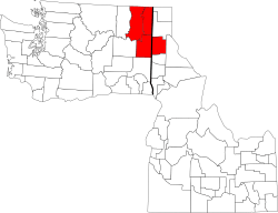 A map of the Spokane-Coeur d'Alene CSA in the U.S. states of Idaho and Washington. | |
| Country | United States |
| State(s) | Washington & Idaho |
| Largest city | Spokane (213,272) |
| Other cities |
- Spokane Valley (94,919) - Coeur d'Alene (49,122) - Post Falls (30,453) - Cheney (11,534) - Liberty Lake (8,906) - Airway Heights (6,639) |
| Area | |
| • Total | 6,885.7 sq mi (17,834 km2) |
| Highest elevation | 7,320 ft (2,230 m) |
| Lowest elevation | 1,273 ft (338 m) |
| Population | |
| • Total | 710, 946 |
| • Density | 101/sq mi (63/km2) |
Spokane-Spokane Valley-Coeur d'Alene, WA-ID CSA is the United States Census Bureau's official name for the combined statistical area that includes the Spokane metro area as well as the Coeur d'Alene metro area. The population was 710,946 as of 2016.[1] It is the 69th largest Combined Statistical Area in the United States, and is the economic and cultural center of the Inland Northwest. The CSA is Anchored by Spokane, and Coeur d'Alene, which are separated by suburbs that primarily follow the path of Interstate 90.
Demographics
| Historical population | |||
|---|---|---|---|
| Census | Pop. | %± | |
| 1880 | 6,025 | — | |
| 1890 | 45,936 | 662.4% | |
| 1900 | 78,301 | 70.5% | |
| 1910 | 187,448 | 139.4% | |
| 1920 | 187,135 | −0.2% | |
| 1930 | 195,651 | 4.6% | |
| 1940 | 213,336 | 9.0% | |
| 1950 | 272,501 | 27.7% | |
| 1960 | 332,687 | 22.1% | |
| 1970 | 346,249 | 4.1% | |
| 1980 | 439,164 | 26.8% | |
| 1990 | 470,991 | 7.2% | |
| 2000 | 578,438 | 22.8% | |
| 2010 | 666,247 | 15.2% | |
| Est. 2016 | 710,946 | 6.7% | |
References
- ↑ "Census Reporter". United States Census Bureau. Retrieved 2015-08-31.
This article is issued from
Wikipedia.
The text is licensed under Creative Commons - Attribution - Sharealike.
Additional terms may apply for the media files.