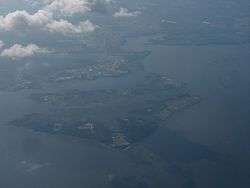
Spesutie Island
|
Spesutie Island, Maryland | |
| Geography | |
|---|---|
| Location | Harford County, Maryland |
| Coordinates | 39°27′21″N 76°04′36″W / 39.4559467°N 76.0766160°WCoordinates: 39°27′21″N 76°04′36″W / 39.4559467°N 76.0766160°W |
| Area | 1,500 acres (610 ha) |
| Highest elevation | 3 ft (0.9 m) |
| Administration | |
| Part of | Aberdeen Proving Ground |
Spesutie Island is a 1,500-acre (610 ha) island located in the Chesapeake Bay in Harford County, Maryland, United States. It lies 5.5 miles (8.9 km) southeast of Aberdeen, Maryland.[1][2] Spesutie Narrows bounds the island on the west and the bay bounds it on the north, east, and south. The island is part of Aberdeen Proving Ground.[2]
History
Evidence has been found of the historic presence of Native Americans on Spesutie Island.[2] In 1658, Lord Baltimore granted the island to Nathaniel Utie who named his manor house after his surname and the Latin word for hope, spes.[2] The property remained in the Utie family until 1779 when Samuel Hughes purchased it.[2] In 1802, William Smith bought the island, and his descendants would remain there for almost a century, though the War of 1812 brought some disruption.[2] In late April 1813, troops under the command of Rear Admiral George Cockburn briefly occupied the island, and passing vessels such as HMS Highflyer engaged in the forced purchase of cattle.[3] The Smith family sold the island in 1900 and by 1927 ownership had passed to the Susquehanna Development Company. In 1936, J. P. Morgan, Jr. built a house on the island to use as a hunting lodge. The Spesutie Island Hunting and Fishing Club maintained the island until 1945 when the United States government purchased it and incorporated it into Aberdeen Proving Ground.[2]
Other names
The United States Geological Survey records the following variant names for Spesutie Island: Bearsons Island, Spes Island, Spes Utia Island, Spes Utie Island, and Spesutia Island.[1]
Wildlife
Spesutie Island is home to a large population of bald eagles.[2]
See also
References
- 1 2 "Spesutie Island". Geographic Names Information System. United States Geological Survey. Retrieved May 9, 2011.
- 1 2 3 4 5 6 7 8 Cronin, William B. (2005). The Disappearing Islands of the Chesapeake. Baltimore: Johns Hopkins University Press. pp. 22–26. ISBN 0-8018-7435-1.
- ↑ "No. 16750". The London Gazette. 6 July 1813. p. 1331.
External links
- Spesutia Island Marker — Historical Marker Database
- NOAA Nautical Chart 12274 (showing Spesutie Island in the center)
