Sonbhadra district
Coordinates: 24°41′23″N 83°3′55″E / 24.68972°N 83.06528°E
| Sonbhadra district | |
|---|---|
| District of Uttar Pradesh | |
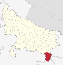
 Location of Sonbhadra district in Uttar Pradesh | |
| Country | India |
| State | Uttar Pradesh |
| Administrative division | Mirzapur |
| Headquarters | Robertsganj |
| Tehsils | Robertsganj, Ghorawal, Dudhi |
| Government | |
| • Lok Sabha constituencies | Robertsganj |
| • Assembly seats | Robertsganj, Ghorawal, Obra, Dudhi |
| Area | |
| • Total | 6,788 km2 (2,621 sq mi) |
| Population (2011) | |
| • Total | 1,862,559 |
| • Density | 270/km2 (710/sq mi) |
| Demographics | |
| • Literacy | 99 per cent |
| • Sex ratio | 918 |
| Major highways | NH 7, NH 75 |
| Website | Official website |
Sonbhadra district or Sonebhadra is the 2nd largest district of Uttar Pradesh, India. Sonbhadra is the only district in India which borders four states namely Madhya Pradesh, Chhattishgarh Jharkhand and Bihar. In the popular TV Show Kaun Banega Crorepati, a question rewarding 50 lacs was asked based on the fact just mentioned.[1] The district has an area of 6788 km² and a population of 1,862,559 (2011 census), with a population density of 270 persons per km².It lies in the extreme southeast of the state, and is bounded by Mirzapur District to the northwest, Chandauli District to the north, Kaimur and Rohtas districts of Bihar state to the northeast, Garhwa district of Jharkhand state to the east, Koriya and Surguja districts of Chhattisgarh state to the south, and Singrauli district of Madhya Pradesh state to the west. The district headquarters is in the town of Robertsganj.Sonbhadra district is an industrial zone and it has lots of minerals like bauxite, limestone, coal, gold etc.Sonbhadra is called as Energy Capital of India because there are so many power plants.
Sonbhadra lies between vindhya and Kaimur hills, and its topology and natural environment prompted First Prime minister of India Pt. Jawahar Lal Nehru to refer to Sonbhadra as The Switzerland of India.

History
Based on evidence from religious and cultural perspectives Ramayana and the Mahabharat, Huyen found here is the cultural symbol. By Jarasandh many rulers in the Mahabharat war was maintained prisoner here. In the third century, this was the capital of the kings of Kantipuri wakatak Nagvanshi dynasty till ninth centuries it was dominated. Abhor dynasty kings and powerful kings of kol were also ruled in this area. The forts Located in the district are
- 1. Agori Fort - ruled by Madan Shah
- 2.Vijaygarh Fort - ruled by Kashi Naresh Chet Singh
- 3.Sodhrigarh Durg- ruled by Garhwal kings.
The heroine of Famous Novel Chandrakanta written by Devaki Nandan Khatri was the princess of Vijaygarh Fort and the daughter of king Jay Singh.
Geography
The Sone River flows through the district from west to east and its tributary the Rihand River, which rises to the south in the highlands of Surguja district of Chhattisgarh, flows north to join the Son in the center of the district. Sonbhadra is located in the south-eastern ranges of the Vindhyachal mountain. The Govind Ballabh Pant Sagar, a reservoir on the Rihand, lies partly in the district and partly in Madhya Pradesh. The district has historic, cultural, and ecological affinities with the Bagelkhand region. Robertsganj is the district headquarters, but Obra and Renukoot are the bigger and developed cities. Almost 80 km from Varanasi, the cultural centre of Indian epitome of Vedic civilisation, holds a prime importance as the district headquarters.
Climate
Sonbhadra has a relatively subtropical climate with high variation between summer and winter temperatures. The average temperature is 30 °C–46 °C in the summer and 2 °C–15 °C in the winter. The weather is pleasant in rainy season from July to October.
Economy
The southern region of Sonebhadra is referred to as the " Energy Capital of India "; this region has many electrical power stations around Govind Ballabh Pant Sagar. NTPC (a leading power generation company in India) has three coal-based thermal power plants at Shaktinagar SSTPS(Singrauli Super Thermal Power Station),2000 MW (India's first NTPC Power Plant), [VSTPP (Vindhyachal Super Thermal Power project)] |Vindhyanagar]] (largest capacity in India, 4760 MW) and Bijpur (Rihandnagar, RhSTPP(Rihand Super Thermal Power project), 3000 MW]). Other power stations are at Anpara (UPRVUNL), Obra (UPRVUNL), Renusagar (Hindalco) and Pipri-Hydro (UPRVUNL). NCL (a branch of Coal India Limited) has its headquarters and many coal mines in this region. Hindalco has a major aluminium plant at Renukut.
This region became an industrial heaven from an area of forest and hills. Some of the hills were having limestone and lot of them were having coal. There were some small rivers running through the area and the major was the Son.
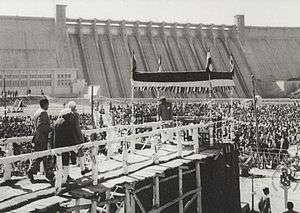
Owing to the limestone hills, initially one cement factory was established at Churk in 1956. Later another cement factory started at Dala in 1971 and ancillary unit of Dala got started at Chunar in 1980. The cement factories became the foundation on which other industries were built. A big dam constructed at Pipri in 1961 and named Rihand Dam. The dam produces 300 MW of electricity. Another small dam was constructed at Obra in 1968, 40 km from Rihand dam which generates 99 MW of electricity.
The Birla group then set up an aluminum plant at Renukut, which is one of the biggest aluminum plant of Hindalco. Later, the Birla group set up its own power plant at Renusagar in 1967. This plant has the current capacity of 887.2 MW and supplies the power to Hindalco. The Birlas also started a company in Renukut called HiTech Carbon. Another industrial group initiated a company in Renukut named Kanoria Chemicals, which produces chemicals and later it started own power plant at Renukoot in 1998 which generates 50 MW of electricity.
A big thermal power plant construction was started at Obra in 1967 with support of Russian engineers and was successfully completed in 1971. This had a capacity to produce 1550 MW of electricity.Another power plant was initiated at Anpara in 1980. It produces 1630 MW of electricity and has proposed to extend the capacity to 2630 MW. NTPC's first thermal power plant that it started in Shaktinagar, generates 2000 MW. The plant at Bijpur generates 3000 MW.
This region has three cement factories, one of the biggest aluminum plants, a carbon plant, a chemical factory and an energy hub of India, which generates 11000 MW with plans to reach 20000 MW. The whole country is benefiting from this region, which was once full of forests and hills, which seemed like infertile land.
In 2006 the Ministry of Panchayati Raj named Sonbhadra one of the country's 250 most backward districts (out of a total of 640).[2] It is one of the 34 districts in Uttar Pradesh currently receiving funds from the Backward Regions Grant Fund Programme (BRGF).[2]
Industry timeline
- 1956 : Churk Cement Factory, 800 T/day.
- 1961 : Rihand Dam, Pipri, 300 MW of electricity, Reservoir for power plants.
- 1962 : Hindalco Aluminium Plant, Renukoot, Alumina refining - 114,5000 TPA, Aluminium metal - 424,000 TPA.
- 1965 : Kanoria Chemicals, Renukoot, Acetaldehyde - 10000 TPA, Formaldehyde - 75000 TPA, Lindane - 875 TPA, Hexamine - 4000 TPA, Industrial Alcohol - 225 million litters/annum, Aluminium Chloride - 6875 TPA, Ethyl Acetate - 3300 TPA, Acetic Acid - 6000 TPA, Commercial Hydrogen.
- 1967 : Renusagar Power Plant (Hindalco), 741.7 MW of electricity.
- 1968 : Obra Dam, 99 MW of electricity, Reservoir for power plant..
- 1971 : Obra Thermal Power Plant, Uttar Pradesh State Electricity Board (UPSEB), 1550 MW of electricity.
- 1980 : Chunar Cement Factory, Ancillary unit of Dala Cement Factory.
- 1980: Vindhaya stone cruising company kuwari.
- 1980 : Anpara Thermal Power Plant, UPSEB, 2000 MW of electricity.
- 1983 : B.P. Construction Company, Anpara.
- 1984 : Singrauli Thermal Power Plant, NTPC Limited (NTPC), Shaktinagar, 2000 MW of electricity.
- 1988 : Hi -Tech Carbon, Renukoot, Carbon Black - 1,60,000 MT/annum.
- 1989: Vindhaya stone cruising company bagvanwa obra.
- 1989 : Rihand Thermal Power Plant, NTPC, Bijpur, 3000 MW of electricity.
- 1990 : Finding of Gold Mine in Hills, Mirchadhuri.
- 1993 :Jan Kalyan Gramodyog Seva Ashram Sonbhadra. http://jkgsa.org
- 1998 : Kanoria Chemicals Power Plant, Renukoot, 50 MW of electricity.
- 2008 : Lanco Anpara Power Limited, 1200 MW of electricity.
- 2014: BGR outsourcing company coal mines
Bhaskar group, Reliance Power, Essar Power, Jaypee Power and Aditya Birla Group (Mahan Project) are in erection phase with their power plants.
Tourist attraction

Historical places

- 1. Vijaygarh Fort
- 2. Agori Fort
- 3. Mukkha-Lakhaniya Cave paintings
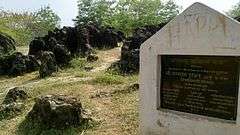
- 4. Veer Lorik Patthar
- 5. Shahid Park, Parasi
- 6.panchmukhi mahadev mandir churk
- 7. sone eco point robertsganj
Nature
- 1. Salkhan Fossil Park
- 2 Mukkha Fall
- 3 Mahuwariya sanctuary
- 4 Son View Point, Robertsganj
- 5. Rihand Dam
- 6. Dhanraul Dam
- 7. Chilka lake, Shaktinagar
- 8 Kaimur Wildlife Sanctuary
- 9.Ash Dam Park, Renusagar
- 10.Maya Van Chetna KendraHathinala
Temples
- 1. Shivdwar Temple
- 2 Mata vaishnav Temple, Dalla
- 3 Panchmuki
- 4 Gauri Shankar Mandir
- 5 Baraila Mahadev Mandir
- 6 Renukeshwar Mahadev Temple
- 7. Radha Krishna Temple
- 9.Vandevi Temple
- 10 Lotus Temple, Renukut
- 11. Ram Mandir, Renukoot
- 12.Jwaladevi Temple, Shaktinagar
- 13.Shitla mata temple, main chauk, Robertsganj
- 14.Shree Banke Bihari Mandir, Robertsganj
- 15.Brihdeshwar Mahadev Temple, Robertsganj
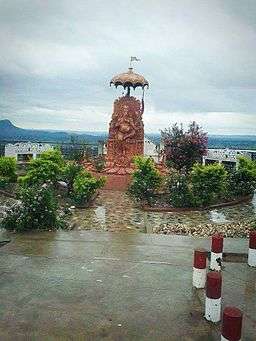
- 16.old hanuman temple (Anpara)
Transport
By air
- Mayurpur Airport at Myorpur, a private airport used by chartered and private planes.
- Varanasi International Airport in Varanasi.
Flights are available to all major Indian cities including Delhi, Mumbai, Kolkata, Lucknow, Agra, Bangalore, Chennai, Patna, Khajuraho, Hyderabad, Gaya, etc. International connections are Bangkok, Colombo, Hong Kong and Kathmandu.
By train
- Mirzapur Railway Station.
- Robertsganj Railway Station.
- Churk Railway Station.
- Chopan Railway station.
- Obra Railway station.
- Renukoot Railway station near RIHAND DAM.
- Anpara Railway station.
- Krishan Shila (Bina) Railway station.
- Shaktinagar Railway station.
- Varanasi Railway station.
- Dudhi Railway station.
- Wyndhamganj Railway Station.
The city is connected by rail to Delhi, Allahabad, Ranchi and Patna. Some notable trains passing through the district are Muri express (Jammu Tawi - Delhi - Tata Nagar), Jharkhand Swarna Jayanti Express/12873(Hatia - Kanpur - Delhi), Triveni Express (Bareilly - Lucknow - Shaktinagar/Singrauli/barwadih) Bhopal Express(Bhopal-Howrah)weekly and Shaktipunj Express/11448(Howrah-Bokaro - Chopan- Jabalpur).Intercity Express/03346 (Singrauli- Chopan-Varanasi).
By road
Robertsganj, the headquarters of Sonbhadra, is located about 88 km from the city of Varanasi which has the nearest airport. Robertsganj is well connected to Lucknow, Allahabad, Varanasi, Mirzapur, Gorakhpur, Faizabad, [[Ambikapur, Sasaram (Bihar) & Garhwa(Jharkhand) India by road. Buses are available at all hours of the day from Varanasi and it normally takes 2½ hours to cover the distance. The highway connecting Varanasi and Waidhan passes through the district. Though this is not a national highway it is a very busy road because of the towns Renukot, Anpara, Shaktinagar which are sufficiently commercialized areas. National Thermal Power corporation is in Shaktinagar and also National Coalfield different projects like Singrauli, Khadia, Jayant, Dudhichua, amlori, Kakri etc. These areas have several major coal mines which cater a big part of the coal need of the state. Churk a nearby town is situated around 10 km, where Jaypee Group is establishing a thermal power project. One of the main reasons this road is always busy is due to daily transport of around 1000 trucks of grits and sand.Sasaram( Bihar), Garway
Demographics
According to the 2011 census Sonbhadra district has a population of 1,862,559, of which male and female were 971,344 and 891,215 respectively.[4] roughly equal to the nation of Kosovo[5] or the US state of West Virginia.[6] This gives it a ranking of 254th in India (out of a total of 640).[4] The district has a population density of 270 inhabitants per square kilometre (700/sq mi) .[4] Its population growth rate over the decade 2001-2011 was 27.27%.[4]
Sex ratio and child population
[4] Sonbhadra has a sex ratio of 996 females for every 1000 males. In census enumeration, data regarding child under 0-6 age were also collected for districts Sonbhadra. There were total 323,092 children under age of 0-6 against 302,834 of 2001 census. Of total 323,092 male and female were 167,870 and 155,222 respectively. Child Sex Ratio as per census 2011 was 925 compared to 956 of census 2001. In 2011, Children under 0-6 formed 17.35 percent of Sonbhadra District compared to 20.69 percent of 2001. There was net change of -3.34 percent in this compared to previous census.
Literacy rate
[4] literacy rate of 64%. Male and female literacy were 74.92%and 52.14% respectively. Total literate in Sonbhadra District were 985,708 of which male and female were 601,988 and 383,720 respectively.
Sonbhadra District urban population
Out of the total Sonbhadra population for 2011 census, 16.88 percent lives in urban regions of district. In total 314,342 people lives in urban areas of which males are 167,999 and females are 146,343. Sex Ratio in urban region of Sonbhadra district is 871 as per 2011 census data. Similarly child sex ratio in Sonbhadra district was 868 in 2011 census. Child population (0-6) in urban region was 38,169 of which males and females were 20,434 and 17,735. This child population figure of Sonbhadra district is 12.16% of total urban population.there are 11.7% urban people belong to scheduled casts and 3.2% urban people belong to scheduled tribes.
Average literacy rate in Sonbhadra Urban as per census 2011 is 84.31% of which males and females are 90.73% and 76.93% literates respectively.
Sonbhadra District rural population
As per 2011 census, 83.12% population of Sonbhadra districts lives in rural areas of villages. The total Sonbhadra district population living in rural areas is 1,548,217 of which males and females are 803,345 and 744,872 respectively. there are 24.9% rural people belong to scheduled casts and 24.2% rural people belong to scheduled tribes.
Literacy rate in rural areas of Sonbhadra district is 59.60% as per census data 2011. Gender wise, male and female literacy stood at 71.37 and 46.89 percent respectively. In total, 752,876 people were literate of which males and females were 468,097 and 284,779 respectively.
| Sonbhdra District Population | ||||
| Total | 1,942,955 | |||
| Males | 971,344 | |||
| Females | 891,215 | |||
| Urban population | 314,342 | |||
| Rural Population | 1,548,217 | |||
| Literacy Rate | ||||
| Total | 64% | |||
| Males | 74.92% | |||
| Females | 52.14% | |||
| Urban literacy | 84.31% | |||
| Rural literacy | 59.60% | |||
| Density of population | ||||
| per km2 | 270 | |||
| Sex ratio | ||||
| per 1000 males | 918 females | |||
| Child sex ratio (0–6 age group) | ||||
| per 1000 males | 925 females | |||
Referenced
- ↑ http://www.thelallantop.com/up-election/uttar-pradesh-assembly-election-2017-ground-report-of-dudhi-sonbhadra-last-assembly-seat-of-up/
- 1 2 Ministry of Panchayati Raj (8 September 2009). "A Note on the Backward Regions Grant Fund Programme" (PDF). National Institute of Rural Development. Retrieved 27 September 2011.
- ↑ http://www.census2011.co.in/data/religion/district/571-sonbhadra.html
- 1 2 3 4 5 6 7 "District Census 2011". Census2011.co.in. 2011. Retrieved 2011-09-30.
- ↑ US Directorate of Intelligence. "Country Comparison:Population". Retrieved 2011-10-01.
Kosovo 1,825,632 July 2011 est.
- ↑ "2010 Resident Population Data". U. S. Census Bureau. Retrieved 2011-09-30.
West Virginia 1,852,994
External links
| Wikimedia Commons has media related to Sonbhadra district. |


