Sơn La Province
| Sơn La Province Tỉnh Sơn La | |
|---|---|
| Province | |
 | |
 Location of Sơn La within Vietnam | |
| Coordinates: 21°10′N 104°0′E / 21.167°N 104.000°ECoordinates: 21°10′N 104°0′E / 21.167°N 104.000°E | |
| Country |
|
| Region | Northwest |
| Capital | Sơn La |
| Area | |
| • Total | 14,055 km2 (5,427 sq mi) |
| Population (2004) | |
| • Total | 972,800 |
| • Density | 69/km2 (180/sq mi) |
| Demographics | |
| • Ethnicities | Vietnamese, Tai, H'Mông, Mường, Dao |
| Time zone | ICT (UTC+7) |
| Area codes | 212 |
| ISO 3166 code | VN-05 |
| Website |
www |
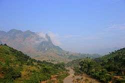
Sơn La (![]() listen) is a province in the Northwest region of Vietnam. It borders Laos to the south. The population includes Black and White Tai.
listen) is a province in the Northwest region of Vietnam. It borders Laos to the south. The population includes Black and White Tai.
Sơn La Dam, the largest hydroelectric power station in Southeast Asia.[1] is located in this province.
Administrative divisions
Sơn La is subdivided into 12 district-level sub-divisions:
- 11 districts:
- Bắc Yên
- Mai Sơn
- Mộc Châu
- Mường La
- Phù Yên
- Quỳnh Nhai
- Sông Mã
- Sốp Cộp
- Thuận Châu
- Yên Châu
- Vân Hồ (newly created)
- 1 provincial city:
- Sơn La (capital)
They are further subdivided into 9 commune-level towns (or townlets), 188 communes, and 7 wards.
Etymology
The province's name derives from Sino-Vietnamese 山羅.
See also
- Nà Sản Airport
- Mộc Châu plateau
References
- ↑ "Huge hydro plant starts operation in Vietnam, says official". Intellasia News Services. 2010-12-22. Retrieved 2011-01-22.
External links
Places adjacent to Sơn La Province | |||
|---|---|---|---|
 | | ||
This article is issued from
Wikipedia.
The text is licensed under Creative Commons - Attribution - Sharealike.
Additional terms may apply for the media files.