Solar eclipse of February 26, 2017
| Solar eclipse of February 26, 2017 | |
|---|---|
|
Partial from Buenos Aires, Argentina | |
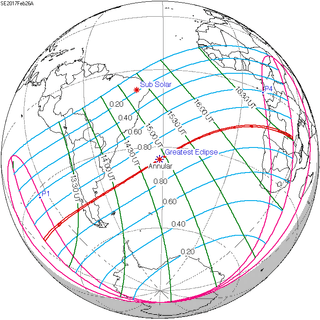 Map | |
| Type of eclipse | |
| Nature | Annular |
| Gamma | -0.4578 |
| Magnitude | 0.9922 |
| Maximum eclipse | |
| Duration | 44 sec (0 m 44 s) |
| Coordinates | 34°42′S 31°12′W / 34.7°S 31.2°W |
| Max. width of band | 31 km (19 mi) |
| Times (UTC) | |
| Greatest eclipse | 14:54:33 |
| References | |
| Saros | 140 (29 of 71) |
| Catalog # (SE5000) | 9545 |
An annular solar eclipse took place on February 26, 2017. A solar eclipse occurs when the Moon passes between Earth and the Sun, thereby totally or partly obscuring the image of the Sun for a viewer on Earth. An annular solar eclipse occurs when the Moon's apparent diameter is smaller than the Sun's, blocking most of the Sun's light and causing the Sun to look like an annulus (ring). An annular eclipse appears as a partial eclipse over a region of the Earth thousands of kilometres wide.
It was visible across southern South America in the morning and ended in south-western Africa at sunset. In Argentina, the best places to see the eclipse were located in the south of the Chubut Province, in the towns of Facundo, Sarmiento and Camarones.
Images

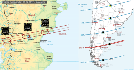
Gallery
.jpg) Partial from Villa Gesell, Argentina, 10:18 local time (13:18 GMT)
Partial from Villa Gesell, Argentina, 10:18 local time (13:18 GMT) Partial from Coyhaique, Chile, 10:35 local time (13:35 GMT)
 At greatest eclipse from Rafael Castillo, Buenos Aires, Argentina, 10:53 local time (13:53 GMT)
 Predicted eclipse time lapse seen from Buenos Aires, Argentina
.png) Time lapse images as seen from Villa Gesell, Argentina
Time lapse images as seen from Villa Gesell, Argentina Animation of the eclipse seen from Montevideo, Uruguay
Related eclipses
Solar eclipses 2015-2018
Each member in a semester series of solar eclipses repeats approximately every 177 days and 4 hours (a semester) at alternating nodes of the Moon's orbit.
| Solar eclipse series sets from 2015–18 | ||||||
|---|---|---|---|---|---|---|
| Descending node | Ascending node | |||||
| Saros | Map | Saros | Map | |||
120 Longyearbyen, Svalbard | March 20, 2015 Total |
125 | September 13, 2015 Partial | |||
| 130 Balikpapan, Indonesia | March 9, 2016 Total |
135 L'Étang-Salé, Réunion | September 1, 2016 Annular | |||
140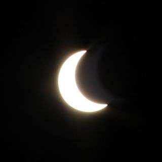 Partial from Buenos Aires | February 26, 2017 Annular |
145.jpg) Oregon | August 21, 2017 Total | |||
| 150 | February 15, 2018 Partial |
155 | August 11, 2018 Partial | |||
| Partial solar eclipses on July 13, 2018, and January 6, 2019, occur during the next semester series. | ||||||
Metonic cycle
The metonic series repeats eclipses every 19 years (6939.69 days), lasting about 5 cycles. Eclipses occur in nearly the same calendar date. In addition the octon subseries repeats 1/5 of that or every 3.8 years (1387.94 days).
| 21 events between July 22, 1971 and July 22, 2047 | ||||
|---|---|---|---|---|
| July 21-22 | May 9-11 | February 26-27 | December 14-15 | October 2-3 |
| 116 | 118 | 120 | 122 | 124 |
 July 22, 1971 |
 May 11, 1975 |
 February 26, 1979 |
 December 15, 1982 |
 October 3, 1986 |
| 126 | 128 | 130 | 132 | 134 |
 July 22, 1990 |
 May 10, 1994 |
 February 26, 1998 |
 December 14, 2001 |
 October 3, 2005 |
| 136 | 138 | 140 | 142 | 144 |
 July 22, 2009 |
 May 10, 2013 |
 February 26, 2017 |
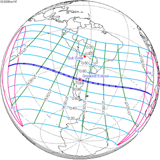 December 14, 2020 |
 October 2, 2024 |
| 146 | 148 | 150 | 152 | 154 |
 July 22, 2028 |
 May 9, 2032 |
 February 27, 2036 |
 December 15, 2039 |
 October 3, 2043 |
| 156 | ||||
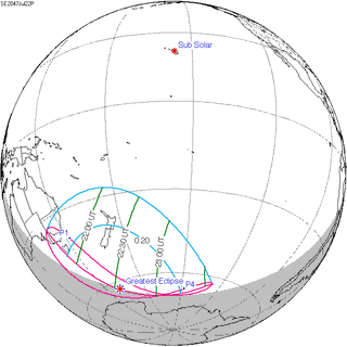 July 22, 2047 | ||||
Notes and References
References
- www.solar-eclipse.de - The annular solar eclipse of 02/26/2017
- NASA graphics
- hermet.org: Annular Solar Eclipse: February 26 2017
External links
| Wikimedia Commons has media related to Solar eclipse of 2017 February 26. |
- www.solar-eclipse.de - Average cloud coverage and cities along the eclipse path
