Sidi Fredj
.jpg)
 Algeria | |
| Location |
Sidi Fredj Algeria |
|---|---|
| Coordinates | 36°45′53.86″N 2°50′53.53″E / 36.7649611°N 2.8482028°E |
| Year first constructed | 1970s |
| Construction | concrete building |
| Tower shape | square prism building with light atop |
| Markings / pattern | white building |
| Height | 24 metres (79 ft)[1] |
| Focal height | 42 metres (138 ft)[1] |
| Light source | main power |
| Range | 17 nautical miles (31 km; 20 mi)[1] |
| Characteristic | Fl (3) W 12s.[1] |
| Admiralty number | E6624 |
| NGA number | 22432 |
| ARLHS number | ALG-046[2] |
| Managing agent | Office Nationale de Signalisation Maritime |
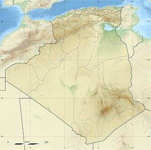
Sidi Fredj is a coastal town in Algiers Province, Algeria. It is located within the territory of the municipality of Staouéli, on a presque-isle on the Mediterranean Sea. It isthe site of Ancient city and bishopric Obori, which remains a Catholic titular see.
History
Obori was important enough in the Roman province of Mauretania Caesariensis to become one of the many suffragans of its capital Caesarea Mauretaniae's Metropolitan Archbishopric, but faded like most sees in Roman Africa.
Sidi Fredj was the landing spot where the French established their beachhead for the Invasion of Algiers in 1830. A number of ships of the French Navy were subsequently named Sidi Ferruch, the colonial name of the town under French rule, in honour of the event.
Titular see
The diocese was nominally restored in 1933 as Titular bishopric of Obori (Latin) / Obori (Curiate Italian) / Oboritan(us) (Latin adjective).
It has had the following incumbents, so far of the fitting Episcopal (lowest) rank :[3]
- James Francis Carney (1966.01.07 – 1969.01.08) as Auxiliary Bishop of Vancouver (Canada) (1966.01.07 – 1969.01.08), next succeeding as Metropolitan Archbishop of Vancouver (1969.01.08 – death 1990.09.16)
- Luigi Zanzottera, Oblates of Saint Joseph (O.S.J.) (1969.03.13 – death 2005.01.18), as Auxiliary Bishop of Huaraz (Peru) (1969.03.13 – 1970.05.31) and on emeritate
- Juan José Pineda Fasquelle, Claretians (C.M.F.) (2005.05.21 – ...), Auxiliary Bishop of Tegucigalpa (Honduras).
See also
References
- 1 2 3 4 List of Lights, Pub. 113: The West Coasts of Europe and Africa, the Mediterranean Sea, Black Sea and Azovskoye More (Sea of Azov) (PDF). List of Lights. United States National Geospatial-Intelligence Agency. 2015.
- ↑ "Western Algeria". The Lighthouse Directory. University of North Carolina at Chapel Hill. Retrieved 1 May 2017.
- ↑ http://www.gcatholic.org/dioceses/former/t1297.htm GCatholic
External links
Coordinates: 36°45′40″N 2°50′38″E / 36.76111°N 2.84389°E
