Sibalom River
| Sibalom River | |
|---|---|
|
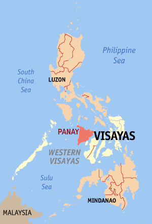
Location in Philippines | |
| Country | Philippines |
| Basin features | |
| Main source |
Central Panay Mountain Range, San Remigio, Antique. 4,000 ft. ( 1,219 m ). 10°45′46″N 122°8′22″E / 10.76278°N 122.13944°E |
| River mouth | Sulu Sea, on the Coastal border of Belison and San Jose de Buenavista, Antique. |
| Basin size | 502 sq.km ( 193 sq.mi ) |
| Tributaries |
|
| Bridges | Sibalom Bridge |
| Physical characteristics | |
| Length | 48 km ( 29 mi ) |
| Discharge |
|
Sibalom River is the longest river in Antique province, Philippines, with a total length of 48 km ( 29 mi ) and its Drainage basin covered 502 sq.km ( 193 sq.mi ). making the largest river system in Antique. located in Sibalom, Antique, on the island of Panay in the Philippines. Along with its main tributaries Mao-it River and Tipulu-an River, it forms the 5,511.47-hectare (13,619.1-acre) Tipulu-an and Mao-it River Watershed Forest Reserve (now known as Sibalom Natural Park) which was proclaimed a natural park on 23 April 2000.[1]
The river's watershed is considered as one of the last remaining lowland rainforests on Panay.[2]
References
- ↑ "Region 6 - Protected Areas". Department of Environment and Natural Resources Biodiversity Management Bureau. Retrieved 11 October 2014.
- ↑ Salas, Jessica. Common Land, Common Waters, the Island Perspective in Watershed Management: The Case of Panay Island. (PDF). Foundation for the Philippine Environment. Retrieved 11 October 2014.
This article is issued from
Wikipedia.
The text is licensed under Creative Commons - Attribution - Sharealike.
Additional terms may apply for the media files.