Stavropol Shpakovskoye Airport
| Stavropol Shpakovskoye Airport Аэропорт Ставрополь-Шпаковское | |||||||||||
|---|---|---|---|---|---|---|---|---|---|---|---|
 | |||||||||||
| Summary | |||||||||||
| Airport type | Public | ||||||||||
| Operator | JSC, Airport Stavropol | ||||||||||
| Serves | Stavropol | ||||||||||
| Location | Stavropol, Russia | ||||||||||
| Elevation AMSL | 1,486 ft / 453 m | ||||||||||
| Coordinates | 45°6′36″N 042°6′48″E / 45.11000°N 42.11333°ECoordinates: 45°6′36″N 042°6′48″E / 45.11000°N 42.11333°E | ||||||||||
| Website | stavavia.ru/ | ||||||||||
| Map | |||||||||||
 STW Location of airport in Stavropol Krai | |||||||||||
| Runways | |||||||||||
| |||||||||||
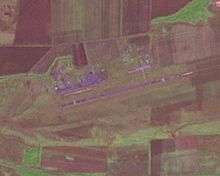
Stavropol Shpakovskoye Airport (IATA: STW, ICAO: URMT) (sometimes appearing as Mikhaylovskoye) is an airport in Stavropol Krai, Russia located 13 km northeast of Stavropol.
It services medium-sized airliners with 14 parking spaces. It is also a small military training base, previously home to the Stavropol Higher Military Aviation School of Pilots and Navigators PVO im. Marshal of Aviation V.A. Sudts (SVVAULSh),[1] and 163rd OUAE (Separate Training Aviation Squadron) flying the Mi-8. The school was formed on 1 November 1969 and controlled four training aviation regiments (at Salsk, Khankala, Tikhoretsk, and Kholodnogorsk). In 1993 the school was renamed the Stavropol Higher Aviation Engineering Institute, with schools at Stavropol, Daugavpils and Lomonosov.
Airlines and destinations
| Airlines | Destinations |
|---|---|
| Aeroflot | Moscow-Sheremetyevo[2] |
| S7 Airlines | Moscow-Domodedovo |
| Turkish Airlines | Istanbul-Atatürk[3] |
| UTair Aviation | Moscow-Vnukovo |
References
- ↑ Michael Holm, Stavropol Higher Military Aviation School of Pilots and Navigators PVO im. Marshal of Aviation V.A. Sudts (SVVAULSh), 2015
- ↑ http://airlineroute.net/2015/07/31/su-stw-w15/
- ↑ L, J (24 October 2014). "Turkish Airlines W14 Astrakhan / Stavropol Operation Changes". Airline Route. Retrieved 27 October 2014.
External links
- (in Russian)Shpakovskoye Airport Official Site