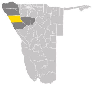
Sesfontein Constituency

Sesfontein Constituency is an electoral constituency of Namibia. Located in Kunene Region, it has a population of 7,358.[1] Its district capital is the settlement of Sesfontein. It is bordered by Khorixas Constituency to the south, Kamanjab Constituency to the east, Opuwo Rural to the north and Okahao Constituency in Omusati Region to the northeast.
Sesfontein is the only settlement in this constituency but this vast area contains a number of tourism facilities like the Palmwag and Warmquelle lodges.[2]
Politics
Sesfontein Constituency voters traditionally supported electing opposition parties for the National Assembly and President.
2004
In 2004, it was one of the few constituencies in Namibia to vote for an opposition candidate for President in the latest Presidential election, 2004. In that year, Justus ǁGaroëb of the United Democratic Front) received the most votes for President with 1,259 (46.01%) total votes, while Hifikepunye Pohamba of the South West Africa People's Organization (SWAPO), who won more than 76% of the national vote, received only 896 votes (32.78%) in the Constituency.[3] Nationally, Sesfontein represented approximately 4% of ǁGaroëb's vote despite only representing less than .0033% of the national vote for President. Likewise, Sesfontein supported an opposition candidate, Hendrik Gaobaeb also of the UDF, for regional council.[4]
2009
In 2009, Sesfontein Constituency again supported the UDF (1142 or 38.36%), though to a lesser degree than in 2004. SWAPO improved their vote total and percentage to 1092 from 896 (32.78% to 36.68%).[5]
2015
The 2015 regional election was won by Julius Koujova of the SWAPO Party with 1,514 votes, Hendrik Gaobaeb of the United Democratic Front (UDF) came second with 1,063 votes. Independent candidates Asser Ndjitezeua and Timotheus Hochobeb followed with 328 and 272 votes respectively. Amon Kapi of the Rally for Democracy and Progress (RDP) also ran and received 87 votes.[6]
References
- ↑ Constituencies of Namibia, 2004
- ↑ ǃHoaës, Irene (15 November 2010). "ELECTIONS 2010: Sesfontein Constituency profile". New Era.
- ↑ Sesfontein Constituency Presidential election result, 2004
- ↑ Sesfontein Constituency regional council election result, 2004
- ↑ 2009 Parliamentary Election Results Namibia Election Watch, 2009
- ↑ "Regional Council Election Results 2015" (PDF). Electoral Commission of Namibia. 3 December 2015. p. 12.
Coordinates: 19°8′S 13°37′E / 19.133°S 13.617°E