Sequalitchew Creek
| Sequalitchew Creek | |
|---|---|
|
Sequalitchew Creek, lower canyon | |
| Basin features | |
| Main source | Sequalitchew Lake |
| River mouth | DuPont Warf, Nisqually Reach |
| Physical characteristics | |
| Length | 38.4 mi (61.8 km) |
| Discharge |
|
| Watershed | Chambers-Clover Watershed |
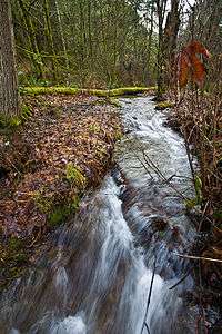
Sequalitchew Creek, located in DuPont, Washington emanates from Sequalitchew Lake, Fort Lewis, Washington, was the location of the original Fort Nisqually trading post established in 1833 by the Hudson's Bay Company. The historic, natural flow of Sequalitchew Creek runs from Sequalitchew Lake, through Edmonds Marsh, down the canyon and out to the Puget Sound.[1][2]
History

- In 1832 the area that became Fort Nisqually was sited by Hudson’s Bay Company’s chief trader, Archibald McDonald. In cooperation with the Nisqually people, a storehouse for blankets, seeds, and potatoes was built at the mouth of Sequalitchew Creek.
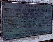
- 1839 Nisqually Methodist Episcopal Mission was established, bringing the first U.S. citizens into the Puget Sound region near the creek canyon.
- 1841 Wilkes U.S. Exploring Expedition set up an observatory on the bluff near the creek to survey, map and chart the waters of Puget Sound. They joined the Americans at the mission to hold the first 4 July celebration west of the Mississippi River.
- 1843 Second Fort Nisqually. Business became mainly agricultural, and the fort was relocated on a flat-plains area near the banks of Sequalitchew Creek.
- 1904 First joint Army-National Guard training exercises on west coast were held. The massive encampment near Sequalitchew Creek included the “Buffalo Soldiers” of the 9th Cavalry.[3]
In 1959 and 1960, Sequalitchew Lake was utilized by the Washington Department of Fisheries as a fish farm that reared and released coho salmon to Sequalitchew Creek. From 1976 until the mid-1990s the Washington Department of Fisheries operated a coho salmon fish hatchery and rearing facility on Sequalitchew Lake. In the past, Native Americans caught from 3,500 to 4,000 fish annually in Sequalitchew Creek.
Course

The total drainage basin of the Creek encompasses 38.4 square miles (99 km2). This watershed begins at Kinsey Marsh, draining via Murray Creek into American Lake. Seasonal overflow from American Lake feeds Sequalitchew Lake. The water level of both lakes is maintained year round by springs and water table seepage. A diversion dam, built by Fort Lewis around 1950, lies near the headwaters of the Creek. The dam drains through a canal that originates in Hamer Marsh, east of the Creek. Just south of Sequalitchew Lake, the canal passes under the Creek through a series of complicated culverts. It continues west for one mile (1.6 km), and turns north to empty into Puget Sound at Tatsolo Point, off Steilacoom-DuPont Road, DuPont. The creek bed still carries water, in the form of ground water runoff, down the same historic creek path, finally emptying into the Puget Sound.

Creek trail and beach
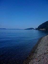
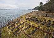
The areas unparalleled natural beauty can be traversed on an old narrow gauge railway roadbed that ran from the DuPont Company area to Puget Sound. The trail leads to Sequalitchew beach. The creek corridor is used by hundreds of species, including eagles, hawks, song birds, herons, ducks, owls, frogs, salamanders, snakes, beaver, raccoons, coyotes, deer, and rabbits.[1][4] The waters off Sequalitchew Beach are inhabited by harbor seal and gray whale.[4]
Proposed mining expansion
A proposed 177-acre (0.72 km2) expansion of Glacier Northwest's, (recently renamed as Cal-Portland, previously known as Lone Star Gravel), existing gravel mine will involve the removal of 184 acres (0.74 km2) of forest and topsoil surrounding Sequalitchew Creek. If allowed, it will create a 550-acre (2.2 km2) hole in the underlying gravel as 40 million tons of gravel is extracted over the next 14 years. The pit will be 80 feet (24 m) deep and expose the underlying Vashon Aquifer. The flow from this exposed aquifer (estimated at approximately 6.5 million gallons per day) will be directed down a man made ditch to Sequalitchew Creek with a flow eight times that of present Sequalitchew Creek. The dewatering of the aquifer will lower the groundwater level in the vicinity by as much as 30 feet (9.1 m), thereby draining nearby Edmonds Marsh, a Class I wetland.[5][6][7] Nearby Pond Lake, McKay Marsh, Bell Marsh and Hammer Marsh will be adversely affected.[8]
On January 16, 2009, Bill Kingman, DuPont Planning Department signed on behalf of the City of DuPont to accept the proposed mining expansion as follows, (directly quoting):
DuPont staff recommendation
On January 16, 2009, Bill Kingman, DuPont Planning Department signed on behalf of the City of DuPont to accept the proposed mining expansion as follows, (directly quoting):
Approval of expansion of the aggregate mine into the area proposed is recommended, but with conditions that change some of the characteristics of the proposal.
This approval would include:
- Expansion of aggregate removal throughout the 177 acres (0.72 km2) proposed would be allowed.
- Groundwater aquifer dewatering to lower the water table for access to additional aggregate would be allowed. This initially would be accomplished through interceptor wells. In the long term, construction of a portion of the proposed new North Sequalitchew Creek channel would permanently intercept groundwater and discharge to the existing Sequalitchew Creek.
- Mitigation for potential groundwater aquifer drawdown impacts on Edmond Marsh would be accomplished by replacing invasive vegetation by native vegetation that will result in equal or greater wetland function and values.
- Removal of the “Kettle Wetland” would be allowed with mitigation consisting of creation of replacement wetlands that may be located adjacent to the proposed new North Sequalitchew Creek channel.
- Displacement of wetland functions at the Seep and Riparian Forest wetlands adjacent to Sequalitchew Creek due to interception of groundwater from the excavation for aggregate removal would be approved with mitigation consisting of replacement wetlands.
- The conditions of approval would not allow the excavation of the north side of the existing Sequalitchew Creek ravine but would, instead, require installation of a bored pipeline approximately 500 feet (150 m) long.[9]
Glacier Northwest’s current Conditional Use Permit to expand the mine, and dewater the aquifer and creek violates the 1994 Settlement Agreement as established by the Nisqually Delta Association. DuPont Municipal Code specifically protects wetlands.[10] Although a signatory, the city of DuPont ignored the '94 agreement and their own municipal code and did not discourage Glacier from applying to expand their mining extraction.[5] In accordance with the '94 Agreement, parties are now meeting regularly to determine next steps.[7]
Sequalitchew Village
City of DuPont's 2008 Draft Comprehensive Land Use Plan, p. 47 describes future use of the mining area, Sequalitchew Creek and dewatering of the aquifer to include total build out of approximately 2,138 residences. The proposed neighborhood would be named Sequalitchew Village.[11]
Memorandum of Understanding
A Memorandum of Understanding has been crafted regarding the supplemental review process for Glacier NW's mining expansion at Sequalitchew Creek.[12] The document was introduced to the council at their October 13, 2009 meeting, to be signed and approved. Several council members expressed concern about lack of public review. Public review and comment is currently being solicited, after which the document will then be again considered at the November 10, 2009 meeting.
Footnotes
- 1 2 Sequalitchew Creek Council
- ↑ Anderson, Ruth; Price, Lori (2002). Puyallup: a pioneer paradise. Arcadia Publishing. ISBN 978-0-7385-2374-3 – via books.google.co.uk.
- ↑ The DuPont Historical Museum
- 1 2 Weyerhaueser Export Facility Plan, Final Environmental Impact Statement
- 1 2 1994 Settlement Agreement
- ↑ Glacier NW Pioneer Aggregate Mine Expansion Staff Report
- 1 2 Sequalitchew Creek Council
- ↑ Ground Water and Surface Water Flow Summary
- ↑ Staff Recommendation: Glacier Northwest, Pioneer Aggregate Mine Expansion City File No’s, CUP 07-01, LU 07-01, SA 07-01
- ↑ DuPont Municipal Code, Chapter 25.105, Sensitive Areas
- ↑ City of DuPont 2008 Draft Comprehensive Land Use Plan
- ↑ Memorandum of Understanding, Glacier NW, City of DuPont, Washington at Sequalitchew Creek.
References
- City of DuPont, Washington
- Glacier Northwest, Pioneer Aggregate Mine Expansion City File No’s, CUP 07-01, LU 07-01, SA 07-01
- Memorandum of Understanding, Glacier NW, City of DuPont, Washington at Sequalitchew Creek.
- DuPont Municipal Code, Chapter 25.105, Sensitive Areas
- Nisqually Delta Association
- 1994 Settlement Agreement
- Final Supplemental Environmental Impact Statement, Glacier NW DuPont Mining Expansion and North Sequalitchew Creek Project, May 1, 2007
- Glacier Northwest Application for Conditional Use Permit Compiance Statement, November 15, 2007
- A Twentieth Century History of Sequalitchew Creek
- DuPont Historical Museum
- City of DuPont's 2008 Draft Comprehensive Land Use Plan, p. 47
- Weyerhaueser Export Facility Plan, Final Environmental Impact Statement, Volume II, U.S. Army Corp of Engineers, Seattle District, May 1982, p. 111
- City of DuPont, Glacier NW Pioneer Aggregate Mine Expansion Staff Report
- Sequalitchew Creek Council
- Sequalitchew Creek Watershed Project, Pacific Lutheran University, Tacoma
- Glacier Northwest's Sand and Gravel Mine Permit History
- RCW 36.70A.060: Natural resources lands and critical areas - Development regulations.
External links
- Pioneer Aggregates Expansion and North Sequalitchew Creek Project
- Glacier Northwest Aggregate Mine Proposal
- Published Tidal Bench Mark Sheet for 9446828 DuPont Warf, Nisqually Reach, Washington
- Dewatering Plan, DuPont Mine Expansion and North Sequalitchew Creek Project Prepared for: Glacier Northwest Project No. 040001-009-01, November 15, 2007
Coordinates: 47°04′12″N 122°24′00″W / 47.0700°N 122.4000°W

