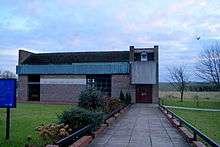
Scholes, Leeds
| Scholes-in-Elmet | |
|---|---|
 Main Street, Scholes | |
 Scholes-in-Elmet | |
| Scholes-in-Elmet shown within West Yorkshire | |
| Population | 2,403 |
| OS grid reference | SE 37766 37254 |
| Metropolitan county | |
| Region | |
| Country | England |
| Sovereign state | United Kingdom |
| Post town | Leeds |
| Postcode district | LS15 |
| Police | West Yorkshire |
| Fire | West Yorkshire |
| Ambulance | Yorkshire |
| EU Parliament | Yorkshire and the Humber |
Scholes is a village between Leeds and Barwick-in-Elmet, West Yorkshire, England. It is part of the civil parish of Barwick in Elmet and Scholes in the City of Leeds. It is sometimes known as Scholes-in-Elmet to distinguish it from the Scholes, Holme Valley and Scholes, Cleckheaton in Kirklees, West Yorkshire, by analogy with Barwick-in-Elmet and Sherburn-in-Elmet. Its name is a plural of Old Norse skáli = "temporary shed". In 2001, its population was 2,403.[1]
History
In the 1800s, Colonel Frederick Trench-Gascoigne (of Parlington Hall, Aberford) owned and rented out a large number of houses, mines, woodlands and farming land in the areas of Scholes, Swarcliffe, Barnbow, Garforth, Barwick-in-Elmet, Cross Gates, and Whinmoor.[2]
In the mid-1880s, a previous occupant of the Seacroft windmill, Isaac Chippindale, started the Scholes Brick and Tile Works on Wood Lane, on the border to Swarcliffe. The company's quarry produced high-quality bricks with which many houses in the surrounding area were built.[3] Its kilns and house were demolished in the early 1980s, leaving two small fishing lakes, but is still known as "Chippy's Quarry".[4]
Amenities

Scholes has several shops including a convenience store and off-licence, two pubs, a library and two churches. The nearest commercial centres are in Seacroft and Cross Gates. The Seacroft Green shopping centre contains amongst other shops a large Tesco supermarket, while the Cross Gates Shopping Centre (formerly an Arndale Centre) contains many high street shops. Other nearby commercial centres include Garforth and Wetherby.
The Barley Corn is a historic Samuel Smiths pub on Main Street, while the former railway station on Station Road (The Buffers) has been converted into a pub and restaurant.
Transport
Scholes lies close to the Leeds Outer Ring Road, the A64 and the M1. Opened on 1 May 1876, a rail connection owned by LNER (London and North Eastern Railway) ran past the eastern border of Swarcliffe and Stanks, which was a part of the Cross Gates to Wetherby line.[5] In 1965, services were withdrawn as part of the Beeching Axe; an informal name for the British Government's attempt to reduce the cost of running British Railways in the 1960s.[6] Local bus services are 64 and 11, provided by First Leeds.[7] The nearest international airport is Leeds Bradford Airport, which is 12.4 miles (20 km).[8]
 Scholes Junior School
 Scholes Methodist Church
 Houses on Main Street
 Barley Corn Inn
 Leeds Road
Comparison
Scholes is in the LS15 postcode area.
| Category | LS15 | UK average |
|---|---|---|
| Population density (people / sq mi) | 43.2 | 24.9 |
| Gender split (females / male) | 1.05 | 1.05 |
| Average commute | 6.1 miles | 8.73 miles |
| Average age | 38 | 39 |
| Home ownership | 16% | 16.9% |
| Student population | 2.4% | 4.4% |
| People in good health | 69% | 69% |
Location grid
Climate
The climate in Scholes is moderate.
| Climate data for East Leeds (2011) | |||||||||||||
|---|---|---|---|---|---|---|---|---|---|---|---|---|---|
| Month | Jan | Feb | Mar | Apr | May | Jun | Jul | Aug | Sep | Oct | Nov | Dec | Year |
| Average high °C (°F) | 8 (46) |
9 (48) |
11 (52) |
13 (55) |
17 (63) |
19 (66) |
22 (72) |
22 (72) |
18 (64) |
14 (57) |
10 (50) |
7 (45) |
14.2 (57.5) |
| Average low °C (°F) | 2.0 (35.6) |
3.0 (37.4) |
4.0 (39.2) |
5.0 (41) |
7.0 (44.6) |
10.0 (50) |
13.0 (55.4) |
13.0 (55.4) |
10.0 (50) |
7.0 (44.6) |
4.0 (39.2) |
2.0 (35.6) |
6.7 (44) |
| Average precipitation mm (inches) | 41 (1.61) |
46 (1.81) |
40 (1.57) |
55 (2.17) |
43 (1.69) |
61 (2.4) |
46 (1.81) |
44 (1.73) |
55 (2.17) |
65 (2.56) |
62 (2.44) |
69 (2.72) |
627 (24.68) |
| Source: World Weather[9] | |||||||||||||
Notes
- ↑ "SCHOLES (West Yorkshire, Yorkshire and the Humber, Great Britain)". City Population. Retrieved 2 August 2011.
- ↑
- Hull, Brian. "The Gascoigne Mines in Garforth". Parlington Hall Website. Retrieved 4 August 2011.
- Colman, F. S. (1908). "A History of the Parish of Barwick-in-Elmet in the County of York". Barwick-in-Elmet Historical Society. Retrieved 2 August 2011.
- ↑ "Isaac Chippindale & Sons, brick and tile manufacturers". The National Archives. Retrieved 4 August 2011.
- ↑ Marshall, Nigel. "The Chippindale Family". pro-patria-mori. Retrieved 4 August 2011.
- ↑ Cox, Tony. "The Leeds - Cross Gates - Wetherby Railway". Barwick-in-Elmet Historical Society. Retrieved 4 August 2011.
- ↑ "The Development Of The Major Railway Trunk Routes". Railways Archive. Retrieved 28 July 2011.
- ↑ "Welcome to First in Leeds". FirstGroup plc. Retrieved 2 August 2011.
- ↑ "Leeds Bradford International Airport". Leeds Bradford International Airport Company. Retrieved 2 August 2011.
- ↑ "Climate info for Scholes" World Weather, 30 July 2011, web: worldweatheronline.com.
External links
| Wikimedia Commons has media related to Scholes, Leeds. |
- A site showing places in the UK called Scholes (Scholes-in-Elmet is at the top of the page)
- "The Ancient Parish of Barwick in Elmet". GENUKI. Retrieved 2007-10-29. - Scholes was in this parish
