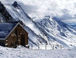
Schinhorn
| Schinhorn | |
|---|---|
|
The Schinhorn (left summit) from the Lötschenlücke | |
| Highest point | |
| Elevation | 3,797 m (12,457 ft) |
| Prominence | 422 m (1,385 ft) [1] |
| Isolation | 3.9 kilometres (2.4 mi) |
| Parent peak | Aletschhorn |
| Coordinates | 46°27′05″N 7°56′48″E / 46.45139°N 7.94667°ECoordinates: 46°27′05″N 7°56′48″E / 46.45139°N 7.94667°E |
| Geography | |
 Schinhorn Location in Switzerland | |
| Location | Valais, Switzerland |
| Parent range | Bernese Alps |
| Climbing | |
| First ascent | 30 August 1869 by E. J. Häberlin and Johann and Andreas von Weissenfluh |
The Schinhorn is a mountain of the Bernese Alps, located west of the Aletschhorn in the canton of Valais. It lies between the valleys of Lötschental (north) and Oberaletsch (south).
See also
References
External links
This article is issued from
Wikipedia.
The text is licensed under Creative Commons - Attribution - Sharealike.
Additional terms may apply for the media files.
