Scandinavian Mountains Airport
| Scandinavian Mountains Airport | |||||||||||
|---|---|---|---|---|---|---|---|---|---|---|---|
| Summary | |||||||||||
| Airport type | Public | ||||||||||
| Owner | Scandinavian Mountains Airport AB | ||||||||||
| Serves | Sälen and Trysil | ||||||||||
| Location | Rörbäcksnäs, Malung-Sälen, Dalarna, Sweden | ||||||||||
| Opened | December, 2018 | ||||||||||
| Time zone | UTC+01:00 (CET) | ||||||||||
| Website |
scandinavianmountains | ||||||||||
| Runways | |||||||||||
| |||||||||||
Scandinavian Mountains Airport, also referred to as Sälen Trysil Airport, is an airport under construction in Dalarna, Sweden, close to the Norwegian border. It is planned to open in December 2018. It will be the first airport in the world built without an air traffic control tower, instead having a virtual tower.[1]
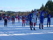
It is intended for both scheduled and chartered services, primarily aimed at bringing tourists to the winter sport resorts of Sälen, Idre, Trysil and Engerdal. In addition to the core markets of Norway and Sweden, the intention is to attract significantly more visitors from Denmark, England, Germany, the Netherlands and Russia.
The new airport is being constructed on the site of an existing small sports airfield at Mobergskölen, near Rörbäcksnäs, in Malung-Sälen. It will be first new airport in Sweden since Pajala opened in 1999.[2] The nearest airports from area until the new airport is built are the local Mora Airport (113 km from Sälen/168 km from Trysil) and the large Oslo Airport (213 km from Sälen/171 km from Trysil)
Owners and stakeholders
Scandinavia Mountains Airport AB is 95.2% owned by Scandinavian Mountains AB. The minority owners are:
- Året Runt i Sälenfjällen AB
- Destinasjon Trysil SA
- Visit Idre AB
- Destinasjon Femund Engerdal AS
- SkiStar AB
The parent company Scandinavian Mountains AB is owned by:
- HEA Property Partner AB
- Fjällinvest AB
- Lima Utveckling AB
- Stolen Fastighets AB
- Kläppen Ski Resort AB
- Topeja AB
- Tomas Kaiser AB
- Christina Paredes
- Österling Bygg
- Per-Uno Sandberg AB
- Lammet & Grisen AB
- Lindvallen Restauranger AB
- Tandådalens Wärdshus AB
- Trysilfjell Utmarkslag
- Fageråsen Fritid AS
- Norske Fjellbygg AS
Public partners
The local partners are:
- Region Dalarna, a local federation of the 15 municipalities and the county council in Dalarna, Sweden
- Malung-Sälen municipality, Sweden
- Älvdalen municipality, Sweden
- Trysil municipality, Norway
- Engerdal municipality, Norway
In addition, in 2014, the Swedish government invested SEK 250 million.
See also
References
- ↑ Carlsson, Anders (20 December 2016). "Sälen första flygplats i världen utan flygledartorn" (in Swedish). Flygtorget. Retrieved 22 December 2016.
- ↑ "Scandinavian Mountain Airport ska öppna 2017". Vagabond. 9 April 2015. Retrieved 20 September 2016.
External links
- Official website
- Engelskmenn inntar skistedene (in Norwegian)
Coordinates: 61°09′32″N 12°50′24″E / 61.1590°N 12.8400°E