St Lucia, Queensland
| St Lucia Brisbane, Queensland | |||||||||||||||
|---|---|---|---|---|---|---|---|---|---|---|---|---|---|---|---|
 St Lucia surrounded by the Brisbane River | |||||||||||||||
 St Lucia | |||||||||||||||
| Coordinates | 27°30′00″S 153°00′00″E / 27.500°S 153.000°ECoordinates: 27°30′00″S 153°00′00″E / 27.500°S 153.000°E | ||||||||||||||
| Population | 12,574 (2016 census)[1] | ||||||||||||||
| • Density | 3,700/km2 (9,580/sq mi) | ||||||||||||||
| Postcode(s) | 4067 | ||||||||||||||
| Area | 3.4 km2 (1.3 sq mi) | ||||||||||||||
| Location | 6 km (4 mi) from Brisbane GPO | ||||||||||||||
| LGA(s) | City of Brisbane (Walter Taylor Ward)[2] | ||||||||||||||
| State electorate(s) | Indooroopilly | ||||||||||||||
| Federal Division(s) | Ryan | ||||||||||||||
| |||||||||||||||
St Lucia is a suburb within the City of Brisbane, Queensland, Australia 6 kilometres (3.7 mi) southwest of the Brisbane CBD.[3] The suburb sits on a peninsula, bounded on the north, east and south by a bend in the Brisbane river. The eastern third of the suburb is occupied by the main campus of The University of Queensland. The flat area on the northern side is primarily medium to high density residential including numerous high-rise apartments on the river-front. The more hilly area in the centre and south is mainly low-density residential. The south-west is occupied by the Saint Lucia golf links.
St Lucia is mainly a residential suburb and is generally regarded as one of the most affluent suburbs in Brisbane. For many years it was the third most expensive suburb behind Hamilton and Ascot and is still one of the top five most expensive suburbs in Brisbane today.
History

The area was originally part of Indooroopilly and later part of Toowong. Originally known as Indooroopilly Pocket, for a short time it was called Toowong South and part of the area was hived off as Lang Farm. Sugar plantations were established in the area in the 1860s. William Alexander Wilson, born in St Lucia in the West Indies, purchased the Coldridge Plantation in 1882 and renamed it St Lucia Sugar Plantation. It was subdivided in 1883 for housing and the name was transferred to the subdivision.[4]
St Lucia is a green, leafy suburb with a variety of housing including apartment complexes and detached Federation styles and Queenslanders.
Historical houses

St Lucia has a number of heritage-listed sites, including:
- 12 Upland Road: Great Court, University of Queensland[5]
- 38 Upland Road: Union College[6]
- 99 Sir Fred Schonnel Drive: Vida and Jayne Lahey's House[7]
- 396 Swann Road: Langer House[8]
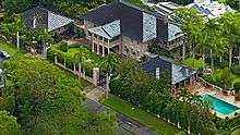
Although never heritage-listed, one of St Lucia's most iconic homes was once the so-called The Pink Palace at 272 Swann Rd until it was demolished in 2015.
Demographics
St Lucia is home to a diverse range of individuals. Typically, the student population of St Lucia is high, especially in dwellings in the immediate vicinity of the university, but the suburb is also home to wealthy professionals and families. Houses and apartments in close proximity to the Brisbane River typically attract price tags in the millions.
In the 2016 census, St Lucia had a population of 12,574 people, an increase from 11,195 in the 2011 census;[1] 52.0% were female and 48.0% were male.
The median age of the St Lucia population was 23 years, 15 years below the Australian median. Children aged under 15 years made up 8.6% of the population and people aged 65 years and over made up 8.3% of the population. The most notable difference was in the group aged between 15–24 years; in St Lucia this group comprises 47.2% of the population, compared to 12.8% nationally.
46.2% of people living in St Lucia were born in Australia, compared to the national average of 66.7%; the next most common countries of birth were China (9.9%), Malaysia (5.9%), Singapore (3.6%), England (2.6%), and Indonesia (2.5%). 55.1% of people spoke only English at home; the next most popular languages were Mandarin Chinese (14.0%), Malay (3.4%), Indonesian and Cantonese (2.4% each), and Vietnamese (2.1%).
The most common response for religion in St Lucia was No Religion (39.7%), followed by Catholicism (14.8)%, "Not stated" (10.4%), Anglicanism (8.6%), and Islam (7.1%).
In St Lucia, just over half of all households (50.1%) were family households, 21.7% were single person households and 28.3% were group households. The median weekly household income was $1,385, similar to the national median of $1,438.[9]
Attractions
The University of Queensland is the main attraction of St Lucia, with the university, and residential colleges covering a large proportion of the suburb. Ironside State School which was opened in 1870 is located on Hawken Drive and is the only primary school in the suburb. Several small shopping precincts are located throughout the suburb but otherwise the suburb is residential. St Lucia Golf Links is an 18-hole pay-and-play public golf course located on the corner of Indooroopilly Road and Carawa Street, St Lucia. The golf course is one of Brisbane's oldest and has hosted several Queensland Open and PGA tournaments. The layout suits golfers of all levels.[10]
Transport

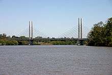
By Bus, St Lucia can be accessed from the western suburbs and Brisbane CBD, with routes terminating at the University of Queensland. There is also a NightLink service, a safety initiative which provides buses with security on board all night Fridays and Saturdays. The Eleanor Schonell Bridge, a dedicated bus/pedestrian/bicycle bridge, connects the University with Dutton Park and carries buses from the southern suburbs, CBD and Royal Brisbane Hospital to the Lakes Bus Station on St Lucia campus.
By Ferry, The CityCat stops at two terminals in St Lucia, the Guyatt Park CityCat Terminal and University of Queensland Terminal.
By Bicycle, St Lucia has bicycle routes that utilise the residential streets between the University of Queensland and Toowong.
By Road, St Lucia has three major thoroughfares which all lead to the University of Queensland. These are Swann Road, Sir Fred Schonell Drive and The Esplanade.
References
- 1 2 Australian Bureau of Statistics (27 June 2017). "St Lucia (State Suburb)". 2016 Census QuickStats. Retrieved 28 June 2017.

- ↑ "Walter Taylor Ward". Brisbane City Council. Brisbane City Council. Retrieved 19 March 2017.
- ↑ "St Lucia (entry 46115)". Queensland Place Names. Queensland Government. Retrieved 17 August 2015.
- ↑ "St Lucia (entry 46115)". Queensland Place Names. Queensland Government. Retrieved 28 August 2015.
- ↑ "University of Queensland, Great Court Complex (entry 601025)". Queensland Heritage Register. Queensland Heritage Council. Retrieved 6 July 2013.
- ↑ "Union College (entry 602504)". Queensland Heritage Register. Queensland Heritage Council. Retrieved 6 July 2013.
- ↑ "Vida and Jayne Lahey's House (entry 600316)". Queensland Heritage Register. Queensland Heritage Council. Retrieved 6 July 2013.
- ↑ "Langer House (entry 600317)". Queensland Heritage Register. Queensland Heritage Council. Retrieved 6 July 2013.
- ↑ Australian Bureau of Statistics (27 June 2017). "St Lucia (State Suburb)". 2016 Census QuickStats. Retrieved 18 July 2017.

- ↑ "St Lucia Golf Links". Retrieved 21 October 2014.
External links
| Wikimedia Commons has media related to St Lucia, Queensland. |