Saint-Julien-en-Genevois
| Saint-Julien-en-Genevois | ||
|---|---|---|
| Subprefecture and commune | ||
|
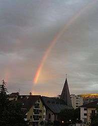
A rainbow over Saint-Julien-en-Genevois | ||
| ||
 Saint-Julien-en-Genevois | ||
|
Location within Auvergne-Rhône-Alpes region  Saint-Julien-en-Genevois | ||
| Coordinates: 46°08′37″N 6°04′52″E / 46.1436°N 6.0811°ECoordinates: 46°08′37″N 6°04′52″E / 46.1436°N 6.0811°E | ||
| Country | France | |
| Region | Auvergne-Rhône-Alpes | |
| Department | Haute-Savoie | |
| Arrondissement | Saint-Julien-en-Genevois | |
| Canton | Saint-Julien-en-Genevois | |
| Intercommunality | Genevois | |
| Government | ||
| • Mayor (2014-2020) | Antoine Vielliard | |
| Area1 | 15 km2 (6 sq mi) | |
| Population (2014)2 | 13,253 | |
| • Density | 880/km2 (2,300/sq mi) | |
| Time zone | CET (UTC+1) | |
| • Summer (DST) | CEST (UTC+2) | |
| INSEE/Postal code | 3 21 243 74 3 21 243 /74160 | |
|
1 French Land Register data, which excludes lakes, ponds, glaciers > 1 km² (0.386 sq mi or 247 acres) and river estuaries. 2 Population without double counting: residents of multiple communes (e.g., students and military personnel) only counted once. | ||
Saint-Julien-en-Genevois (French pronunciation: [sɛ̃ ʒyljɛ̃n‿ɑ̃ ʒənvwa]) is a commune in the Haute-Savoie department in the Auvergne-Rhône-Alpes region in south-eastern France. It is a sub-prefecture of the department.
Geography
Saint-Julien-en-Genevois is located right on the Swiss border some 9 km (5.6 mi) southwest of downtown Geneva and forms part of its metropolitan area.
The municipality of Saint Julien-en-Genevois also consists of the following villages: Thairy, Crâche, Thérens, Norcier, Ternier, and Lathoy.
Twin towns
Saint-Julien-en-Genevois has been twinned with Mössingen, Germany, since January 13, 1990.
Gallery
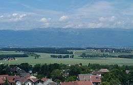
 General view of Saint Julien with Geneva in the background.
 The church square.
 The Catholic church.
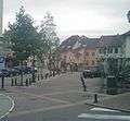
 Place de la Libération, the main square.
 The old water trough at the Place de la Libération.
 'L'Escalade" residential area.
 Chemin des marronniers, the chestnut lane at l'Escalade.
 View on the Salève mountain.
 View on the Jura mountains.
 Place du Maquis des Glières et Mairie (façade ouest).
 View of the Acacias area and the hospital. In the background, the Geneva countryside and the Jura mountain range.
 The townhall as seen from the Promenade du Crêt.
Economy
Employment
- In 2007, there were 4,491 jobs in Saint-Julien-en-Genevois and 5,401 active inhabitants. However, 46,1% of active inhabitants were working in neighbouring Switzerland. The unemployment rate stood at 10,6%, twice as high as in the neighbouring rural and residential communes. .[1]
Culture
Every Summer, a rock-oriented music festival called "Guitare en Scène" is held in Saint-Julien-en-Genevois.
See also
References
External links
| Wikimedia Commons has media related to Saint-Julien-en-Genevois. |
- Official town website (in French)
- Official tourist office website (in French)

