Ronehamn
| Ronehamn | |
|---|---|
|
Ronehamn beach | |
 Ronehamn | |
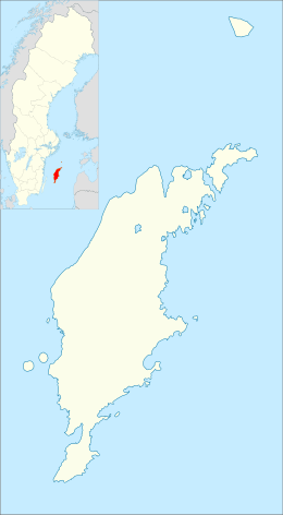
| Coordinates: 57°10′28″N 18°29′8″E / 57.17444°N 18.48556°ECoordinates: 57°10′28″N 18°29′8″E / 57.17444°N 18.48556°E | |
| Country | Sweden |
| Province | Gotland |
| County | Gotland County |
| Municipality | Gotland Municipality |
| Area[1] | |
| • Total | 0.34 km2 (0.13 sq mi) |
| Population (2005-12-31)[1] | |
| • Total | 129 |
| • Density | 374/km2 (970/sq mi) |
| Time zone | CET (UTC+1) |
| • Summer (DST) | CEST (UTC+2) |
Ronehamn is a settlement in Rone on the southeast coast of Gotland island, Sweden, with 129 inhabitants in 2005.[1]
History
Several Bronze Age grooves have been found in Ronehamn. The best examples are those at Rone Halor II.[2]
During the second half of the 19Th century, Ronehamn was the second most important harbor on Gotland after Visby. In 1902, one of the island's railways was extended to Ronehamn. The railway is now discontinued.[3]
References
- 1 2 3 "Småorternas landareal, folkmängd och invånare per km2 2000 och 2005" (xls) (in Swedish). Statistics Sweden. Retrieved 2010-08-14.
- ↑ "List of Gotland grinding grooves OR". www.stavgard.com. Sören Gannholm. 27 June 2015. Retrieved 9 May 2016.
- ↑ Henriksson, Greta (13 August 2014). "Rone, Kulturmiljöprogram Gotland". www.gotland.se. Gotland County Administrative Board. Retrieved 6 June 2016.
External links
| Wikimedia Commons has media related to Ronehamn. |
This article is issued from
Wikipedia.
The text is licensed under Creative Commons - Attribution - Sharealike.
Additional terms may apply for the media files.
.jpg)
