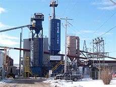
West Elgin, Ontario
| West Elgin | |
|---|---|
| Municipality (lower-tier) | |
| Municipality of West Elgin | |
|
Municipal office in Rodney | |
 West Elgin Location in southern Ontario | |
| Coordinates: 42°35′N 81°40′W / 42.583°N 81.667°WCoordinates: 42°35′N 81°40′W / 42.583°N 81.667°W | |
| Country |
|
| Province |
|
| County | Elgin |
| Formed | January 1, 1998 |
| Government | |
| • Mayor | Bernhard Wiehle |
| • Federal riding | Elgin—Middlesex—London |
| • Prov. riding | Elgin—Middlesex—London |
| Area[1] | |
| • Land | 322.52 km2 (124.53 sq mi) |
| Population (2011)[1] | |
| • Total | 5,157 |
| • Density | 16.0/km2 (41/sq mi) |
| Time zone | EST (UTC-5) |
| • Summer (DST) | EDT (UTC-4) |
| Postal Code | N0L |
| Area code(s) | 519 and 226 |
| Website |
www |
West Elgin is a municipality in Elgin County, Ontario, Canada. The township was created on January 1, 1998, through the amalgamation of the former township of Aldborough with the village of West Lorne.
Communities
The two main population centres within the township are Rodney and West Lorne. Additionally, it also includes the smaller communities of Churchville, Clachan, Crinan, Eagle, Kintyre, New Glasgow, Port Glasgow and Twin Valleys.
- Rodney
- West Lorne
 Clachan
History
The original township of Aldborough was named in 1792 after Aldeburgh, Suffolk, England.
The community of Rodney was originally named Stewart's Mills after the owner of the first sawmill in the community. From 1840 to 1865, it was called Centreville due to its central location at the intersection of Furnival Road and 7th Concession (now Downie Line). In 1865, the community was renamed Rodney after British naval officer George Brydges Rodney. The centre of the village was relocated three kilometres to the south when the Canada Southern Railway was built in the area in 1872.
The community of West Lorne also had its origins the Canada Southern Railway. Originally named Bismarck after the German chancellor, the community was renamed West Clayton, Dutton, Lorne and finally West Lorne. The name came from the Lorne Mills on the south side of the railway, themselves named for John Campbell, Marquess of Lorne. The station itself was renamed West Lorne in 1907 to avoid confusion with a community named Bismarck in Lincoln County.
The villages of Rodney and West Lorne were incorporated as municipalities in 1907 and 1908 respectively, and separated from the township. Subsequently, Aldborough remained a mainly rural municipality.
In 1994, Aldborough and Rodney amalgamated to form an expanded Township of Aldborough. In 1998, Aldborough amalgamated with West Lorne to form West Elgin.
Demographics
| Canada census – West Elgin, Ontario community profile | |||
|---|---|---|---|
| 2011 | 2006 | ||
| Population: | 5157 (-3.6% from 2006) | 5349 (-2.1% from 2001) | |
| Land area: | 322.52 km2 (124.53 sq mi) | 322.52 km2 (124.53 sq mi) | |
| Population density: | 16.0/km2 (41/sq mi) | 16.6/km2 (43/sq mi) | |
| Median age: | 46.5 (M: 46.2, F: 46.9) | 42.9 (M: 42.4, F: 43.4) | |
| Total private dwellings: | 2233 | 2216 | |
| Median household income: | $49,415 | ||
| References: 2011[2] 2006[3] earlier[4] | |||
Population trend:[5]
- Population in 2006: 5349
- Population in 2001: 5464
- Population total in 1996: 5573
- Aldborough (township): 4042
- West Lorne (village): 1531
- Population in 1991:
- Aldborough (township): 3889
- West Lorne (village): 1477
Infrastructure

West Lorne is home to western Elgin County's only high school, West Elgin Secondary School.
West Elgin Secondary school draws in students from West Elgin as well as Middlesex County. The school's mascot is a wildcat and their official colours are white and purple.[6]
West Lorne is linked by Elgin County Road 76 to the 401, a major arterial highway link in Ontario affording easy access to Windsor, Chatham, St. Thomas, London, Brantford, Toronto, and many other places.
Local agriculture includes dairy farming, mixed farming, fruit growing and a sizeable tobacco industry. The town of West Lorne was greatly influenced by the railroad that crossed through the heart of the village. The railroad provided jobs for the first residents of the area. There is also some light manufacturing in the town.
Notable attractions
- Ontario has had some historical claimants, by towns, for the smallest jailhouse in the province. These have included: Tweed, Coboconk and Creemore. However, the jailhouse in Rodney has proven to be smaller than all three, measuring in at 4.5 metres by 5.4 metres. Today, it serves as a part-time tourist information centre. Other villages in Ontario with similar jailhouse dimensions include: Port Dalhousie, Ontario, Providence Bay, Ontario, the ghost town of Berens River and Ray.
Notable people
- Bo Horvat, centre for the Vancouver Canucks
- Travis Konecny, centre for the Ottawa 67's
See also
References
- 1 2 "West Elgin, Ontario (Code 3534042) and Elgin, Ontario (Code 3534) (table)". 2011 Census of Population. Statistics Canada. Retrieved 2012-07-16.
- ↑ "2011 Community Profiles". Canada 2011 Census. Statistics Canada. July 5, 2013. Retrieved 2012-07-16.
- ↑ "2006 Community Profiles". Canada 2006 Census. Statistics Canada. March 30, 2011. Retrieved 2011-02-14.
- ↑ "2001 Community Profiles". Canada 2001 Census. Statistics Canada. February 17, 2012.
- ↑ Statistics Canada: 1996, 2001, 2006 census
- ↑ Thames Valley District School Board. Tvdsb.ca. Retrieved on 2013-10-05.
External links
- Official website
- The St.Thomas - Elgin Tourist Association - West Elgin
- West Lorne Lakers Junior Hockey Club
- Western Elgin Experience
- West Elgin Chronicle
