Rocky Cape National Park
| Rocky Cape National Park Tasmania | |
|---|---|
|
IUCN category II (national park) | |
 Rocky Cape, 2009 | |
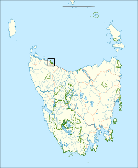
 Map of Rocky Cape National Park in Tasmania | |
| Nearest town or city | Burnie |
| Coordinates | 40°53′59″S 145°32′9″E / 40.89972°S 145.53583°ECoordinates: 40°53′59″S 145°32′9″E / 40.89972°S 145.53583°E |
| Established | 1967 |
| Area | 30.64 km2 (11.8 sq mi) |
| Managing authorities | Tasmania Parks and Wildlife Service |
| Website | Rocky Cape National Park |
| See also | Protected areas of Tasmania |
Rocky Cape National Park is a national park on the North West Coast of Tasmania, Australia. It is located at a geographical headland and surrounds the town of Sisters Beach. It is located approximately 365 km by car northwest of State Capital Hobart.
Evidence of Aboriginal occupation dating from 8000 years ago was found by Rhys Jones in the 1960s. The Rocky Cape Lighthouse was erected in 1968.
See also
External links
This article is issued from
Wikipedia.
The text is licensed under Creative Commons - Attribution - Sharealike.
Additional terms may apply for the media files.