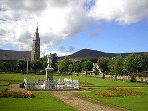
Rhynie, Aberdeenshire

Rhynie (/ˈraɪni/) (Scottish Gaelic: Roinnidh) is a village in Aberdeenshire, Scotland which the A97 road runs through, situated 14 miles northwest of Alford.
The Rhynie Chert is named after the village as well as the extinct plant genus Rhynia. The Rhynie Chert is a sediment deposited in the Devonian period which contains the oldest fossil insect in the world (Rhyniognatha hirsti).[1]
The missionary, teacher and engineer Alexander Murdoch Mackay was born in Rhynie on 13 October 1849.
The Station Hotel at Rhynie is mentioned in the sketch "The Will" by Scotland the What, the joke being that there is no railway station at Rhynie, "..but they were aye hopin' for one."
History

Eight Pictish symbol stones have been found at Rhynie, including the "Rhynie Man", a 6 foot tall boulder carved with a bearded man carrying an axe, possibly a representation of the Celtic god Esus, that was discovered in 1978. The "Rhynie Man" now stands inside Woodhill House (the headquarters of Aberdeenshire Council ) in Aberdeen.[2]
In 2011 archaeological excavations at Rhynie, near the site of the "Rhynie Man", by archaeologists from Aberdeen University and Chester University uncovered a substantial fortified settlement dating to the early medieval period. Among the finds at the site were fragments of a late 5th or 6th century Roman amphora that must have been imported from the Mediterranean region. This is significant as it is the only known example of a Roman amphora from Eastern Britain dating to the post-Roman period, and indicates that the inhabitants of the settlement must have been of high status. Archaeologists working at the excavation have speculated that the settlement may have been a royal site occupied by Pictish kings.[2]
References
- ↑ "The oldest fossil insect in the world". nhm.ac.uk. Retrieved 29 June 2015.
- 1 2 Urquhart, Frank (16 November 2011). "Archaeologists find village fit for Pictish kings". The Scotsman. Retrieved 29 June 2015.
Sources
- Rhynie in the Gazetteer for Scotland.
| Wikimedia Commons has media related to Rhynie. |
Coordinates: 57°19′N 2°50′W / 57.317°N 2.833°W

