Republic of Winston
| Free State of Winston | |||||
| Republic of Winston | |||||
| |||||
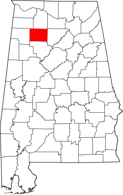
 Map of Alabama highlighting Winston County | |||||
| Capital | Not specified | ||||
| Government | Republic | ||||
| Historical era | American Civil War | ||||
| • | Established | Enter start year | |||
| • | Disestablished | Enter end year | |||
| b. | ... | ||||
| Warning: Value not specified for "common_name" | |||||
The "Republic" of Winston, present-day Winston County, Alabama, was one of several places, in the Confederate States of America, where disaffection, during the American Civil War, was strong. In Winston County, this opposition became violent and had long-lasting political consequences—deep enough to generate a legend, after the war, that the county had seceded from Alabama.[1]
Background
Winston County is located in the hilly terrain of North Alabama. At the time of the Civil War Winston County also included the areas that later became Cullman and Blount counties. Its shallow soil is highly unsuitable for plantation-style agriculture, and thus the county was never home to many slaves. The 1860 US Census lists only 3,450 white residents in the underpopulated county, and just 122 slaves.[2] Winston's residents were mainly poor farmers who viewed the Confederacy with suspicion, fearing it was meant to maintain the political control of the wealthy planter class.
Winston County's representative at the January 1861 Alabama Secession Convention was Charles Christopher Sheats, a 21-year-old school teacher. He refused to sign Alabama's ordinance of secession, even after it had been passed by a vote of 61 to 39. Sheats became so vocal in his opposition that he was finally arrested. On his release, he became a leader of a pro-neutrality group. Later, he would become an open supporter of the Union and spent most of the war in prison.[3] Many Winston County residents refused induction into the Confederate Army, and some spoke openly of organizing troops to support the Union. The worried state authorities moved to enforce obedience through conscription and loyalty oaths, which only made matters worse. A meeting was held at Looney's Tavern, where a series of resolutions were passed. These stated that the people of Winston County had no desire to take part in the war and intended to support neither side. One resolution declared that if a state could secede from the Union, then a county could secede from the state. Richard Payne, a pro-Confederate, laughed with delight. "Winston County secedes!" he shouted. "Hoorah for the Free State of Winston!" From Payne's remark was born the legend of the "Republic of Winston".[3]
In April 1862, the Union Army invaded north Alabama. Many of the pro-Union Winstonians enlisted in Union Army's new 1st Alabama Cavalry Regiment, commanded by an officer from New York, George E. Spencer. While the Union 1st Alabama Cavalry would play a heroic part in the war, it generally did so outside of Alabama.
Winston County itself was suffering from its own internal war. Confederate Home Guards in the county were poorly disciplined and often used their uniforms as excuses to settle old grudges. The Union men responded by forming their own irregular bands, and by the end of the war Winston County had been largely devastated by its own people.
After the war, Winston County became a bastion of the Republican Party in Alabama, in sharp contrast to the overwhelming support for the Democrats in the rest of the state. Winston's unique history has become the basis of a small tourist industry, which includes an outdoor drama loosely based on the events. A passenger boat named the "Free State Lady" plies the waters of nearby Smith lake. "Dual Destiny", a memorial statue of a young soldier dressed half as a Union troop and half as Confederate, is frequently photographed.[4]
See also
- Nickajack, a similar region in North Alabama and East Tennessee
- State of Scott, a similar secession resisting area in North Tennessee
- Tap Roots, a highly fictionalized film of Winston County's Civil War history
- Searcy County, Arkansas, a similar county in Arkansas
- Jones County, Mississippi, which also resisted secession
References
- ↑ McRae, David (2008-12-15). "Free State of Winston". Encyclopedia of Alabama. Retrieved 2009-05-03.
- ↑ 1860 US Census, Winston County, Alabama
- 1 2 Rice, Charles S.,Hard Times: the Civil War in Huntsville and North Alabama, Old Huntsville Press, 1994, pp 142-3
- ↑ Double Springs, Alabama: Dual Destiny Monument
Further reading
- Downing, David C. A South Divided: Portraits of Dissent in the Confederacy. Nashville: Cumberland House, 2007. ISBN 978-1-58182-587-9
- Dodd, Donald B., and Amy Bartlett-Dodd. The Free State of Winston. Charleston, S.C.: Arcadia Publishing, 2000.
- Dodd, Donald B., and Wynelle S. Dodd. Winston: An Antebellum and Civil War History of a Hill County of North Alabama. Vol. 4 of Annals of Northwest Alabama, comp. Carl Elliot. Birmingham: Oxmoor Press, 1972.
- Winston County Heritage Book Committee. The Heritage of Winston County, Alabama. Clanton, Ala.: Heritage Publishing Consultants, 1998.
- Umphrey, Don. Southerners in Blue: They Defied the Confederacy. Quarry Press, 2002. ISBN 978-0971495814
External links
- The Incident at Looney's Tavern information at the Alabama Department of Archives and History
- Free State of Winston
Coordinates: 34°08′57″N 87°22′29″W / 34.14917°N 87.37472°W