Rampur district
| Rampur district | |
|---|---|
| District of Uttar Pradesh | |
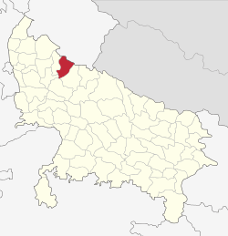 Location of Rampur district in Uttar Pradesh | |
| Country | India |
| State | Uttar Pradesh |
| Administrative division | Moradabad |
| Headquarters | Rampur, Uttar Pradesh |
| Government | |
| • Lok Sabha constituencies | Rampur |
| Area | |
| • Total | 2,367 km2 (914 sq mi) |
| Population (2015) | |
| • Total | 2,335,398 |
| • Density | 990/km2 (2,600/sq mi) |
| Demographics | |
| • Literacy | 53.34.[1] |
| Website | Official website |
Rampur district is one of the districts of Uttar Pradesh state of India, and Rampur town is the district headquarters. Rampur district is a part of Moradabad division. The district occupies an area of 2,367 km². This district has a population of 1,922,450 (2001 Census). Rampur is known for its 'Rampuri knives'.
Divisions
The district comprises five tehsils: Rampur, Bilaspur, Milak, Shahabad, Suar and Tanda
There are five Vidhan Sabha constituencies in this district: Swar, Chamraua, Bilaspur, Rampur and Milak. All of these are part of Rampur Lok Sabha constituency.
Birthplace of Indian Cinema Actors
- Raza Murad an Hindi Cinema's Veteran Actor was born and brought-up in Rampur.
- Pran a Bollywood actor was brought up Here.
Demographics
According to the 2011 Census of India, Rampur district has a population of 2,335,398,[1] roughly equal to the nation of Latvia[3] or the US state of New Mexico.[4] This gives it a ranking of 194th in India (out of a total of 640).[1] The district has a population density of 987 inhabitants per square kilometre (2,560/sq mi) .[1] Its population growth rate over the decade 2001-2011 was 21.4%.[1] Rampur has a sex ratio of 905 females for every 1000 males,[1] and a literacy rate of 75.08%.[1] 50% of the population of Rampur is Muslim.
References
- 1 2 3 4 5 6 7 "District Census 2011". Census2011.co.in. 2011. Retrieved 2011-09-30.
- ↑ "Rampur Religion Census 2011". Office of the Registrar General and Census Commissioner, India. Retrieved 2015-10-19.
- ↑ US Directorate of Intelligence. "Country Comparison:Population". Retrieved 2011-10-01.
Latvia 2,204,708 July 2011 est.
- ↑ "2010 Resident Population Data". U. S. Census Bureau. Retrieved 2011-09-30.
New Mexico - 2,059,179
External links
Adjacent places of Rampur district | |||
|---|---|---|---|
 | | ||
Coordinates: 28°48′00″N 79°01′12″E / 28.80000°N 79.02000°E